 |
|
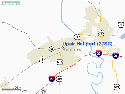
Location & QuickFacts
| FAA Information Effective: | 2008-09-25 |
| Airport Identifier: | 27SC |
| Airport Status: | Operational |
| Longitude/Latitude: | 080-40-56.0000W/34-13-46.0000N
-80.682222/34.229444 (Estimated) |
| Elevation: | 251 ft / 76.50 m (Estimated) |
| Land: | 0 acres |
| From nearest city: | 1 nautical miles SE of Lugoff, SC |
| Location: | Kershaw County, SC |
| Magnetic Variation: | () |
Owner & Manager
| Ownership: | Privately owned |
| Owner: | Joe Upchurch |
| Address: | 852 Ridgeway Road
Lugoff, SC 29078 |
| Phone number: | 803-427-3794 |
| Manager: | Joe Upchurch |
| Address: | 852 Ridgeway Road
Lugoff, SC 29078 |
| Phone number: | 803-427-3794 |
Airport Operations and Facilities
| Airport Use: | Private |
| Wind indicator: | Yes |
| Control Tower: | No |
| Sectional chart: | Charlotte |
| Region: | ASO - Southern |
| Boundary ARTCC: | ZJX - Jacksonville |
| Tie-in FSS: | AND - Anderson |
| FSS Toll Free: | 1-800-WX-BRIEF |
Runway Information
Helipad H1
| Dimension: | 40 x 40 ft / 12.2 x 12.2 m |
| Surface: | CONC, |
| |
Runway H1 |
Runway |
| Traffic Pattern: | Left | Left |
|
Radio Navigation Aids
| ID |
Type |
Name |
Ch |
Freq |
Var |
Dist |
| CDN | NDB | Camden | | 263.00 | 05W | 6.8 nm |
| MMT | NDB | Mc Entire | | 427.00 | 05W | 18.6 nm |
| SMS | NDB | Sumter | | 252.00 | 04W | 21.5 nm |
| FDW | NDB | Winnsboro | | 414.00 | 05W | 22.0 nm |
| HVS | NDB | Hartsville | | 341.00 | 07W | 29.9 nm |
| LKR | NDB | Lancaster | | 400.00 | 07W | 31.0 nm |
| PYG | NDB | Pageland | | 270.00 | 06W | 35.4 nm |
| UDG | NDB | Darlington | | 245.00 | 06W | 41.5 nm |
| DCM | NDB | Chester | | 220.00 | 06W | 42.2 nm |
| TWL | NDB | Wesley | | 204.00 | 06W | 43.5 nm |
| UZ | NDB | Rally | | 227.00 | 05W | 44.3 nm |
| MNI | NDB | Manning | | 381.00 | 06W | 45.3 nm |
| EOE | NDB | Enoree | | 278.00 | 05W | 47.6 nm |
| SSC | TACAN | Shaw | 038X | | 05W | 18.6 nm |
| CTF | VOR/DME | Chesterfield | 019X | 108.20 | 03W | 32.4 nm |
| EDS | VOR/DME | Edisto | 051X | 111.40 | 05W | 47.3 nm |
| MMT | VORTAC | Mc Entire | 079X | 113.20 | 05W | 19.3 nm |
| CAE | VORTAC | Columbia | 094X | 114.70 | 02W | 29.0 nm |
| VAN | VORTAC | Vance | 041X | 110.40 | 06W | 46.8 nm |
| FML | VORTAC | Fort Mill | 071X | 112.40 | 02W | 47.6 nm |
Remarks
- 149 FT ANTENNA 2300 FT N; 350 FT ANTENNA 1740 FT E; AND 85 FT ANTENNA 1500 FT E OF PAD.
- PRVDD VFR OPNS, PVT USE, AREA IS MKD, AND WIND INDICATOR IS MAINTAINED.
Images and information placed above are from
http://www.airport-data.com/airport/27SC/
We thank them for the data!
|
|


