 |
|
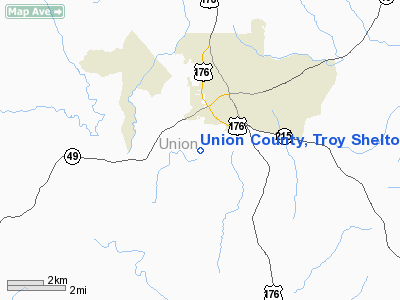
Union County, Troy Shelton Field Airport |
Location & QuickFacts
| FAA Information Effective: | 2008-09-25 |
| Airport Identifier: | 35A |
| Airport Status: | Operational |
| Longitude/Latitude: | 081-38-28.2000W/34-41-13.0300N
-81.641167/34.686953 (Estimated) |
| Elevation: | 610 ft / 185.93 m (Estimated) |
| Land: | 64 acres |
| From nearest city: | 1 nautical miles SW of Union, SC |
| Location: | Union County, SC |
| Magnetic Variation: | 06W (2000) |
Owner & Manager
| Ownership: | Publicly owned |
| Owner: | Union County |
| Address: | Po Drawer G
Union, SC 29379 |
| Phone number: | 864-429-1600 |
| Manager: | Ronnie Wade |
| Address: | Union County Airport, 198 Airport Rd
Union, SC 29379 |
| Phone number: | 864-429-1680 |
Airport Operations and Facilities
| Airport Use: | Open to public |
| Wind indicator: | Yes |
| Segmented Circle: | Yes |
| Control Tower: | No |
| Lighting Schedule: | DUSK-DAWN
MIRL RY 05/23 PRESET MED INTST DUSK-0000; AFTER 0000 ACTVT - CTAF. ACTVT PAPI RYS 05 & 23 - CTAF. |
| Beacon Color: | Clear-Green (lighted land airport) |
| Landing fee charge: | No |
| Sectional chart: | Atlanta |
| Region: | ASO - Southern |
| Boundary ARTCC: | ZTL - Atlanta |
| Tie-in FSS: | AND - Anderson |
| FSS on Airport: | No |
| FSS Toll Free: | 1-800-WX-BRIEF |
| NOTAMs Facility: | AND (NOTAM-d service avaliable) |
| Federal Agreements: | NGY |
Airport Communications
| CTAF: | 122.700 |
| Unicom: | 122.700 |
Airport Services
| Fuel available: | 100LL
SELF-SERVE FUEL AVBL 24 HRS. FOR SVC AFT HRS CALL 864-426-3003. |
| Airframe Repair: | MINOR |
| Power Plant Repair: | MINOR |
| Bottled Oxygen: | NONE |
| Bulk Oxygen: | NONE |
Runway Information
Runway 05/23
| Dimension: | 3508 x 60 ft / 1069.2 x 18.3 m |
| Surface: | ASPH, Good Condition |
| Weight Limit: | Single wheel: 12500 lbs. |
| Edge Lights: | Medium |
| |
Runway 05 |
Runway 23 |
| Longitude: | 081-38-43.6000W | 081-38-12.8000W |
| Latitude: | 34-41-01.2300N | 34-41-24.8300N |
| Elevation: | 573.00 ft | 610.00 ft |
| Alignment: | 47 | 127 |
| Traffic Pattern: | Left | Left |
| Markings: | Basic, Good Condition | Basic, Good Condition |
| Crossing Height: | 40.00 ft | 38.00 ft |
| VASI: | 2-light PAPI on left side | 2-light PAPI on left side |
| Visual Glide Angle: | 4.00° | 4.00° |
| Obstruction: | 94 ft tree, 2019.0 ft from runway, 84 ft left of centerline, 19:1 slope to clear | 109 ft tree, 2083.0 ft from runway, 213 ft left of centerline, 17:1 slope to clear |
|
Radio Navigation Aids
| ID |
Type |
Name |
Ch |
Freq |
Var |
Dist |
| UOT | NDB | Union County | | 326.00 | 04W | 0.2 nm |
| LUX | NDB | Laurens | | 307.00 | 04W | 18.7 nm |
| FRT | NDB | Fairmont | | 248.00 | 05W | 21.3 nm |
| DCM | NDB | Chester | | 220.00 | 06W | 22.6 nm |
| EOE | NDB | Enoree | | 278.00 | 05W | 22.6 nm |
| UZ | NDB | Rally | | 227.00 | 05W | 30.2 nm |
| SLP | NDB | First River | | 417.00 | 06W | 34.1 nm |
| GIW | NDB | Coronaca | | 239.00 | 04W | 34.1 nm |
| FDW | NDB | Winnsboro | | 414.00 | 05W | 34.5 nm |
| GHJ | NDB | Stonia | | 260.00 | 06W | 38.6 nm |
| LKR | NDB | Lancaster | | 400.00 | 07W | 38.8 nm |
| GY | NDB | Dyana | | 338.00 | 03W | 39.7 nm |
| RFE | NDB | Rutherford | | 344.00 | 05W | 42.7 nm |
| TWL | NDB | Wesley | | 204.00 | 06W | 48.9 nm |
| CLT | VOR/DME | Charlotte | 097X | 115.00 | 05W | 45.5 nm |
| SPA | VORTAC | Spartanburg | 104X | 115.70 | 02W | 25.2 nm |
| GRD | VORTAC | Greenwood | 102X | 115.50 | 01W | 36.5 nm |
| FML | VORTAC | Fort Mill | 071X | 112.40 | 02W | 38.4 nm |
| CLT | VOT | Charlotte | | 112.00 | | 47.0 nm |
Images and information placed above are from
http://www.airport-data.com/airport/35A/
We thank them for the data!
| General Info
|
| Country |
United States
|
| State |
SOUTH CAROLINA
|
| FAA ID |
35A
|
| Latitude |
34-41-11.365N
|
| Longitude |
081-38-30.345W
|
| Elevation |
605 feet
|
| Near City |
UNION
|
We don't guarantee the information is fresh and accurate. The data may
be wrong or outdated.
For more up-to-date information please refer to other sources.
|
|


