 |
|
| Twin Lakes Airport |
| IATA: none – ICAO: none – FAA LID: S17 |
| Summary |
| Airport type |
Public |
| Owner |
S17 Owners Association, Inc. |
| Serves |
Graniteville, South Carolina |
| Elevation AMSL |
540 ft / 165 m |
| Coordinates |
33°38′44″N 081°52′01″W / 33.64556°N 81.86694°W / 33.64556; -81.86694 |
| Runways |
| Direction |
Length |
Surface |
| ft |
m |
| 6/24 |
4,000 |
1,219 |
Asphalt |
| Statistics (2007) |
| Aircraft operations |
9,000 |
| Based aircraft |
35 |
| Source: Federal Aviation Administration |
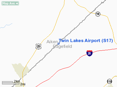
Twin Lakes Airport (FAA LID: S17) is a privately-owned, public-use airport located four miles (6 km) northwest of the central business district of Graniteville, in Aiken County, South Carolina, United States. A portion of the airport is also located in Edgefield County.
Facilities and aircraft
Twin Lakes Airport covers an area of 35 acres (14 ha) and has one runway designated 6/24 with a 4,000 x 60 ft (1,219 x 18 m) asphalt surface. For the 12-month period ending April 10, 2007, the airport had 9,000 general aviation aircraft operations, an average of 24 per day. At that time there were 35 single-engine aircraft based at this airport.
The above content comes from Wikipedia and is published under free licenses – click here to read more.
Location & QuickFacts
| FAA Information Effective: | 2008-09-25 |
| Airport Identifier: | S17 |
| Airport Status: | Operational |
| Longitude/Latitude: | 081-52-01.4030W/33-38-44.4890N
-81.867056/33.645691 (Estimated) |
| Elevation: | 540 ft / 164.59 m (Estimated) |
| Land: | 35 acres |
| From nearest city: | 4 nautical miles NW of Graniteville, SC |
| Location: | Aiken County, SC |
| Magnetic Variation: | 04W (1985) |
Owner & Manager
| Ownership: | Privately owned |
| Owner: | S17 Owners Association, Inc |
| Address: | 85 Rachel Ave.
Trenton, SC 29847 |
| Phone number: | 803-232-1220 |
| Manager: | Bruce Douglas |
| Address: | 85 Rachel Ave.
Trenton, SC 29847 |
| Phone number: | 803-232-1220 |
Airport Operations and Facilities
| Airport Use: | Open to public |
| Wind indicator: | Yes |
| Segmented Circle: | No |
| Control Tower: | No |
| Lighting Schedule: | RDO-CTL
ACTVT ROTG BCN - CTAF. |
| Beacon Color: | Clear-Green (lighted land airport) |
| Landing fee charge: | No |
| Sectional chart: | Atlanta |
| Region: | ASO - Southern |
| Boundary ARTCC: | ZTL - Atlanta |
| Tie-in FSS: | AND - Anderson |
| FSS on Airport: | No |
| FSS Toll Free: | 1-800-WX-BRIEF |
| NOTAMs Facility: | AND (NOTAM-d service avaliable) |
Airport Communications
Runway Information
Runway 06/24
| Dimension: | 4000 x 60 ft / 1219.2 x 18.3 m |
| Surface: | ASPH, |
| Weight Limit: | Single wheel: 12500 lbs. |
| |
Runway 06 |
Runway 24 |
| Traffic Pattern: | Left | Left |
| Markings: | Basic, Good Condition
RUNWAY MARKINGS ARE NOT TO FAA STANDARD. | Basic, Good Condition
RUNWAY MARKINGS ARE NOT TO FAA STANDARDS. |
| Displaced threshold: | 390.00 ft | 421.00 ft |
| Obstruction: | 48 ft tree, 642.0 ft from runway, 90 ft left of centerline, 9:1 slope to clear
RY 6 APCH RATIO 21:1 TO DSPLCD THLD. | 39 ft tree, 808.0 ft from runway, 164 ft left of centerline, 15:1 slope to clear |
|
Radio Navigation Aids
| ID |
Type |
Name |
Ch |
Freq |
Var |
Dist |
| AIK | NDB | Aiken | | 347.00 | 04W | 9.5 nm |
| EMR | NDB | Emory | | 385.00 | 04W | 12.8 nm |
| BKO | NDB | Barnwell | | 392.00 | 06W | 28.6 nm |
| HQU | NDB | Thomson-mcduffie | | 333.00 | 04W | 33.2 nm |
| BXG | NDB | Burke County | | 356.00 | 04W | 36.9 nm |
| AA | NDB | Cedar | | 341.00 | 04W | 38.0 nm |
| GIW | NDB | Coronaca | | 239.00 | 04W | 38.1 nm |
| EOE | NDB | Enoree | | 278.00 | 05W | 41.6 nm |
| LNH | NDB | Millen | | 205.00 | 05W | 45.4 nm |
| IIY | NDB | Washington/wilkes County | | 435.00 | 03W | 47.9 nm |
| ALD | VOR | Allendale | | 116.70 | 01W | 47.8 nm |
| IRQ | VORTAC | Colliers | 086X | 113.90 | 04W | 15.2 nm |
| GRD | VORTAC | Greenwood | 102X | 115.50 | 01W | 39.1 nm |
| CAE | VORTAC | Columbia | 094X | 114.70 | 02W | 42.6 nm |
Remarks
- NO PARKING FOR TSNT ACFT.
- CLSD TO ACFT WITH MAX GWT 10,000 LBS AND ABOVE.
Images and information placed above are from
http://www.airport-data.com/airport/S17/
We thank them for the data!
| General Info
|
| Country |
United States
|
| State |
SOUTH CAROLINA
|
| FAA ID |
S17
|
| Latitude |
33-38-44.489N
|
| Longitude |
081-52-01.403W
|
| Elevation |
540 feet
|
| Near City |
GRANITEVILLE
|
We don't guarantee the information is fresh and accurate. The data may
be wrong or outdated.
For more up-to-date information please refer to other sources.
|
|


