 |
|
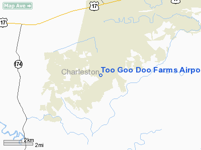
Too Goo Doo Farms Airport |
Location & QuickFacts
| FAA Information Effective: | 2008-09-25 |
| Airport Identifier: | SC51 |
| Airport Status: | Operational |
| Longitude/Latitude: | 080-15-11.3550W/32-42-16.6430N
-80.253154/32.704623 (Estimated) |
| Elevation: | 15 ft / 4.57 m (Estimated) |
| Land: | 0 acres |
| From nearest city: | 1 nautical miles W of Meggett, SC |
| Location: | Charleston County, SC |
| Magnetic Variation: | 05W (1985) |
Owner & Manager
| Ownership: | Privately owned |
| Owner: | Susan Stanley |
| Address: | 4692 Too Goo Doo Farm Rd
Meggett, SC 29449 |
| Phone number: | 803-889-6468 |
| Manager: | Too Goo Doo Plantation |
| Address: | 4682 Too Goo Doo Farm Rd
Meggett, SC 29449 |
| Phone number: | 483-889-9888 |
Airport Operations and Facilities
| Airport Use: | Private |
| Wind indicator: | Yes |
| Segmented Circle: | No |
| Control Tower: | No |
| Landing fee charge: | No |
| Sectional chart: | Charlotte |
| Region: | ASO - Southern |
| Boundary ARTCC: | ZJX - Jacksonville |
| Tie-in FSS: | AND - Anderson |
| FSS on Airport: | No |
| FSS Toll Free: | 1-800-WX-BRIEF |
Runway Information
Runway 15/33
| Dimension: | 2600 x 80 ft / 792.5 x 24.4 m |
| Surface: | TURF, |
| |
Runway 15 |
Runway 33 |
| Traffic Pattern: | Left | Left |
| Obstruction: | 50 ft pline, 50.0 ft from runway | 50 ft pline, 50.0 ft from runway |
|
Radio Navigation Aids
| ID |
Type |
Name |
Ch |
Freq |
Var |
Dist |
| JZI | NDB | Johns Island | | 283.00 | 05W | 12.5 nm |
| CH | NDB | Ashly | | 329.00 | 05W | 18.1 nm |
| DYB | NDB | Dorchester County | | 365.00 | 05W | 21.5 nm |
| RBW | NDB | Walterboro | | 221.00 | 05W | 23.6 nm |
| MKS | NDB | Moncks Corner | | 354.00 | 05W | 31.3 nm |
| NBC | TACAN | Beaufort | 042X | | 05W | 27.1 nm |
| CHS | VORTAC | Charleston | 082X | 113.50 | 05W | 15.8 nm |
| VAN | VORTAC | Vance | 041X | 110.40 | 06W | 47.3 nm |
| CHS | VOT | Charleston | | 111.00 | | 16.1 nm |
Remarks
- VFR PVT USE; ESTAB & MAINTAIN COMPATIBLE TFC PATS WITH OPERATOR OF YONGES ISLAND ARPT.
Images and information placed above are from
http://www.airport-data.com/airport/SC51/
We thank them for the data!
| General Info
|
| Country |
United States
|
| State |
SOUTH CAROLINA
|
| FAA ID |
SC51
|
| Latitude |
32-42-16.643N
|
| Longitude |
080-15-11.355W
|
| Elevation |
15 feet
|
| Near City |
MEGGETT
|
We don't guarantee the information is fresh and accurate. The data may
be wrong or outdated.
For more up-to-date information please refer to other sources.
|
|


