 |
|
| Sumter Airport |
| IATA: SUM – ICAO: KSMS – FAA LID: SMS |
| Summary |
| Airport type |
Public |
| Owner |
City & County of Sumter |
| Serves |
Sumter, South Carolina |
| Elevation AMSL |
182 ft / 55 m |
| Coordinates |
33°59′42″N 080°21′41″W / 33.995°N 80.36139°W / 33.995; -80.36139 |
| Runways |
| Direction |
Length |
Surface |
| ft |
m |
| 5/23 |
5,501 |
1,677 |
Asphalt |
| 14/32 |
3,081 |
939 |
Turf |
| Statistics (2008) |
| Aircraft operations |
48,300 |
| Based aircraft |
55 |
| Source: Federal Aviation Administration |
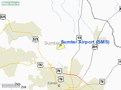
Sumter Airport (IATA: SUM, ICAO: KSMS, FAA LID: SMS) is a public use airport located four nautical miles (7 km) north of the central business district of Sumter, a city in Sumter County, South Carolina, United States. It is owned by the city and county of Sumter.
Although most U.S. airports use the same three-letter location identifier for the FAA and IATA, this airport is assigned SMS by the FAA and SUM by the IATA (which assigned SMS to Sainte Marie Airport in Sainte-Marie, Madagascar).
Facilities and aircraft
Sumter Airport covers an area of 429 acres (174 ha) at an elevation of 182 feet (55 m) above mean sea level. It has two runways: 5/23 is 5,501 by 100 feet (1,677 x 30 m) with an asphalt surface; 14/32 is 3,081 by 120 feet (939 x 37 m) with a turf surface.
For the 12-month period ending August 15, 2008, the airport had 48,300 aircraft operations, an average of 132 per day: 97% general aviation, 2% air taxi and 1% military. At that time there were 55 aircraft based at this airport: 84% single-engine and 16% multi-engine.
The above content comes from Wikipedia and is published under free licenses – click here to read more.
Location & QuickFacts
| FAA Information Effective: | 2008-09-25 |
| Airport Identifier: | SMS |
| Airport Status: | Operational |
| Longitude/Latitude: | 080-21-40.7840W/33-59-42.0920N
-80.361329/33.995026 (Estimated) |
| Elevation: | 182 ft / 55.47 m (Surveyed) |
| Land: | 429 acres |
| From nearest city: | 4 nautical miles N of Sumter, SC |
| Location: | Sumter County, SC |
| Magnetic Variation: | 04W (1980) |
Owner & Manager
| Ownership: | Publicly owned |
| Owner: | City & County Of Sumter |
| Address: | 727 Fawn Circle
Sumter, SC 29150 |
| Phone number: | 803-494-2250 |
| Manager: | Jeremy Bauer |
| Address: | 800 Windrow Dr..
Sumter, SC 29153 |
| Phone number: | 803-469-4639 |
Airport Operations and Facilities
| Airport Use: | Open to public |
| Wind indicator: | Yes |
| Segmented Circle: | Yes |
| Control Tower: | No |
| Lighting Schedule: | DUSK-DAWN
AFTER 2000, ACTVT MIRL RY 05/23, REILS RY 05/23 AND PAPI RYS 05 & 23 - CTAF. |
| Beacon Color: | Clear-Green (lighted land airport) |
| Landing fee charge: | No |
| Sectional chart: | Charlotte |
| Region: | ASO - Southern |
| Boundary ARTCC: | ZJX - Jacksonville |
| Tie-in FSS: | AND - Anderson |
| FSS on Airport: | No |
| FSS Toll Free: | 1-800-WX-BRIEF |
| NOTAMs Facility: | AND (NOTAM-d service avaliable) |
| Federal Agreements: | NGY |
Airport Communications
| CTAF: | 122.700 |
| Unicom: | 122.700 |
Airport Services
| Fuel available: | 100LLA
FOR FUEL AFT 2000 CALL 803-983-6577. |
| Airframe Repair: | MAJOR |
| Power Plant Repair: | MAJOR |
| Bottled Oxygen: | NONE |
| Bulk Oxygen: | NONE |
Runway Information
Runway 05/23
| Dimension: | 5501 x 100 ft / 1676.7 x 30.5 m |
| Surface: | ASPH, |
| Weight Limit: | Single wheel: 26000 lbs.
Dual wheel: 55000 lbs. |
| Edge Lights: | Medium |
| |
Runway 05 |
Runway 23 |
| Longitude: | 080-22-03.7647W | 080-21-19.0649W |
| Latitude: | 33-59-24.6819N | 34-00-04.3688N |
| Elevation: | 179.00 ft | 182.00 ft |
| Alignment: | 43 | 127 |
| Traffic Pattern: | Right | Left |
| Markings: | Non-precision instrument, Good Condition | Non-precision instrument, Good Condition |
| Crossing Height: | 26.00 ft | 26.00 ft |
| VASI: | 2-light PAPI on left side | 2-light PAPI on left side |
| Visual Glide Angle: | 3.00° | 3.00° |
| Approach lights: | | ODALS |
| Runway End Identifier: | Yes | Yes |
| Centerline Lights: | No | No |
| Touchdown Lights: | No | No |
| Obstruction: | 42 ft tree, 810.0 ft from runway, 189 ft left of centerline, 14:1 slope to clear | 53 ft tree, 1435.0 ft from runway, 275 ft right of centerline, 23:1 slope to clear |
|
Runway 14/32
| Dimension: | 3081 x 120 ft / 939.1 x 36.6 m |
| Surface: | TURF, Good Condition |
| |
Runway 14 |
Runway 32 |
| Longitude: | 080-21-52.8248W | 080-21-26.4926W |
| Latitude: | 33-59-48.3359N | 33-59-27.1661N |
| Elevation: | 177.00 ft | 179.00 ft |
| Alignment: | 127 | 127 |
| Traffic Pattern: | Left | Right |
| Markings: | None, | None, |
| Runway End Identifier: | No | No |
| Centerline Lights: | No | No |
| Touchdown Lights: | No | No |
| Obstruction: | 82 ft tree, 575.0 ft from runway, 150 ft right of centerline, 7:1 slope to clear | 63 ft tree, 500.0 ft from runway, 100 ft right of centerline, 7:1 slope to clear |
|
Radio Navigation Aids
| ID |
Type |
Name |
Ch |
Freq |
Var |
Dist |
| SMS | NDB | Sumter | | 252.00 | 04W | 0.3 nm |
| CDN | NDB | Camden | | 263.00 | 05W | 20.0 nm |
| MMT | NDB | Mc Entire | | 427.00 | 05W | 22.1 nm |
| MNI | NDB | Manning | | 381.00 | 06W | 25.7 nm |
| HVS | NDB | Hartsville | | 341.00 | 07W | 27.5 nm |
| CKI | NDB | Kingstree | | 404.00 | 06W | 30.3 nm |
| CFY | NDB | Evans | | 420.00 | 06W | 30.9 nm |
| UDG | NDB | Darlington | | 245.00 | 06W | 35.8 nm |
| FDW | NDB | Winnsboro | | 414.00 | 05W | 42.0 nm |
| OYI | NDB | Orangeburg | | 226.00 | 05W | 44.1 nm |
| HEK | NDB | Stuckey | | 236.00 | 06W | 44.7 nm |
| PYG | NDB | Pageland | | 270.00 | 06W | 45.1 nm |
| BES | NDB | Bennettsville | | 230.00 | 07W | 48.8 nm |
| SSC | TACAN | Shaw | 038X | | 05W | 5.3 nm |
| CTF | VOR/DME | Chesterfield | 019X | 108.20 | 03W | 39.6 nm |
| EDS | VOR/DME | Edisto | 051X | 111.40 | 05W | 40.8 nm |
| MMT | VORTAC | Mc Entire | 079X | 113.20 | 05W | 22.4 nm |
| VAN | VORTAC | Vance | 041X | 110.40 | 06W | 31.6 nm |
| CAE | VORTAC | Columbia | 094X | 114.70 | 02W | 35.5 nm |
| FLO | VORTAC | Florence | 099X | 115.20 | 03W | 37.9 nm |
Remarks
- WILDLIFE ON & INVOF ARPT WITH INCR ACTVTY DUSK & DAWN.
Images and information placed above are from
http://www.airport-data.com/airport/SMS/
We thank them for the data!
| General Info
|
| Country |
United States
|
| State |
SOUTH CAROLINA
|
| FAA ID |
SMS
|
| Latitude |
33-59-44.500N
|
| Longitude |
080-21-41.400W
|
| Elevation |
182 feet
|
| Near City |
SUMTER
|
We don't guarantee the information is fresh and accurate. The data may
be wrong or outdated.
For more up-to-date information please refer to other sources.
|
|


