 |
|
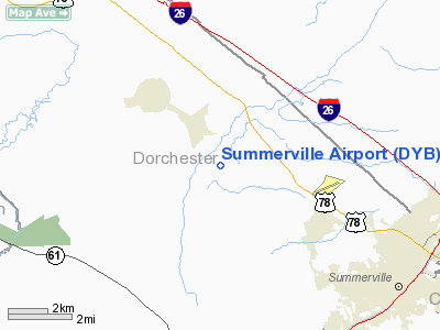
Location & QuickFacts
| FAA Information Effective: | 2008-09-25 |
| Airport Identifier: | DYB |
| Airport Status: | Operational |
| Longitude/Latitude: | 080-16-45.6000W/33-03-48.4000N
-80.279333/33.063444 (Estimated) |
| Elevation: | 56 ft / 17.07 m (Surveyed) |
| Land: | 195 acres |
| From nearest city: | 5 nautical miles NW of Summerville, SC |
| Location: | Dorchester County, SC |
| Magnetic Variation: | 05W (1990) |
Owner & Manager
| Ownership: | Publicly owned |
| Owner: | Dorchester County |
| Address: | Box 416
St. George, SC 29477 |
| Phone number: | 843-563-0100 |
| Manager: | Don Hay |
| Address: | Po Box 347, P.o. Box 3
Harleyville, SC 29448 |
| Phone number: | 843-412-1999 |
Airport Operations and Facilities
| Airport Use: | Open to public |
| Wind indicator: | Yes |
| Segmented Circle: | Yes |
| Control Tower: | No |
| Lighting Schedule: | DUSK-DAWN
MIRL RY 06/24 OPER DUSK-2200; AFTER 2200 ACTVT - CTAF. |
| Beacon Color: | Clear-Green (lighted land airport) |
| Sectional chart: | Charlotte |
| Region: | ASO - Southern |
| Boundary ARTCC: | ZJX - Jacksonville |
| Tie-in FSS: | AND - Anderson |
| FSS Toll Free: | 1-800-WX-BRIEF |
| NOTAMs Facility: | AND (NOTAM-d service avaliable) |
| Federal Agreements: | NGY |
Airport Communications
| CTAF: | 123.000 |
| Unicom: | 123.000 |
Airport Services
| Fuel available: | 100LLA |
| Airframe Repair: | MAJOR |
| Power Plant Repair: | MAJOR |
Runway Information
Runway 06/24
| Dimension: | 3700 x 75 ft / 1127.8 x 22.9 m |
| Surface: | ASPH, Good Condition |
| Weight Limit: | Single wheel: 12500 lbs.
Dual wheel: 30000 lbs. |
| Edge Lights: | Medium |
| |
Runway 06 |
Runway 24 |
| Longitude: | 080-17-01.9876W | 080-16-29.1472W |
| Latitude: | 33-03-36.3748N | 33-04-00.3619N |
| Elevation: | 45.00 ft | 53.00 ft |
| Alignment: | 49 | 127 |
| Traffic Pattern: | Right | Left |
| Markings: | Non-precision instrument, Good Condition
END NUMBERS AND THLD. MARKINGS ARE BEGINNING TO FADE. | Non-precision instrument, Good Condition |
| Crossing Height: | 28.00 ft | 28.00 ft |
| VASI: | 2-light PAPI on left side | 2-light PAPI on left side |
| Visual Glide Angle: | 3.30° | 3.30° |
| Obstruction: | 48 ft tree, 779.0 ft from runway, 267 ft left of centerline, 12:1 slope to clear | 70 ft trees, 1550.0 ft from runway, 220 ft right of centerline, 19:1 slope to clear |
|
Radio Navigation Aids
| ID |
Type |
Name |
Ch |
Freq |
Var |
Dist |
| DYB | NDB | Dorchester County | | 365.00 | 05W | 0.2 nm |
| CH | NDB | Ashly | | 329.00 | 05W | 10.6 nm |
| MKS | NDB | Moncks Corner | | 354.00 | 05W | 14.6 nm |
| RBW | NDB | Walterboro | | 221.00 | 05W | 20.0 nm |
| JZI | NDB | Johns Island | | 283.00 | 05W | 25.8 nm |
| MNI | NDB | Manning | | 381.00 | 06W | 31.8 nm |
| OYI | NDB | Orangeburg | | 226.00 | 05W | 38.0 nm |
| PHH | NDB | Andrews | | 255.00 | 06W | 44.4 nm |
| CKI | NDB | Kingstree | | 404.00 | 06W | 44.7 nm |
| NBC | TACAN | Beaufort | 042X | | 05W | 41.5 nm |
| EDS | VOR/DME | Edisto | 051X | 111.40 | 05W | 37.5 nm |
| CHS | VORTAC | Charleston | 082X | 113.50 | 05W | 15.9 nm |
| VAN | VORTAC | Vance | 041X | 110.40 | 06W | 26.2 nm |
| CHS | VOT | Charleston | | 111.00 | | 15.3 nm |
Remarks
- VFR ACFT ARE OPTG IN AND OUT OF A SOD STRIP 3 MILES EAST OF ARPT.
- FOR FBO CALL (843) 851-0970.
- BANNER TOWING 1500/BLO INTMT DAILY, SOUTH SIDE RY 06/24.
- PRVDD VFR ONLY.
Images and information placed above are from
http://www.airport-data.com/airport/DYB/
We thank them for the data!
| General Info
|
| Country |
United States
|
| State |
SOUTH CAROLINA
|
| FAA ID |
DYB
|
| Latitude |
33-03-48.400N
|
| Longitude |
080-16-45.600W
|
| Elevation |
56 feet
|
| Near City |
SUMMERVILLE
|
We don't guarantee the information is fresh and accurate. The data may
be wrong or outdated.
For more up-to-date information please refer to other sources.
|
|


