 |
|
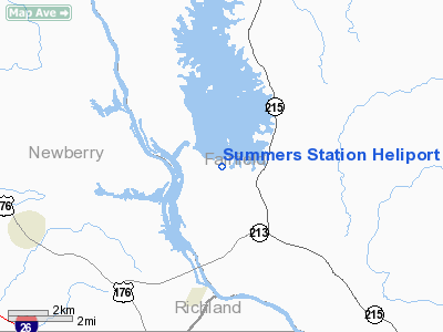
Location & QuickFacts
| FAA Information Effective: | 2008-09-25 |
| Airport Identifier: | SC63 |
| Airport Status: | Operational |
| Longitude/Latitude: | 081-18-47.9000W/34-17-47.8000N
-81.313306/34.296611 (Estimated) |
| Elevation: | 436 ft / 132.89 m (Estimated) |
| Land: | 0 acres |
| From nearest city: | 3 nautical miles SE of Jenkinsville, SC |
| Location: | Fairfield County, SC |
| Magnetic Variation: | 05W (1985) |
Owner & Manager
| Ownership: | Privately owned |
| Owner: | Sc Electric & Gas Co |
| Address: | P O Box 102407
Columbia, SC 29224 |
| Phone number: | 803-699-3126 |
| Manager: | James Breznay |
| Address: | P O Box 102407
Columbia, SC 29224 |
| Phone number: | 803-699-3126 |
Airport Operations and Facilities
| Airport Use: | Private |
| Wind indicator: | Yes |
| Segmented Circle: | No |
| Control Tower: | No |
| Lighting Schedule: | PHONE REQ
FOR PERIMETER LGTS PHONE 803-788-3220. |
| Landing fee charge: | No |
| Sectional chart: | Charlotte |
| Region: | ASO - Southern |
| Boundary ARTCC: | ZJX - Jacksonville |
| Tie-in FSS: | AND - Anderson |
| FSS on Airport: | No |
| FSS Toll Free: | 1-800-WX-BRIEF |
Runway Information
Helipad H1
| Dimension: | 30 x 30 ft / 9.1 x 9.1 m |
| Surface: | CONC, |
| |
Runway H1 |
Runway |
| Traffic Pattern: | Left | Left |
|
Radio Navigation Aids
| ID |
Type |
Name |
Ch |
Freq |
Var |
Dist |
| FDW | NDB | Winnsboro | | 414.00 | 05W | 10.0 nm |
| EOE | NDB | Enoree | | 278.00 | 05W | 16.0 nm |
| UOT | NDB | Union County | | 326.00 | 04W | 28.4 nm |
| DCM | NDB | Chester | | 220.00 | 06W | 30.0 nm |
| MMT | NDB | Mc Entire | | 427.00 | 05W | 33.6 nm |
| LUX | NDB | Laurens | | 307.00 | 04W | 34.0 nm |
| LKR | NDB | Lancaster | | 400.00 | 07W | 34.2 nm |
| CDN | NDB | Camden | | 263.00 | 05W | 37.3 nm |
| UZ | NDB | Rally | | 227.00 | 05W | 37.5 nm |
| GIW | NDB | Coronaca | | 239.00 | 04W | 38.5 nm |
| AIK | NDB | Aiken | | 347.00 | 04W | 42.8 nm |
| FRT | NDB | Fairmont | | 248.00 | 05W | 49.3 nm |
| TWL | NDB | Wesley | | 204.00 | 06W | 49.6 nm |
| SSC | TACAN | Shaw | 038X | | 05W | 46.3 nm |
| CAE | VORTAC | Columbia | 094X | 114.70 | 02W | 29.4 nm |
| MMT | VORTAC | Mc Entire | 079X | 113.20 | 05W | 33.9 nm |
| GRD | VORTAC | Greenwood | 102X | 115.50 | 01W | 41.9 nm |
| FML | VORTAC | Fort Mill | 071X | 112.40 | 02W | 45.2 nm |
Remarks
Images and information placed above are from
http://www.airport-data.com/airport/SC63/
We thank them for the data!
| General Info
|
| Country |
United States
|
| State |
SOUTH CAROLINA
|
| FAA ID |
SC63
|
| Latitude |
34-17-47.800N
|
| Longitude |
081-18-47.900W
|
| Elevation |
436 feet
|
| Near City |
JENKINSVILLE
|
We don't guarantee the information is fresh and accurate. The data may
be wrong or outdated.
For more up-to-date information please refer to other sources.
|
|


