 |
|
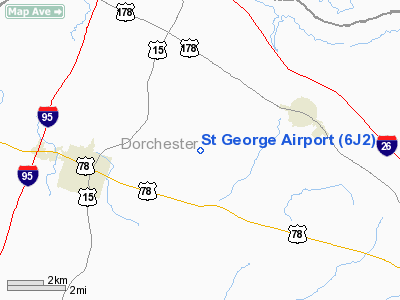
Location & QuickFacts
| FAA Information Effective: | 2008-09-25 |
| Airport Identifier: | 6J2 |
| Airport Status: | Operational |
| Longitude/Latitude: | 080-30-30.5000W/33-11-43.8000N
-80.508472/33.195500 (Estimated) |
| Elevation: | 85 ft / 25.91 m (Surveyed) |
| Land: | 103 acres |
| From nearest city: | 3 nautical miles E of St George, SC |
| Location: | Dorchester County, SC |
| Magnetic Variation: | 06W (1995) |
Owner & Manager
| Ownership: | Publicly owned |
| Owner: | Dorchester County |
| Address: | Po Box 416
St George, SC 29477 |
| Phone number: | 843-563-0100 |
| Manager: | Don Hay |
| Address: | Po Box 347, Box 3
Harleyville, SC 29448 |
| Phone number: | 843-412-1999 |
Airport Operations and Facilities
| Airport Use: | Open to public |
| Wind indicator: | Yes |
| Segmented Circle: | Yes |
| Control Tower: | No |
| Lighting Schedule: | DUSK-DAWN |
| Beacon Color: | Clear-Green (lighted land airport)
ARPT BCN OTS INDEFLY. |
| Landing fee charge: | No |
| Sectional chart: | Charlotte |
| Region: | ASO - Southern |
| Boundary ARTCC: | ZJX - Jacksonville |
| Tie-in FSS: | AND - Anderson |
| FSS on Airport: | No |
| FSS Toll Free: | 1-800-WX-BRIEF |
| NOTAMs Facility: | AND (NOTAM-d service avaliable) |
| Federal Agreements: | NY1 |
Airport Communications
| CTAF: | 122.800 |
| Unicom: | 122.800 |
Airport Services
| Bottled Oxygen: | NONE |
| Bulk Oxygen: | NONE |
Runway Information
Runway 05/23
| Dimension: | 3201 x 60 ft / 975.7 x 18.3 m |
| Surface: | ASPH, Good Condition |
| Weight Limit: | Single wheel: 21000 lbs.
Dual wheel: 30000 lbs. |
| Edge Lights: | Low |
| |
Runway 05 |
Runway 23 |
| Longitude: | 080-30-44.0260W | 080-30-16.9880W |
| Latitude: | 33-11-32.8120N | 33-11-54.8580N |
| Elevation: | 83.00 ft | 82.00 ft |
| Alignment: | 46 | 127 |
| Traffic Pattern: | Left | Left |
| Markings: | Basic, Good Condition | Basic, Good Condition |
| Obstruction: | 90 ft tree, 1301.0 ft from runway, 164 ft left of centerline, 12:1 slope to clear | 66 ft tree, 1270.0 ft from runway, 58 ft left of centerline, 16:1 slope to clear |
|
Radio Navigation Aids
| ID |
Type |
Name |
Ch |
Freq |
Var |
Dist |
| DYB | NDB | Dorchester County | | 365.00 | 05W | 14.2 nm |
| RBW | NDB | Walterboro | | 221.00 | 05W | 17.5 nm |
| MKS | NDB | Moncks Corner | | 354.00 | 05W | 23.9 nm |
| OYI | NDB | Orangeburg | | 226.00 | 05W | 24.0 nm |
| CH | NDB | Ashly | | 329.00 | 05W | 24.5 nm |
| MNI | NDB | Manning | | 381.00 | 06W | 28.1 nm |
| JZI | NDB | Johns Island | | 283.00 | 05W | 39.0 nm |
| CKI | NDB | Kingstree | | 404.00 | 06W | 45.4 nm |
| MMT | NDB | Mc Entire | | 427.00 | 05W | 46.8 nm |
| BKO | NDB | Barnwell | | 392.00 | 06W | 46.9 nm |
| SMS | NDB | Sumter | | 252.00 | 04W | 48.4 nm |
| NBC | TACAN | Beaufort | 042X | | 05W | 44.3 nm |
| SSC | TACAN | Shaw | 038X | | 05W | 47.1 nm |
| ALD | VOR | Allendale | | 116.70 | 01W | 41.0 nm |
| EDS | VOR/DME | Edisto | 051X | 111.40 | 05W | 23.5 nm |
| VAN | VORTAC | Vance | 041X | 110.40 | 06W | 17.1 nm |
| CHS | VORTAC | Charleston | 082X | 113.50 | 05W | 29.8 nm |
| MMT | VORTAC | Mc Entire | 079X | 113.20 | 05W | 46.2 nm |
| CAE | VORTAC | Columbia | 094X | 114.70 | 02W | 48.3 nm |
| CHS | VOT | Charleston | | 111.00 | | 29.3 nm |
Remarks
Images and information placed above are from
http://www.airport-data.com/airport/6J2/
We thank them for the data!
| General Info
|
| Country |
United States
|
| State |
SOUTH CAROLINA
|
| FAA ID |
6J2
|
| Latitude |
33-11-43.800N
|
| Longitude |
080-30-30.500W
|
| Elevation |
84 feet
|
| Near City |
ST GEORGE
|
We don't guarantee the information is fresh and accurate. The data may
be wrong or outdated.
For more up-to-date information please refer to other sources.
|
|


