 |
|
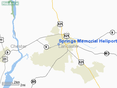
Springs Memorial Heliport |
Location & QuickFacts
| FAA Information Effective: | 2008-09-25 |
| Airport Identifier: | SC31 |
| Airport Status: | Operational |
| Longitude/Latitude: | 080-47-01.2480W/34-43-07.5310N
-80.783680/34.718759 (Estimated) |
| Elevation: | 600 ft / 182.88 m (Estimated) |
| Land: | 0 acres |
| From nearest city: | 4 nautical miles W of Lancaster, SC |
| Location: | Lancaster County, SC |
| Magnetic Variation: | 05W (1985) |
Owner & Manager
| Ownership: | Privately owned |
| Owner: | Community Health Systems |
| Address: | Po Box 217
Brentwood, TN 37027-4600 |
| Manager: | Community Health Systems |
| Address: | 800 W. Meeting St
Lancaster, SC 29720 |
| Phone number: | 803-286-1214 |
Airport Operations and Facilities
| Airport Use: | Private
MEDICAL. |
| Wind indicator: | No |
| Segmented Circle: | No |
| Control Tower: | No |
| Landing fee charge: | No |
| Sectional chart: | Charlotte |
| Region: | ASO - Southern |
| Boundary ARTCC: | ZTL - Atlanta |
| Tie-in FSS: | AND - Anderson |
| FSS on Airport: | No |
| FSS Toll Free: | 1-800-WX-BRIEF |
Airport Services
| Airframe Repair: | NONE |
| Power Plant Repair: | NONE |
Runway Information
Helipad H1
| Dimension: | 50 x 42 ft / 15.2 x 12.8 m |
| Surface: | CONC, |
| |
Runway H1 |
Runway |
| Traffic Pattern: | Left | Left |
|
Radio Navigation Aids
| ID |
Type |
Name |
Ch |
Freq |
Var |
Dist |
| LKR | NDB | Lancaster | | 400.00 | 07W | 3.7 nm |
| TWL | NDB | Wesley | | 204.00 | 06W | 14.6 nm |
| UZ | NDB | Rally | | 227.00 | 05W | 17.9 nm |
| DCM | NDB | Chester | | 220.00 | 06W | 21.0 nm |
| PYG | NDB | Pageland | | 270.00 | 06W | 22.1 nm |
| CDN | NDB | Camden | | 263.00 | 05W | 28.4 nm |
| FDW | NDB | Winnsboro | | 414.00 | 05W | 29.3 nm |
| GHJ | NDB | Stonia | | 260.00 | 06W | 33.8 nm |
| HVS | NDB | Hartsville | | 341.00 | 07W | 37.8 nm |
| AFP | NDB | Anson County | | 283.00 | 07W | 39.1 nm |
| UOT | NDB | Union County | | 326.00 | 04W | 42.5 nm |
| CQW | NDB | Cheraw | | 409.00 | 05W | 45.4 nm |
| MMT | NDB | Mc Entire | | 427.00 | 05W | 47.1 nm |
| UDG | NDB | Darlington | | 245.00 | 06W | 47.3 nm |
| SMS | NDB | Sumter | | 252.00 | 04W | 48.5 nm |
| EOE | NDB | Enoree | | 278.00 | 05W | 48.8 nm |
| SSC | TACAN | Shaw | 038X | | 05W | 47.2 nm |
| CTF | VOR/DME | Chesterfield | 019X | 108.20 | 03W | 25.5 nm |
| CLT | VOR/DME | Charlotte | 097X | 115.00 | 05W | 29.5 nm |
| FML | VORTAC | Fort Mill | 071X | 112.40 | 02W | 18.3 nm |
| MMT | VORTAC | Mc Entire | 079X | 113.20 | 05W | 47.8 nm |
| CLT | VOT | Charlotte | | 112.00 | | 30.8 nm |
Remarks
- VFR, DAY PVT ONLY, UNLISTED.
Images and information placed above are from
http://www.airport-data.com/airport/SC31/
We thank them for the data!
| General Info
|
| Country |
United States
|
| State |
SOUTH CAROLINA
|
| FAA ID |
SC31
|
| Latitude |
34-43-07.531N
|
| Longitude |
080-47-01.248W
|
| Elevation |
600 feet
|
| Near City |
LANCASTER
|
We don't guarantee the information is fresh and accurate. The data may
be wrong or outdated.
For more up-to-date information please refer to other sources.
|
|


