 |
|
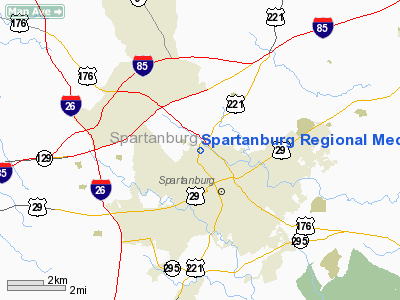
Spartanburg Rgnl Medical Center Heliport |
Location & QuickFacts
| FAA Information Effective: | 2008-09-25 |
| Airport Identifier: | 22SC |
| Airport Status: | Operational |
| Longitude/Latitude: | 081-56-28.0000W/34-58-04.0000N
-81.941111/34.967778 (Estimated) |
| Elevation: | 800 ft / 243.84 m (Estimated) |
| Land: | 0 acres |
| From nearest city: | 0 nautical miles N of Spartanburg, SC |
| Location: | Spartanburg County, SC |
| Magnetic Variation: | () |
Owner & Manager
| Ownership: | Privately owned |
| Owner: | Spartanburg Rgnl Health Care System |
| Address: | 101 East Wood St
Spartanburg, SC 29303 |
| Phone number: | 864-560-6228 |
| Manager: | Doug Dills |
| Address: | Spartanburg Rgnl Health Care System
Spartanburg, SC 29303 |
| Phone number: | 864-560-6228 |
Airport Operations and Facilities
| Airport Use: | Private
MEDICAL USE. |
| Wind indicator: | Yes |
| Control Tower: | No |
| Lighting Schedule: | DUSK-DAWN |
| Sectional chart: | Atlanta |
| Region: | ASO - Southern |
| Boundary ARTCC: | ZTL - Atlanta |
| Tie-in FSS: | AND - Anderson |
| FSS Toll Free: | 1-800-WX-BRIEF |
Runway Information
Helipad H1
| Dimension: | 35 x 35 ft / 10.7 x 10.7 m |
| Surface: | CONC, |
| |
Runway H1 |
Runway |
| Traffic Pattern: | Left | Left |
|
Radio Navigation Aids
| ID |
Type |
Name |
Ch |
Freq |
Var |
Dist |
| FRT | NDB | Fairmont | | 248.00 | 05W | 4.5 nm |
| UOT | NDB | Union County | | 326.00 | 04W | 22.5 nm |
| RFE | NDB | Rutherford | | 344.00 | 05W | 22.9 nm |
| SLP | NDB | First River | | 417.00 | 06W | 24.0 nm |
| LUX | NDB | Laurens | | 307.00 | 04W | 27.6 nm |
| GY | NDB | Dyana | | 338.00 | 03W | 29.9 nm |
| BRA | NDB | Broad River | | 379.00 | 04W | 31.9 nm |
| DCM | NDB | Chester | | 220.00 | 06W | 38.1 nm |
| LQK | NDB | Lake Keowee | | 408.00 | 04W | 38.7 nm |
| GHJ | NDB | Stonia | | 260.00 | 06W | 40.8 nm |
| EOE | NDB | Enoree | | 278.00 | 05W | 42.2 nm |
| UZ | NDB | Rally | | 227.00 | 05W | 42.7 nm |
| GIW | NDB | Coronaca | | 239.00 | 04W | 43.5 nm |
| FIQ | NDB | Fiddlers | | 391.00 | 07W | 46.5 nm |
| AND | NDB | Anderson County | | 230.00 | 04W | 47.3 nm |
| CEU | NDB | Clemson | | 257.00 | 05W | 49.9 nm |
| SPA | VORTAC | Spartanburg | 104X | 115.70 | 02W | 4.0 nm |
| SUG | VORTAC | Sugarloaf Mountain | 059X | 112.20 | 02W | 30.9 nm |
| GRD | VORTAC | Greenwood | 102X | 115.50 | 01W | 44.3 nm |
| FML | VORTAC | Fort Mill | 071X | 112.40 | 02W | 48.6 nm |
Remarks
- OWNER DESIRES ARPT NOT BE CHARTED.
- PRVDD VFR OPNS, PRVT USE, AREA IS MKD, AND WIND INDICATOR IS MAINTAINED.
Images and information placed above are from
http://www.airport-data.com/airport/22SC/
We thank them for the data!
|
|


