|
|
Spartanburg Downtown Memorial Airport |
| Spartanburg Downtown Memorial Airport |
| IATA: SPA – ICAO: KSPA – FAA LID: SPA |
| Summary |
| Airport type |
Public |
| Owner/Operator |
City of Spartanburg |
| Location |
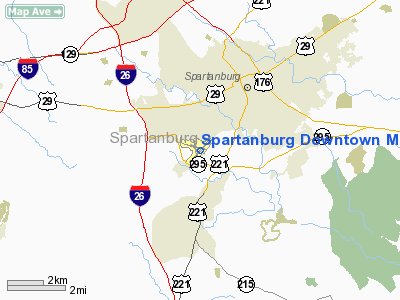
Spartanburg, South Carolina |
| Elevation AMSL |
801 ft / 244.1 m |
| Coordinates |
34°54′57″N 81°57′23″W / 34.9157°N 81.9565°W / 34.9157; -81.9565Coordinates: 34°54′57″N 81°57′23″W / 34.9157°N 81.9565°W / 34.9157; -81.9565 |
| Website |
Spartanburg Downtown Memorial Airport |
| Runways |
| Direction |
Length |
Surface |
| ft |
m |
| 5/23 |
5202 |
1586 |
asphalt |
The Spartanburg Downtown Memorial Airport (IATA: SPA, ICAO: KSPA, FAA LID: SPA) is a general aviation airport located in the city of Spartanburg, South Carolina. The airport is 3 miles from downtown Spartanburg which makes it popular for private and corporate aircraft.
 | |
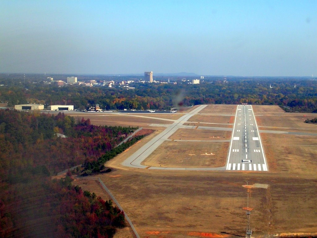
The Spartanburg Downtown Memorial Airport in the foreground with downtown Spartanburg in the background |
History
South Carolina's first commercial airport was opened in 1927. Famed aviator Charles Lindbergh participated in the grand opening of the airport only months following his historic flight across the Atlantic. Passenger air service commenced that same year but ended in 1962 with the opening of the Greenville-Spartanburg Jetport, later renamed Greenville-Spartanburg International Airport.
During World War II, the airport served as a training facility for the United States Army Air Corp and a refueling stop for naval aviators.
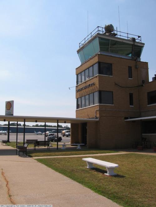
An FAA operated air traffic control tower was operational at the airport but closed in 1981 during the PATCO controllers strike.
Runways and other facilities
The airport once had three intersecting runways with a parallel taxiway system that connected them to the aircraft parking apron. Runway 4/22 was 5,203 feet long by 150 feet wide, Runway 17/35 was 4,226 feet long by 150 feet wide, and runway 11/29 was 4,403 feet long by 150 feet wide. Today only runway 4/22 remains but was redesignated as runway 5/23 several years ago. Prevailing winds in the area generally favor the use of this runway. Only remnants of the other runways are visible today.
An instrument landing system (ILS) is available for use on runway 5. This runway also has high intensity runway edge lighting (HIRL), visual approach slope indicator lights (VASI), and a medium intensity approach lighting system (MALSR). Other navigational aids nearby are the Spartanburg Vortac (VOR) (7.2 miles northeast) and the Fairmont Non-directional beacon (NDB) (1.6 miles west).
The airport's terminal building houses a fixed base operator (FBO) and a flight school. Adjacent to the terminal building are several aircraft hangars.
The airport is also home to the Spartanburg Composite Squadron of the Civil Air Patrol.
Expansion plans
As part of the airport's master plan runway 5/23 will be lengthened to 5,500 feet. The present terminal building, built in 1936 and the oldest in South Carolina, will be renovated beginning in 2010. Additional hangars will also be constructed.
The above content comes from Wikipedia and is published under free licenses – click here to read more.
 |
(Click on the photo to enlarge) |
Location & QuickFacts
| FAA Information Effective: | 2008-09-25 |
| Airport Identifier: | SPA |
| Airport Status: | Operational |
| Longitude/Latitude: | 081-57-23.4000W/34-54-56.6000N
-81.956500/34.915722 (Estimated) |
| Elevation: | 801 ft / 244.14 m (Surveyed) |
| Land: | 544 acres |
| From nearest city: | 3 nautical miles SW of Spartanburg, SC |
| Location: | Spartanburg County, SC |
| Magnetic Variation: | 05W (1995) |
Owner & Manager
| Ownership: | Publicly owned |
| Owner: | City Of Spartanburg |
| Address: | Po Drawer 1749
Spartanburg, SC 29304 |
| Phone number: | 864-596-2000 |
| Manager: | Josh Houston |
| Address: | 500 Ammons Rd
Spartanburg, SC 29306 |
| Phone number: | 864-574-8552 |
Airport Operations and Facilities
| Airport Use: | Open to public |
| Wind indicator: | Yes |
| Segmented Circle: | Yes |
| Control Tower: | No |
| Lighting Schedule: | DUSK-DAWN
ACTVT HIRL RY 05/23 & MALSR RY 05 & REIL RY 23 - CTAF. |
| Beacon Color: | Clear-Green (lighted land airport) |
| Landing fee charge: | No |
| Sectional chart: | Atlanta |
| Region: | ASO - Southern |
| Boundary ARTCC: | ZTL - Atlanta |
| Tie-in FSS: | AND - Anderson |
| FSS on Airport: | No |
| FSS Toll Free: | 1-800-WX-BRIEF |
| NOTAMs Facility: | SPA (NOTAM-d service avaliable) |
| Federal Agreements: | NGPY3 |
Airport Communications
| CTAF: | 123.000 |
| Unicom: | 123.000 |
Airport Services
| Fuel available: | 100LLA
FOR FUEL AFT HRS CALL 864-574-8552. |
| Airframe Repair: | MAJOR |
| Power Plant Repair: | MAJOR |
| Bottled Oxygen: | NONE |
| Bulk Oxygen: | NONE |
Runway Information
Runway 05/23
| Dimension: | 5202 x 100 ft / 1585.6 x 30.5 m |
| Surface: | ASPH, Good Condition |
| Weight Limit: | Single wheel: 30000 lbs.
Dual wheel: 45000 lbs. |
| Edge Lights: | High |
| |
Runway 05 |
Runway 23 |
| Longitude: | 081-57-44.1060W | 081-57-02.6490W |
| Latitude: | 34-54-37.3980N | 34-55-15.8800N |
| Elevation: | 793.00 ft | 789.00 ft |
| Alignment: | 42 | 127 |
| ILS Type: | ILS
| |
| Traffic Pattern: | Left | Left |
| Markings: | Non-precision instrument, Good Condition | Non-precision instrument, Good Condition |
| Crossing Height: | 59.00 ft | 57.00 ft |
| VASI: | 4-box on left side | 4-box on left side |
| Visual Glide Angle: | 3.00° | 3.00° |
| Approach lights: | MALSR | |
| Runway End Identifier: | No | No |
| Centerline Lights: | No | No |
| Touchdown Lights: | No | No |
| Obstruction: | 73 ft tree, 2520.0 ft from runway, 137 ft right of centerline, 31:1 slope to clear | 33 ft tree, 250.0 ft from runway, 78 ft left of centerline, 1:1 slope to clear |
|
Radio Navigation Aids
| ID |
Type |
Name |
Ch |
Freq |
Var |
Dist |
| FRT | NDB | Fairmont | | 248.00 | 05W | 1.6 nm |
| UOT | NDB | Union County | | 326.00 | 04W | 20.8 nm |
| LUX | NDB | Laurens | | 307.00 | 04W | 24.5 nm |
| RFE | NDB | Rutherford | | 344.00 | 05W | 26.0 nm |
| SLP | NDB | First River | | 417.00 | 06W | 26.8 nm |
| GY | NDB | Dyana | | 338.00 | 03W | 27.6 nm |
| BRA | NDB | Broad River | | 379.00 | 04W | 33.2 nm |
| LQK | NDB | Lake Keowee | | 408.00 | 04W | 37.4 nm |
| DCM | NDB | Chester | | 220.00 | 06W | 38.1 nm |
| EOE | NDB | Enoree | | 278.00 | 05W | 39.6 nm |
| GIW | NDB | Coronaca | | 239.00 | 04W | 40.3 nm |
| GHJ | NDB | Stonia | | 260.00 | 06W | 42.7 nm |
| UZ | NDB | Rally | | 227.00 | 05W | 43.2 nm |
| AND | NDB | Anderson County | | 230.00 | 04W | 44.8 nm |
| CEU | NDB | Clemson | | 257.00 | 05W | 48.2 nm |
| FIQ | NDB | Fiddlers | | 391.00 | 07W | 49.8 nm |
| SPA | VORTAC | Spartanburg | 104X | 115.70 | 02W | 7.2 nm |
| SUG | VORTAC | Sugarloaf Mountain | 059X | 112.20 | 02W | 33.2 nm |
| GRD | VORTAC | Greenwood | 102X | 115.50 | 01W | 41.1 nm |
| FML | VORTAC | Fort Mill | 071X | 112.40 | 02W | 49.5 nm |
Remarks
- RY 05 50 FT DROP 97 FT FROM THR.
- RY 23 15 FT DROP 168 FT FROM THR.
- ARPT EXISTED PRIOR 1958.
Images and information placed above are from
http://www.airport-data.com/airport/SPA/
We thank them for the data!
| General Info
|
| Country |
United States
|
| State |
SOUTH CAROLINA
|
| FAA ID |
SPA
|
| Latitude |
34-54-56.600N
|
| Longitude |
081-57-23.400W
|
| Elevation |
801 feet
|
| Near City |
SPARTANBURG
|
We don't guarantee the information is fresh and accurate. The data may
be wrong or outdated.
For more up-to-date information please refer to other sources.
|
|