 |
|
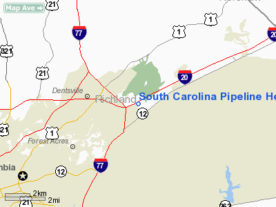
South Carolina Pipeline Heliport |
Location & QuickFacts
| FAA Information Effective: | 2008-09-25 |
| Airport Identifier: | 2SC2 |
| Airport Status: | Operational |
| Longitude/Latitude: | 080-54-40.0000W/34-04-13.0000N
-80.911111/34.070278 (Estimated) |
| Elevation: | 350 ft / 106.68 m (Estimated) |
| Land: | 0 acres |
| From nearest city: | 6 nautical miles SW of Columbia, SC |
| Location: | Richland County, SC |
| Magnetic Variation: | 06W (1995) |
Owner & Manager
| Ownership: | Privately owned |
| Owner: | South Carolina Pipeline Corporation |
| Address: | P.o. Box 102407
Columbia, SC 29224-2407 |
| Phone number: | 803-699-3126 |
| Manager: | James T. Breznay |
| Address: | P.o. Box 102407
Columbia, SC 29224-2407 |
| Phone number: | 803-699-3126 |
Airport Operations and Facilities
| Airport Use: | Private |
| Wind indicator: | Yes |
| Segmented Circle: | No |
| Control Tower: | No |
| Lighting Schedule: | PHONE REQ
FOR PERIMETER LGTS CALL 803-699-3126. |
| Sectional chart: | Charlotte |
| Region: | ASO - Southern |
| Boundary ARTCC: | ZJX - Jacksonville |
| Tie-in FSS: | AND - Anderson |
| FSS Toll Free: | 1-800-WX-BRIEF |
Runway Information
Helipad H1
| Dimension: | 35 x 35 ft / 10.7 x 10.7 m |
| Surface: | CONC, |
| |
Runway H1 |
Runway |
| Traffic Pattern: | Left | Left |
|
Radio Navigation Aids
| ID |
Type |
Name |
Ch |
Freq |
Var |
Dist |
| MMT | NDB | Mc Entire | | 427.00 | 05W | 9.8 nm |
| FDW | NDB | Winnsboro | | 414.00 | 05W | 17.8 nm |
| CDN | NDB | Camden | | 263.00 | 05W | 21.6 nm |
| SMS | NDB | Sumter | | 252.00 | 04W | 27.9 nm |
| EOE | NDB | Enoree | | 278.00 | 05W | 38.8 nm |
| OYI | NDB | Orangeburg | | 226.00 | 05W | 39.2 nm |
| LKR | NDB | Lancaster | | 400.00 | 07W | 39.4 nm |
| HVS | NDB | Hartsville | | 341.00 | 07W | 44.2 nm |
| DCM | NDB | Chester | | 220.00 | 06W | 45.4 nm |
| MNI | NDB | Manning | | 381.00 | 06W | 45.6 nm |
| AIK | NDB | Aiken | | 347.00 | 04W | 45.8 nm |
| PYG | NDB | Pageland | | 270.00 | 06W | 49.5 nm |
| UZ | NDB | Rally | | 227.00 | 05W | 50.0 nm |
| SSC | TACAN | Shaw | 038X | | 05W | 22.9 nm |
| EDS | VOR/DME | Edisto | 051X | 111.40 | 05W | 37.0 nm |
| CTF | VOR/DME | Chesterfield | 019X | 108.20 | 03W | 47.0 nm |
| MMT | VORTAC | Mc Entire | 079X | 113.20 | 05W | 10.3 nm |
| CAE | VORTAC | Columbia | 094X | 114.70 | 02W | 14.7 nm |
| VAN | VORTAC | Vance | 041X | 110.40 | 06W | 42.6 nm |
Remarks
- PRVDD VFR/PVT USE, ALL APCH/DEP OPNS 030-090 & 200-240, AREA MKD, WIND INDICATOR MAINTAINED.
Images and information placed above are from
http://www.airport-data.com/airport/2SC2/
We thank them for the data!
| General Info
|
| Country |
United States
|
| State |
SOUTH CAROLINA
|
| FAA ID |
2SC2
|
| Latitude |
34-04-13.000N
|
| Longitude |
080-54-40.000W
|
| Elevation |
350 feet
|
| Near City |
COLUMBIA
|
We don't guarantee the information is fresh and accurate. The data may
be wrong or outdated.
For more up-to-date information please refer to other sources.
|
|


