 |
|
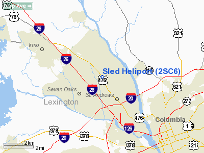
Location & QuickFacts
| FAA Information Effective: | 2008-09-25 |
| Airport Identifier: | 2SC6 |
| Airport Status: | Operational |
| Longitude/Latitude: | 081-06-56.0000W/34-03-58.0000N
-81.115556/34.066111 (Estimated) |
| Elevation: | 275 ft / 83.82 m (Estimated) |
| Land: | 0 acres |
| From nearest city: | 7 nautical miles N of Columbia, SC |
| Location: | Richland County, SC |
| Magnetic Variation: | 06W (1995) |
Owner & Manager
| Ownership: | Privately owned |
| Owner: | S. C. Law Enforcement Division |
| Address: | 4400 Broadriver Road
Columbia, SC 29221-1398 |
| Phone number: | 803-737-9000 |
| Manager: | Mark A. Keel |
| Address: | 4400 Broadriver Road
Columbia, SC 29221-1398 |
| Phone number: | 803-737-9000 |
Airport Operations and Facilities
| Airport Use: | Private
HELIPORT FOR LAW ENFORCEMENT USE ONLY. |
| Wind indicator: | Yes |
| Segmented Circle: | No |
| Control Tower: | No |
| Lighting Schedule: | DUSK-DAWN |
| Sectional chart: | Atlanta |
| Region: | ASO - Southern |
| Boundary ARTCC: | ZJX - Jacksonville |
| Tie-in FSS: | AND - Anderson |
| FSS Toll Free: | 1-800-WX-BRIEF |
Runway Information
Helipad H1
| Dimension: | 130 x 100 ft / 39.6 x 30.5 m |
| Surface: | CONC, |
| |
Runway H1 |
Runway |
| Traffic Pattern: | Left | Left |
|
Radio Navigation Aids
| ID |
Type |
Name |
Ch |
Freq |
Var |
Dist |
| FDW | NDB | Winnsboro | | 414.00 | 05W | 14.9 nm |
| MMT | NDB | Mc Entire | | 427.00 | 05W | 17.6 nm |
| EOE | NDB | Enoree | | 278.00 | 05W | 29.8 nm |
| CDN | NDB | Camden | | 263.00 | 05W | 30.5 nm |
| AIK | NDB | Aiken | | 347.00 | 04W | 37.5 nm |
| SMS | NDB | Sumter | | 252.00 | 04W | 37.9 nm |
| OYI | NDB | Orangeburg | | 226.00 | 05W | 40.3 nm |
| LKR | NDB | Lancaster | | 400.00 | 07W | 41.5 nm |
| DCM | NDB | Chester | | 220.00 | 06W | 43.5 nm |
| UOT | NDB | Union County | | 326.00 | 04W | 45.4 nm |
| BKO | NDB | Barnwell | | 392.00 | 06W | 45.9 nm |
| LUX | NDB | Laurens | | 307.00 | 04W | 49.2 nm |
| UZ | NDB | Rally | | 227.00 | 05W | 49.6 nm |
| GIW | NDB | Coronaca | | 239.00 | 04W | 49.6 nm |
| SSC | TACAN | Shaw | 038X | | 05W | 32.8 nm |
| EDS | VOR/DME | Edisto | 051X | 111.40 | 05W | 38.9 nm |
| CAE | VORTAC | Columbia | 094X | 114.70 | 02W | 12.9 nm |
| MMT | VORTAC | Mc Entire | 079X | 113.20 | 05W | 17.8 nm |
| VAN | VORTAC | Vance | 041X | 110.40 | 06W | 48.7 nm |
Remarks
- SEE AIRSPACE CASE 98-ATL-032-NRA.
Images and information placed above are from
http://www.airport-data.com/airport/2SC6/
We thank them for the data!
| General Info
|
| Country |
United States
|
| State |
SOUTH CAROLINA
|
| FAA ID |
2SC6
|
| Latitude |
34-03-58.000N
|
| Longitude |
081-06-56.000W
|
| Elevation |
275 feet
|
| Near City |
COLUMBIA
|
We don't guarantee the information is fresh and accurate. The data may
be wrong or outdated.
For more up-to-date information please refer to other sources.
|
|


