 |
|
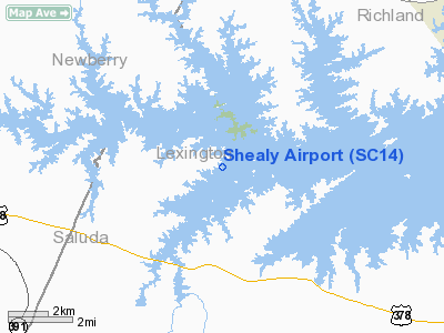
Location & QuickFacts
| FAA Information Effective: | 2008-09-25 |
| Airport Identifier: | SC14 |
| Airport Status: | Operational |
| Longitude/Latitude: | 081-24-35.3660W/34-03-45.5170N
-81.409824/34.062644 (Estimated) |
| Elevation: | 380 ft / 115.82 m (Estimated) |
| Land: | 7 acres |
| From nearest city: | 9 nautical miles N of Gilbert, SC |
| Location: | Lexington County, SC |
| Magnetic Variation: | 04W (1985) |
Owner & Manager
| Ownership: | Privately owned |
| Owner: | Wilson Shealy |
| Address: | 1427 Frank Shealy Rd
Leesville, SC 29070 |
| Phone number: | 803-532-4722 |
| Address: |
|
Airport Operations and Facilities
| Airport Use: | Private |
| Wind indicator: | No |
| Segmented Circle: | No |
| Control Tower: | No |
| Landing fee charge: | No |
| Sectional chart: | Atlanta |
| Region: | ASO - Southern |
| Boundary ARTCC: | ZJX - Jacksonville |
| Tie-in FSS: | AND - Anderson |
| FSS on Airport: | No |
| FSS Toll Free: | 1-800-WX-BRIEF |
Airport Services
| Airframe Repair: | NONE |
| Power Plant Repair: | NONE |
Runway Information
Runway 12/30
| Dimension: | 1700 x 85 ft / 518.2 x 25.9 m |
| Surface: | TURF, |
| |
Runway 12 |
Runway 30 |
| Traffic Pattern: | Left | Left |
|
Radio Navigation Aids
| ID |
Type |
Name |
Ch |
Freq |
Var |
Dist |
| EOE | NDB | Enoree | | 278.00 | 05W | 18.7 nm |
| FDW | NDB | Winnsboro | | 414.00 | 05W | 21.2 nm |
| AIK | NDB | Aiken | | 347.00 | 04W | 28.1 nm |
| MMT | NDB | Mc Entire | | 427.00 | 05W | 31.4 nm |
| GIW | NDB | Coronaca | | 239.00 | 04W | 35.6 nm |
| LUX | NDB | Laurens | | 307.00 | 04W | 37.9 nm |
| UOT | NDB | Union County | | 326.00 | 04W | 39.1 nm |
| BKO | NDB | Barnwell | | 392.00 | 06W | 43.0 nm |
| CDN | NDB | Camden | | 263.00 | 05W | 44.2 nm |
| DCM | NDB | Chester | | 220.00 | 06W | 44.7 nm |
| OYI | NDB | Orangeburg | | 226.00 | 05W | 46.2 nm |
| EMR | NDB | Emory | | 385.00 | 04W | 46.5 nm |
| LKR | NDB | Lancaster | | 400.00 | 07W | 48.2 nm |
| SSC | TACAN | Shaw | 038X | | 05W | 47.3 nm |
| EDS | VOR/DME | Edisto | 051X | 111.40 | 05W | 45.7 nm |
| CAE | VORTAC | Columbia | 094X | 114.70 | 02W | 21.6 nm |
| MMT | VORTAC | Mc Entire | 079X | 113.20 | 05W | 31.4 nm |
| GRD | VORTAC | Greenwood | 102X | 115.50 | 01W | 38.7 nm |
| IRQ | VORTAC | Colliers | 086X | 113.90 | 04W | 43.2 nm |
Remarks
- NON COMPLIANCE FAR PART 157
Images and information placed above are from
http://www.airport-data.com/airport/SC14/
We thank them for the data!
| General Info
|
| Country |
United States
|
| State |
SOUTH CAROLINA
|
| FAA ID |
SC14
|
| Latitude |
34-03-45.517N
|
| Longitude |
081-24-35.366W
|
| Elevation |
380 feet
|
| Near City |
GILBERT
|
We don't guarantee the information is fresh and accurate. The data may
be wrong or outdated.
For more up-to-date information please refer to other sources.
|
|


