 |
|
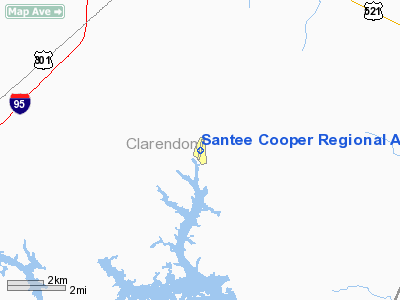
Santee Cooper Rgnl Airport |
Location & QuickFacts
| FAA Information Effective: | 2008-09-25 |
| Airport Identifier: | MNI |
| Airport Status: | Operational |
| Longitude/Latitude: | 080-12-31.2000W/33-35-13.6000N
-80.208667/33.587111 (Estimated) |
| Elevation: | 103 ft / 31.39 m (Surveyed) |
| Land: | 67 acres |
| From nearest city: | 7 nautical miles S of Manning, SC |
| Location: | Clarendon County, SC |
| Magnetic Variation: | 06W (1995) |
Owner & Manager
| Ownership: | Publicly owned |
| Owner: | Clarendon County |
| Address: | Po Box 486
Manning, SC 29102 |
| Phone number: | 803-435-8424 |
| Manager: | Hal Lowder, Manager
FBO - JIM STOIA, PRECISION AIR COMPANY 803-478-4764. |
| Address: | 1636 Wyboo Ave.
Manning, SC 29102 |
| Phone number: | 803-478-7256 |
Airport Operations and Facilities
| Airport Use: | Open to public |
| Wind indicator: | Yes |
| Segmented Circle: | Yes |
| Control Tower: | No |
| Lighting Schedule: | DUSK-DAWN
MIRL PRESET LOW INTST DUSK-2300; TO INCR INTST ACTVT CTAF; AFTER 2300 ACTVT - CTAF. |
| Beacon Color: | Clear-Green (lighted land airport) |
| Landing fee charge: | No |
| Sectional chart: | Charlotte |
| Region: | ASO - Southern |
| Boundary ARTCC: | ZJX - Jacksonville |
| Tie-in FSS: | AND - Anderson |
| FSS on Airport: | No |
| FSS Toll Free: | 1-800-WX-BRIEF |
| NOTAMs Facility: | AND (NOTAM-d service avaliable) |
| Federal Agreements: | NY1 |
Airport Communications
| CTAF: | 122.800 |
| Unicom: | 122.800 |
Airport Services
| Fuel available: | 100LL
SELF SERVICE FUEL AVAILABLE 24 HRS WITH CREDIT CARD. |
| Airframe Repair: | MAJOR |
| Power Plant Repair: | MINOR |
| Bottled Oxygen: | NONE |
| Bulk Oxygen: | NONE |
Runway Information
Runway 02/20
| Dimension: | 3602 x 75 ft / 1097.9 x 22.9 m |
| Surface: | ASPH, Good Condition |
| Weight Limit: | Single wheel: 30000 lbs. |
| Edge Lights: | Medium |
| |
Runway 02 |
Runway 20 |
| Longitude: | 080-12-35.6973W | 080-12-26.7289W |
| Latitude: | 33-34-56.1449N | 33-35-30.9801N |
| Elevation: | 94.00 ft | 103.00 ft |
| Alignment: | 12 | 127 |
| Traffic Pattern: | Left | Left |
| Markings: | Non-precision instrument, Good Condition
RY 02/20 MARKINGS FADED. | Non-precision instrument, Good Condition |
| Crossing Height: | 25.00 ft | 25.00 ft |
| VASI: | 2-light PAPI on left side | 2-light PAPI on left side |
| Visual Glide Angle: | 4.00° | 4.00° |
| Runway End Identifier: | No | No |
| Centerline Lights: | No | No |
| Touchdown Lights: | No | No |
| Obstruction: | 57 ft tree, 1100.0 ft from runway, 166 ft right of centerline, 15:1 slope to clear | 55 ft tree, 1029.0 ft from runway, 165 ft left of centerline, 14:1 slope to clear |
|
Radio Navigation Aids
| ID |
Type |
Name |
Ch |
Freq |
Var |
Dist |
| MNI | NDB | Manning | | 381.00 | 06W | 0.1 nm |
| CKI | NDB | Kingstree | | 404.00 | 06W | 19.4 nm |
| MKS | NDB | Moncks Corner | | 354.00 | 05W | 25.4 nm |
| SMS | NDB | Sumter | | 252.00 | 04W | 25.4 nm |
| CFY | NDB | Evans | | 420.00 | 06W | 27.4 nm |
| DYB | NDB | Dorchester County | | 365.00 | 05W | 31.8 nm |
| PHH | NDB | Andrews | | 255.00 | 06W | 35.1 nm |
| HEK | NDB | Stuckey | | 236.00 | 06W | 35.2 nm |
| MMT | NDB | Mc Entire | | 427.00 | 05W | 36.2 nm |
| OYI | NDB | Orangeburg | | 226.00 | 05W | 36.4 nm |
| CH | NDB | Ashly | | 329.00 | 05W | 37.1 nm |
| RBW | NDB | Walterboro | | 221.00 | 05W | 45.3 nm |
| CDN | NDB | Camden | | 263.00 | 05W | 45.4 nm |
| GGE | NDB | Georgetown | | 242.00 | 06W | 47.3 nm |
| HVS | NDB | Hartsville | | 341.00 | 07W | 49.5 nm |
| SSC | TACAN | Shaw | 038X | | 05W | 26.8 nm |
| EDS | VOR/DME | Edisto | 051X | 111.40 | 05W | 33.5 nm |
| VAN | VORTAC | Vance | 041X | 110.40 | 06W | 13.8 nm |
| MMT | VORTAC | Mc Entire | 079X | 113.20 | 05W | 35.9 nm |
| CHS | VORTAC | Charleston | 082X | 113.50 | 05W | 42.5 nm |
| CAE | VORTAC | Columbia | 094X | 114.70 | 02W | 45.3 nm |
| FLO | VORTAC | Florence | 099X | 115.20 | 03W | 47.6 nm |
| CHS | VOT | Charleston | | 111.00 | | 41.8 nm |
Remarks
- VEHICLES OPER ADJ TO RY 02/20 & CROSS AT MIDFIELD PERIODICALLY.
- GLIDER OPNS ON & INVOF ARPT.
Images and information placed above are from
http://www.airport-data.com/airport/MNI/
We thank them for the data!
| General Info
|
| Country |
United States
|
| State |
SOUTH CAROLINA
|
| FAA ID |
MNI
|
| Latitude |
33-35-13.600N
|
| Longitude |
080-12-31.200W
|
| Elevation |
103 feet
|
| Near City |
MANNING
|
We don't guarantee the information is fresh and accurate. The data may
be wrong or outdated.
For more up-to-date information please refer to other sources.
|
|


