 |
|
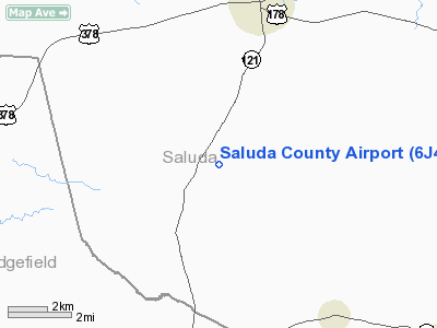
Location & QuickFacts
| FAA Information Effective: | 2008-09-25 |
| Airport Identifier: | 6J4 |
| Airport Status: | Operational |
| Longitude/Latitude: | 081-47-40.3910W/33-55-36.4840N
-81.794553/33.926801 (Estimated) |
| Elevation: | 555 ft / 169.16 m (Estimated) |
| Land: | 59 acres |
| From nearest city: | 4 nautical miles S of Saluda, SC |
| Location: | Saluda County, SC |
| Magnetic Variation: | 04W (1985) |
Owner & Manager
| Ownership: | Publicly owned |
| Owner: | Saluda County |
| Address: | 101 S Main St
Saluda, SC 29138 |
| Phone number: | 864-445-2635 |
| Manager: | John Corley |
| Address: | Po Box 636
Saluda, SC 29138 |
| Phone number: | 864-445-2226 |
Airport Operations and Facilities
| Airport Use: | Open to public |
| Wind indicator: | Yes |
| Segmented Circle: | Yes |
| Control Tower: | No |
| Lighting Schedule: | DUSK-DAWN
ACTVT MIRL RY 01/19 & PAPI RY 19 - CTAF. |
| Beacon Color: | Clear-Green (lighted land airport) |
| Landing fee charge: | No |
| Sectional chart: | Atlanta |
| Region: | ASO - Southern |
| Boundary ARTCC: | ZJX - Jacksonville |
| Responsible ARTCC: | ZTL - Atlanta |
| Tie-in FSS: | AND - Anderson |
| FSS on Airport: | No |
| FSS Toll Free: | 1-800-WX-BRIEF |
| NOTAMs Facility: | AND (NOTAM-d service avaliable) |
| Federal Agreements: | NY1 |
Airport Communications
Airport Services
| Fuel available: | 100LL |
| Airframe Repair: | MAJOR |
| Power Plant Repair: | MAJOR |
| Bottled Oxygen: | NONE |
| Bulk Oxygen: | NONE |
Runway Information
Runway 01/19
| Dimension: | 3200 x 60 ft / 975.4 x 18.3 m |
| Surface: | ASPH, Good Condition |
| Weight Limit: | Single wheel: 11300 lbs. |
| Edge Lights: | Medium |
| |
Runway 01 |
Runway 19 |
| Traffic Pattern: | Left | Left |
| Markings: | Non-precision instrument, Good Condition | Non-precision instrument, Good Condition |
| Crossing Height: | 0.00 ft | 52.00 ft |
| VASI: | | 2-light PAPI on left side |
| Visual Glide Angle: | 0.00° | 4.15° |
| Runway End Identifier: | No | No |
| Centerline Lights: | No | No |
| Touchdown Lights: | No | No |
| Obstruction: | 16 ft tree, 346.0 ft from runway, 47 ft left of centerline, 8:1 slope to clear | 106 ft tree, 2071.0 ft from runway, 159 ft left of centerline, 17:1 slope to clear |
|
Radio Navigation Aids
| ID |
Type |
Name |
Ch |
Freq |
Var |
Dist |
| AIK | NDB | Aiken | | 347.00 | 04W | 17.5 nm |
| GIW | NDB | Coronaca | | 239.00 | 04W | 24.4 nm |
| EOE | NDB | Enoree | | 278.00 | 05W | 24.4 nm |
| EMR | NDB | Emory | | 385.00 | 04W | 29.7 nm |
| LUX | NDB | Laurens | | 307.00 | 04W | 35.8 nm |
| BKO | NDB | Barnwell | | 392.00 | 06W | 39.5 nm |
| FDW | NDB | Winnsboro | | 414.00 | 05W | 41.2 nm |
| HQU | NDB | Thomson-mcduffie | | 333.00 | 04W | 43.3 nm |
| UOT | NDB | Union County | | 326.00 | 04W | 46.1 nm |
| AA | NDB | Cedar | | 341.00 | 04W | 47.3 nm |
| MMT | NDB | Mc Entire | | 427.00 | 05W | 49.7 nm |
| IRQ | VORTAC | Colliers | 086X | 113.90 | 04W | 22.6 nm |
| GRD | VORTAC | Greenwood | 102X | 115.50 | 01W | 26.5 nm |
| CAE | VORTAC | Columbia | 094X | 114.70 | 02W | 37.2 nm |
| MMT | VORTAC | Mc Entire | 079X | 113.20 | 05W | 49.5 nm |
Remarks
- 30 FT DROP OFF N END OF RY 01.
- VFR OPNS ONLY
Images and information placed above are from
http://www.airport-data.com/airport/6J4/
We thank them for the data!
| General Info
|
| Country |
United States
|
| State |
SOUTH CAROLINA
|
| FAA ID |
6J4
|
| Latitude |
33-55-36.484N
|
| Longitude |
081-47-40.391W
|
| Elevation |
555 feet
|
| Near City |
SALUDA
|
We don't guarantee the information is fresh and accurate. The data may
be wrong or outdated.
For more up-to-date information please refer to other sources.
|
|


