 |
|
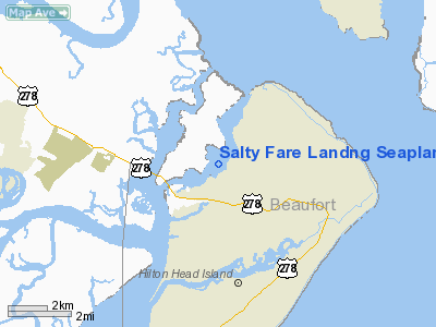
Salty Fare Landng Seaplane Base Airport |
Location & QuickFacts
| FAA Information Effective: | 2008-09-25 |
| Airport Identifier: | 2SC4 |
| Airport Status: | Operational |
| Longitude/Latitude: | 080-45-15.0000W/32-14-02.0000N
-80.754167/32.233889 (Estimated) |
| Elevation: | 0 ft / 0.00 m (Estimated) |
| Land: | 0 acres |
| From nearest city: | 2 nautical miles W of Hilton Head, SC |
| Location: | Beaufort County, SC |
| Magnetic Variation: | 05W (1995) |
Owner & Manager
| Ownership: | Privately owned |
| Owner: | Ny Escape Inc |
| Address: | 30 E. 60th St
Savannah, GA 31405 |
| Phone number: | 912-354-4122 |
| Manager: | Joel T. De Grandis |
| Address: | 30 E. 60th St
Savannah, GA 31405 |
| Phone number: | 912-966-1100 |
Airport Operations and Facilities
| Airport Use: | Private |
| Segmented Circle: | No |
| Control Tower: | No |
| Sectional chart: | Charlotte |
| Region: | ASO - Southern |
| Boundary ARTCC: | ZJX - Jacksonville |
| Tie-in FSS: | AND - Anderson |
| FSS Toll Free: | 1-800-WX-BRIEF |
Runway Information
Runway 06/24
| Dimension: | 5000 x 200 ft / 1524.0 x 61.0 m |
| Surface: | WATER, |
| |
Runway 06 |
Runway 24 |
| Traffic Pattern: | Left | Right |
|
Radio Navigation Aids
| ID |
Type |
Name |
Ch |
Freq |
Var |
Dist |
| RBW | NDB | Walterboro | | 221.00 | 05W | 42.0 nm |
| MOQ | NDB | Mc Intosh | | 263.00 | 04W | 45.5 nm |
| JZI | NDB | Johns Island | | 283.00 | 05W | 47.2 nm |
| BZ | NDB | Bullo | | 407.00 | 05W | 47.5 nm |
| JYL | NDB | Sylvania | | 245.00 | 04W | 49.4 nm |
| NBC | TACAN | Beaufort | 042X | | 05W | 14.9 nm |
| SVN | VOR/DME | Hunter | 53X | 111.60 | 02W | 23.8 nm |
| SAV | VORTAC | Savannah | 106Y | 115.95 | 06W | 23.2 nm |
| SAV | VOT | Savannah Travis Fld | | 111.00 | | 23.7 nm |
Remarks
- DOCKING FEE - 24 HR PPR CALL 919-966-1100.
- SEAPLANE BASE LCTD ON SKULL CREEK.
- VFR DALGT OPNS ONLY.
- 60 FT BRIDGE & 80 FT POWER LINES 1 NM SOUTHWEST OF SEAPLANE BASE.
- PRVDD VFR/PVT USE, BE AWARE OF PROXIMITY TO MTR VR-1040/1041, RIGHT TFC RY 24 TO MINIMIZE CONFLICT WITH HILTON HEAD ARPT.
Images and information placed above are from
http://www.airport-data.com/airport/2SC4/
We thank them for the data!
| General Info
|
| Country |
United States
|
| State |
SOUTH CAROLINA
|
| FAA ID |
2SC4
|
| Latitude |
32-14-02.000N
|
| Longitude |
080-45-15.000W
|
| Elevation |
0 feet
|
| Near City |
HILTON HEAD
|
We don't guarantee the information is fresh and accurate. The data may
be wrong or outdated.
For more up-to-date information please refer to other sources.
|
|


