 |
|
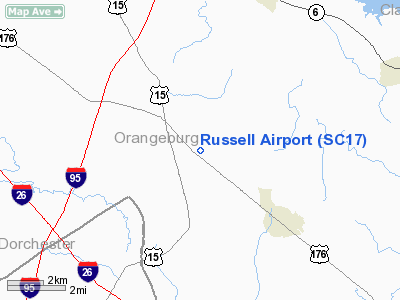
Location & QuickFacts
| FAA Information Effective: | 2008-09-25 |
| Airport Identifier: | SC17 |
| Airport Status: | Operational |
| Longitude/Latitude: | 080-27-35.3310W/33-21-28.5840N
-80.459814/33.357940 (Estimated) |
| Elevation: | 110 ft / 33.53 m (Surveyed) |
| Land: | 0 acres |
| From nearest city: | 3 nautical miles NW of Holly Hill, SC |
| Location: | Orangeburg County, SC |
| Magnetic Variation: | 05W (1985) |
Owner & Manager
| Ownership: | Privately owned |
| Owner: | J M Russell Jr |
| Address: | Rt 1, Box 103
Holly Hill, SC 29059 |
| Phone number: | 803-525-7154 |
| Manager: | J M Russell Jr |
| Address: | Rt 1, Box 103
Holly Hill, SC 29059 |
| Phone number: | 803-496-3379 |
Airport Operations and Facilities
| Airport Use: | Private |
| Wind indicator: | Yes |
| Segmented Circle: | No |
| Control Tower: | No |
| Landing fee charge: | No |
| Sectional chart: | Charlotte |
| Region: | ASO - Southern |
| Boundary ARTCC: | ZJX - Jacksonville |
| Tie-in FSS: | AND - Anderson |
| FSS on Airport: | No |
| FSS Toll Free: | 1-800-WX-BRIEF |
Airport Services
| Airframe Repair: | NONE |
| Power Plant Repair: | NONE |
Runway Information
Runway 13/31
| Dimension: | 2400 x 75 ft / 731.5 x 22.9 m |
| Surface: | TURF, |
| |
Runway 13 |
Runway 31 |
| Traffic Pattern: | Left | Left |
|
Radio Navigation Aids
| ID |
Type |
Name |
Ch |
Freq |
Var |
Dist |
| MNI | NDB | Manning | | 381.00 | 06W | 18.8 nm |
| DYB | NDB | Dorchester County | | 365.00 | 05W | 20.1 nm |
| OYI | NDB | Orangeburg | | 226.00 | 05W | 22.7 nm |
| MKS | NDB | Moncks Corner | | 354.00 | 05W | 23.7 nm |
| RBW | NDB | Walterboro | | 221.00 | 05W | 27.5 nm |
| CH | NDB | Ashly | | 329.00 | 05W | 29.3 nm |
| CKI | NDB | Kingstree | | 404.00 | 06W | 37.2 nm |
| SMS | NDB | Sumter | | 252.00 | 04W | 38.4 nm |
| MMT | NDB | Mc Entire | | 427.00 | 05W | 38.7 nm |
| JZI | NDB | Johns Island | | 283.00 | 05W | 45.6 nm |
| CFY | NDB | Evans | | 420.00 | 06W | 45.9 nm |
| PHH | NDB | Andrews | | 255.00 | 06W | 47.1 nm |
| BKO | NDB | Barnwell | | 392.00 | 06W | 48.4 nm |
| SSC | TACAN | Shaw | 038X | | 05W | 37.3 nm |
| ALD | VOR | Allendale | | 116.70 | 01W | 46.7 nm |
| EDS | VOR/DME | Edisto | 051X | 111.40 | 05W | 20.8 nm |
| VAN | VORTAC | Vance | 041X | 110.40 | 06W | 7.0 nm |
| CHS | VORTAC | Charleston | 082X | 113.50 | 05W | 35.0 nm |
| MMT | VORTAC | Mc Entire | 079X | 113.20 | 05W | 38.1 nm |
| CAE | VORTAC | Columbia | 094X | 114.70 | 02W | 42.3 nm |
| CHS | VOT | Charleston | | 111.00 | | 34.4 nm |
Remarks
Images and information placed above are from
http://www.airport-data.com/airport/SC17/
We thank them for the data!
| General Info
|
| Country |
United States
|
| State |
SOUTH CAROLINA
|
| FAA ID |
SC17
|
| Latitude |
33-21-28.584N
|
| Longitude |
080-27-35.331W
|
| Elevation |
110 feet
|
| Near City |
HOLLY HILL
|
We don't guarantee the information is fresh and accurate. The data may
be wrong or outdated.
For more up-to-date information please refer to other sources.
|
|


