 |
|
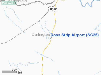
Location & QuickFacts
| FAA Information Effective: | 2008-09-25 |
| Airport Identifier: | SC25 |
| Airport Status: | Operational |
| Longitude/Latitude: | 079-53-05.2310W/34-25-21.5590N
-79.884786/34.422655 (Estimated) |
| Elevation: | 190 ft / 57.91 m (Estimated) |
| Land: | 0 acres |
| From nearest city: | 6 nautical miles S of W. Society Hill, SC |
| Location: | Darlington County, SC |
| Magnetic Variation: | 05W (1985) |
Owner & Manager
| Ownership: | Privately owned |
| Owner: | Jack Ross |
| Address: | P.o. Box 32
Darlington, SC 29532 |
| Phone number: | 803-393-4435 |
| Manager: | Jack Ross |
| Address: | P.o.box 32
Darlington, SC 29532 |
| Phone number: | 803-393-4435 |
Airport Operations and Facilities
| Airport Use: | Private
PERSONAL USE. |
| Segmented Circle: | No |
| Control Tower: | No |
| Sectional chart: | Charlotte |
| Region: | ASO - Southern |
| Boundary ARTCC: | ZJX - Jacksonville |
| Tie-in FSS: | AND - Anderson |
| FSS on Airport: | No |
| FSS Toll Free: | 1-800-WX-BRIEF |
Runway Information
Runway 02/20
| Dimension: | 1900 x 80 ft / 579.1 x 24.4 m |
| Surface: | TURF, |
| |
Runway 02 |
Runway 20 |
| Traffic Pattern: | Left | Left |
|
Radio Navigation Aids
| ID |
Type |
Name |
Ch |
Freq |
Var |
Dist |
| UDG | NDB | Darlington | | 245.00 | 06W | 1.2 nm |
| HVS | NDB | Hartsville | | 341.00 | 07W | 11.7 nm |
| BES | NDB | Bennettsville | | 230.00 | 07W | 14.0 nm |
| CQW | NDB | Cheraw | | 409.00 | 05W | 19.2 nm |
| DLC | NDB | Dillon | | 274.00 | 05W | 25.6 nm |
| RCZ | NDB | Roscoe | | 375.00 | 07W | 27.5 nm |
| ME | NDB | Maxtn | | 257.00 | 08W | 28.7 nm |
| PYG | NDB | Pageland | | 270.00 | 06W | 29.6 nm |
| MAO | NDB | Marion | | 388.00 | 06W | 30.9 nm |
| CFY | NDB | Evans | | 420.00 | 06W | 34.6 nm |
| CDN | NDB | Camden | | 263.00 | 05W | 34.6 nm |
| SMS | NDB | Sumter | | 252.00 | 04W | 35.1 nm |
| AFP | NDB | Anson County | | 283.00 | 07W | 37.4 nm |
| JB | NDB | Jigel | | 384.00 | 08W | 37.7 nm |
| HFF | NDB | Mackall | | 278.00 | 06W | 41.4 nm |
| CKI | NDB | Kingstree | | 404.00 | 06W | 42.4 nm |
| RSY | NDB | Robeson | | 359.00 | 08W | 42.4 nm |
| HEK | NDB | Stuckey | | 236.00 | 06W | 45.4 nm |
| SSC | TACAN | Shaw | 038X | | 05W | 39.4 nm |
| LBT | VOR | Lumberton | | 110.00 | 08W | 42.6 nm |
| CTF | VOR/DME | Chesterfield | 019X | 108.20 | 03W | 23.7 nm |
| FLO | VORTAC | Florence | 099X | 115.20 | 03W | 16.1 nm |
| SDZ | VORTAC | Sandhills | 055X | 111.80 | 03W | 49.9 nm |
Remarks
- PROVIDED ALL OPS VFR/PSNAL USE; OPS AGRMT W/DARLINGTON CO ARPT.
Images and information placed above are from
http://www.airport-data.com/airport/SC25/
We thank them for the data!
| General Info
|
| Country |
United States
|
| State |
SOUTH CAROLINA
|
| FAA ID |
SC25
|
| Latitude |
34-25-21.559N
|
| Longitude |
079-53-05.231W
|
| Elevation |
190 feet
|
| Near City |
W. SOCIETY HILL
|
We don't guarantee the information is fresh and accurate. The data may
be wrong or outdated.
For more up-to-date information please refer to other sources.
|
|


