 |
|
Coordinates: 33°27′06″N 079°31′34″W / 33.45167°N 79.52611°W / 33.45167; -79.52611
| Robert F. Swinnie Airport |
| IATA: ADR – ICAO: KPHH – FAA LID: PHH |
| Summary |
| Airport type |
Public |
| Owner |
Georgetown County |
| Location |
Andrews, South Carolina |
| Elevation AMSL |
26 ft / 8 m |
| Runways |
| Direction |
Length |
Surface |
| ft |
m |
| 18/36 |
3,001 |
915 |
Asphalt |
| Statistics (2006) |
| Aircraft operations |
1,000 |
| Source: Federal Aviation Administration |
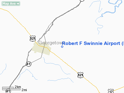
Robert F. Swinnie Airport (IATA: ADR, ICAO: KPHH, FAA LID: PHH) is a public airport located two miles (3 km) east of the central business district of Andrews, a town in Georgetown County, South Carolina, United States. It is owned by Georgetown County.
Although most U.S. airports use the same three-letter location identifier for the FAA and IATA, Robert F. Swinnie Airport is assigned PHH by the FAA and ADR by the IATA.
Facilities and aircraft
Robert F. Swinnie Airport covers an area of 92 acres (37 ha) which contains one asphalt paved runway (18/36) measuring 3,001 x 60 ft (915 x 18 m). For the 12-month period ending September 13, 2006, the airport had 1,000 aircraft operations, 100% of which were general aviation.
The above content comes from Wikipedia and is published under free licenses – click here to read more.
Location & QuickFacts
| FAA Information Effective: | 2008-09-25 |
| Airport Identifier: | PHH |
| Airport Status: | Operational |
| Longitude/Latitude: | 079-31-34.2360W/33-27-06.1190N
-79.526177/33.451700 (Estimated) |
| Elevation: | 26 ft / 7.92 m (Surveyed) |
| Land: | 92 acres |
| From nearest city: | 2 nautical miles E of Andrews, SC |
| Location: | Georgetown County, SC |
| Magnetic Variation: | 06W (1985) |
Owner & Manager
| Ownership: | Publicly owned |
| Owner: | Georgetown County |
| Address: | P.o. Drawer 1270
Georgetown, SC 29442 |
| Phone number: | 843-546-4189 |
| Manager: | Pete Kinder |
| Address: | 12 South Rosemary Ave.
Andrrews, SC 29510 |
| Phone number: | 843-264-5119 |
Airport Operations and Facilities
| Airport Use: | Open to public |
| Wind indicator: | Yes |
| Segmented Circle: | Yes |
| Control Tower: | No |
| Lighting Schedule: | DUSK-DAWN |
| Beacon Color: | Clear-Green (lighted land airport) |
| Landing fee charge: | No |
| Sectional chart: | Charlotte |
| Region: | ASO - Southern |
| Boundary ARTCC: | ZJX - Jacksonville |
| Tie-in FSS: | AND - Anderson |
| FSS on Airport: | No |
| FSS Toll Free: | 1-800-WX-BRIEF |
| NOTAMs Facility: | AND (NOTAM-d service avaliable) |
| Federal Agreements: | NY1 |
Airport Communications
Airport Services
| Airframe Repair: | NONE |
| Power Plant Repair: | NONE |
| Bottled Oxygen: | NONE |
| Bulk Oxygen: | NONE |
Runway Information
Runway 18/36
| Dimension: | 3001 x 60 ft / 914.7 x 18.3 m |
| Surface: | ASPH, Good Condition |
| Weight Limit: | Single wheel: 11000 lbs.
Dual wheel: 22000 lbs. |
| Edge Lights: | Medium
MIRL OTS INDEFLY. |
| |
Runway 18 |
Runway 36 |
| Longitude: | 079-31-36.5970W | 079-31-31.8750W |
| Latitude: | 33-27-20.8300N | 33-26-51.4080N |
| Elevation: | 17.00 ft | 26.00 ft |
| Alignment: | 127 | 127 |
| Traffic Pattern: | Left | Left |
| Markings: | Basic, Good Condition | Basic, Good Condition |
| Crossing Height: | 38.00 ft | 34.00 ft |
| VASI: | 2-box on left side | 2-box on left side |
| Visual Glide Angle: | 3.00° | 3.00° |
| Obstruction: | 15 ft tree, 454.0 ft from runway, 48 ft left of centerline, 16:1 slope to clear | 52 ft tree, 785.0 ft from runway, 146 ft left of centerline, 11:1 slope to clear |
|
Radio Navigation Aids
| ID |
Type |
Name |
Ch |
Freq |
Var |
Dist |
| GGE | NDB | Georgetown | | 242.00 | 06W | 13.0 nm |
| HEK | NDB | Stuckey | | 236.00 | 06W | 16.6 nm |
| CKI | NDB | Kingstree | | 404.00 | 06W | 23.0 nm |
| CFY | NDB | Evans | | 420.00 | 06W | 27.1 nm |
| MKS | NDB | Moncks Corner | | 354.00 | 05W | 29.9 nm |
| HYW | NDB | Horry | | 370.00 | 08W | 29.9 nm |
| MNI | NDB | Manning | | 381.00 | 06W | 35.1 nm |
| CH | NDB | Ashly | | 329.00 | 05W | 40.5 nm |
| DYB | NDB | Dorchester County | | 365.00 | 05W | 44.5 nm |
| MAO | NDB | Marion | | 388.00 | 06W | 45.1 nm |
| CHS | VORTAC | Charleston | 082X | 113.50 | 05W | 42.2 nm |
| CRE | VORTAC | Grand Strand | 123X | 117.60 | 03W | 45.6 nm |
| VAN | VORTAC | Vance | 041X | 110.40 | 06W | 46.3 nm |
| FLO | VORTAC | Florence | 099X | 115.20 | 03W | 47.4 nm |
| CHS | VOT | Charleston | | 111.00 | | 41.8 nm |
Images and information placed above are from
http://www.airport-data.com/airport/PHH/
We thank them for the data!
| General Info
|
| Country |
United States
|
| State |
SOUTH CAROLINA
|
| FAA ID |
PHH
|
| Latitude |
33-27-06.119N
|
| Longitude |
079-31-34.236W
|
| Elevation |
27 feet
|
| Near City |
ANDREWS
|
We don't guarantee the information is fresh and accurate. The data may
be wrong or outdated.
For more up-to-date information please refer to other sources.
|
|


