 |
|
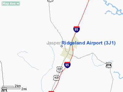
Location & QuickFacts
| FAA Information Effective: | 2008-09-25 |
| Airport Identifier: | 3J1 |
| Airport Status: | Operational |
| Longitude/Latitude: | 080-59-32.3890W/32-29-33.6730N
-80.992330/32.492687 (Estimated) |
| Elevation: | 79 ft / 24.08 m (Surveyed) |
| Land: | 82 acres |
| From nearest city: | 1 nautical miles NW of Ridgeland, SC |
| Location: | Jasper County, SC |
| Magnetic Variation: | 04W (1985) |
Owner & Manager
| Ownership: | Publicly owned |
| Owner: | County Of Jasper |
| Address: | Po Box 653
Ridgeland, SC 29936 |
| Phone number: | 843-726-7724 |
| Manager: | Claude Dean |
| Address: | P.o. Box 653
Ridgeland, SC 29936 |
| Phone number: | 843-726-7759 |
Airport Operations and Facilities
| Airport Use: | Open to public |
| Wind indicator: | Yes |
| Segmented Circle: | Yes |
| Control Tower: | No |
| Lighting Schedule: | DUSK-DAWN |
| Beacon Color: | Clear-Green (lighted land airport) |
| Landing fee charge: | No |
| Sectional chart: | Charlotte |
| Region: | ASO - Southern |
| Boundary ARTCC: | ZJX - Jacksonville |
| Tie-in FSS: | AND - Anderson |
| FSS on Airport: | No |
| FSS Toll Free: | 1-800-WX-BRIEF |
| NOTAMs Facility: | AND (NOTAM-d service avaliable) |
| Federal Agreements: | N |
Airport Communications
| CTAF: | 122.700 |
| Unicom: | 122.700 |
Airport Services
| Fuel available: | 100LL80 |
| Airframe Repair: | MAJOR |
| Power Plant Repair: | MAJOR |
| Bottled Oxygen: | NONE |
| Bulk Oxygen: | NONE |
Runway Information
Runway 03/21
| Dimension: | 2692 x 70 ft / 820.5 x 21.3 m |
| Surface: | ASPH, Fair Condition |
| Weight Limit: | Single wheel: 12500 lbs. |
| Edge Lights: | Low |
| |
Runway 03 |
Runway 21 |
| Traffic Pattern: | Left | Left |
| Markings: | Basic, Fair Condition | Basic, Fair Condition |
| Crossing Height: | 45.00 ft | 0.00 ft |
| VASI: | 2-light PAPI on left side | |
| Visual Glide Angle: | 3.25° | 0.00° |
| Obstruction: | 74 ft tree, 1127.0 ft from runway, 182 ft left of centerline, 12:1 slope to clear | 55 ft tree, 475.0 ft from runway, 128 ft right of centerline, 4:1 slope to clear
50 FT TREES 100-150 FT RIGHT OF CNTRLN 1000 FT FM THLD. |
|
Radio Navigation Aids
| ID |
Type |
Name |
Ch |
Freq |
Var |
Dist |
| RBW | NDB | Walterboro | | 221.00 | 05W | 31.5 nm |
| JYL | NDB | Sylvania | | 245.00 | 04W | 31.9 nm |
| BZ | NDB | Bullo | | 407.00 | 05W | 34.4 nm |
| MOQ | NDB | Mc Intosh | | 263.00 | 04W | 47.7 nm |
| CWV | NDB | Claxton | | 395.50 | 04W | 48.5 nm |
| DYB | NDB | Dorchester County | | 365.00 | 05W | 49.7 nm |
| NBC | TACAN | Beaufort | 042X | | 05W | 14.0 nm |
| ALD | VOR | Allendale | | 116.70 | 01W | 34.7 nm |
| SVN | VOR/DME | Hunter | 53X | 111.60 | 02W | 29.9 nm |
| SAV | VORTAC | Savannah | 106Y | 115.95 | 06W | 23.3 nm |
| SAV | VOT | Savannah Travis Fld | | 111.00 | | 24.4 nm |
Remarks
- RY 03 20' DROP AT END OF PAVEMENT.
- GLIDER OPNS INVOF ARPT.
- ARPT EXISTED PRIOR TO 1958.
Images and information placed above are from
http://www.airport-data.com/airport/3J1/
We thank them for the data!
| General Info
|
| Country |
United States
|
| State |
SOUTH CAROLINA
|
| FAA ID |
3J1
|
| Latitude |
32-29-33.673N
|
| Longitude |
080-59-32.389W
|
| Elevation |
79 feet
|
| Near City |
RIDGELAND
|
We don't guarantee the information is fresh and accurate. The data may
be wrong or outdated.
For more up-to-date information please refer to other sources.
|
|


