 |
|
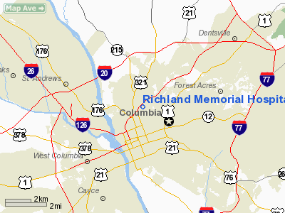
Richland Memorial Hospital Heliport |
Location & QuickFacts
| FAA Information Effective: | 2008-09-25 |
| Airport Identifier: | SC22 |
| Airport Status: | Operational |
| Longitude/Latitude: | 081-02-00.3300W/34-01-40.5550N
-81.033425/34.027932 (Estimated) |
| Elevation: | 258 ft / 78.64 m (Estimated) |
| Land: | 0 acres |
| From nearest city: | 7 nautical miles S of Columbia, SC |
| Location: | Richland County, SC |
| Magnetic Variation: | 04W (1985) |
Owner & Manager
| Ownership: | Publicly owned |
| Owner: | Richland Memorial Hospital |
| Address: | 5 Richland Medical Park
Columbia, SC 29203 |
| Phone number: | 803-434-6512 |
| Manager: | Gary Hogue |
| Address: | 5 Richland Medical Park
Columbia, SC 29203 |
| Phone number: | 803-434-6521 |
Airport Operations and Facilities
| Airport Use: | Private
MEDICAL. |
| Wind indicator: | Yes |
| Segmented Circle: | No |
| Control Tower: | No |
| Lighting Schedule: | DUSK-DAWN |
| Sectional chart: | Atlanta |
| Region: | ASO - Southern |
| Boundary ARTCC: | ZJX - Jacksonville |
| Tie-in FSS: | AND - Anderson |
| FSS Toll Free: | 1-800-WX-BRIEF |
Runway Information
Helipad H1
| Dimension: | 65 x 65 ft / 19.8 x 19.8 m |
| Surface: | CONC, |
| |
Runway H1 |
Runway |
| Traffic Pattern: | Left | Left |
|
Helipad H2
| Dimension: | 50 x 50 ft / 15.2 x 15.2 m |
| Surface: | CONC, |
| |
Runway H2 |
Runway |
| Traffic Pattern: | Left | Left |
|
Radio Navigation Aids
| ID |
Type |
Name |
Ch |
Freq |
Var |
Dist |
| MMT | NDB | Mc Entire | | 427.00 | 05W | 12.9 nm |
| FDW | NDB | Winnsboro | | 414.00 | 05W | 17.7 nm |
| CDN | NDB | Camden | | 263.00 | 05W | 28.1 nm |
| SMS | NDB | Sumter | | 252.00 | 04W | 33.6 nm |
| EOE | NDB | Enoree | | 278.00 | 05W | 34.5 nm |
| OYI | NDB | Orangeburg | | 226.00 | 05W | 37.2 nm |
| AIK | NDB | Aiken | | 347.00 | 04W | 39.3 nm |
| LKR | NDB | Lancaster | | 400.00 | 07W | 42.7 nm |
| BKO | NDB | Barnwell | | 392.00 | 06W | 45.4 nm |
| DCM | NDB | Chester | | 220.00 | 06W | 46.4 nm |
| MNI | NDB | Manning | | 381.00 | 06W | 49.0 nm |
| UOT | NDB | Union County | | 326.00 | 04W | 49.7 nm |
| SSC | TACAN | Shaw | 038X | | 05W | 28.4 nm |
| EDS | VOR/DME | Edisto | 051X | 111.40 | 05W | 35.5 nm |
| CAE | VORTAC | Columbia | 094X | 114.70 | 02W | 10.3 nm |
| MMT | VORTAC | Mc Entire | 079X | 113.20 | 05W | 13.1 nm |
| VAN | VORTAC | Vance | 041X | 110.40 | 06W | 44.3 nm |
Remarks
- PRVDD VFR/PVT USE; ALL APCH/DEP OPERATIONS ARE FROM 220 TO 040 AND FROM 095 TO 150; AREA APPROPRIATLY MKD; & A WIND INDICATOR IS MAINTAINED.
Images and information placed above are from
http://www.airport-data.com/airport/SC22/
We thank them for the data!
|
|


