 |
|
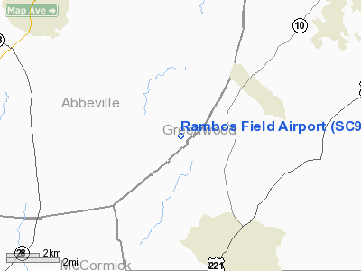
Location & QuickFacts
| FAA Information Effective: | 2008-09-25 |
| Airport Identifier: | SC92 |
| Airport Status: | Operational |
| Longitude/Latitude: | 082-16-54.4500W/34-06-11.4330N
-82.281792/34.103176 (Estimated) |
| Elevation: | 550 ft / 167.64 m (Estimated) |
| Land: | 0 acres |
| From nearest city: | 6 nautical miles SE of Abbeville, SC |
| Location: | Abbeville County, SC |
| Magnetic Variation: | 04W (1990) |
Owner & Manager
| Ownership: | Privately owned |
| Owner: | Barry T Rambo |
| Address: | 3892 Curltail Rd.
Bradley, SC 29819 |
| Phone number: | 864-554-0900 |
| Manager: | Barry T Rambo |
| Address: | 3892 Curltail Rd.
Bradley, SC 29819 |
| Phone number: | 864-554-0900 |
Airport Operations and Facilities
| Airport Use: | Private |
| Wind indicator: | Yes |
| Segmented Circle: | No |
| Control Tower: | No |
| Sectional chart: | Atlanta |
| Region: | ASO - Southern |
| Boundary ARTCC: | ZTL - Atlanta |
| Tie-in FSS: | AND - Anderson |
| FSS on Airport: | No |
| FSS Toll Free: | 1-800-WX-BRIEF |
Runway Information
Runway 10/28
| Dimension: | 2200 x 50 ft / 670.6 x 15.2 m |
| Surface: | TURF,
ROUGH IN SPOTS; DIP IN RY MIDWAY. |
| |
Runway 10 |
Runway 28 |
| Traffic Pattern: | Left | Left |
| Obstruction: | 50 ft trees, 20.0 ft from runway | 50 ft trees, 20.0 ft from runway |
|
Radio Navigation Aids
| ID |
Type |
Name |
Ch |
Freq |
Var |
Dist |
| GIW | NDB | Coronaca | | 239.00 | 04W | 13.3 nm |
| LUX | NDB | Laurens | | 307.00 | 04W | 29.4 nm |
| AND | NDB | Anderson County | | 230.00 | 04W | 31.8 nm |
| IIY | NDB | Washington/wilkes County | | 435.00 | 03W | 33.0 nm |
| EOE | NDB | Enoree | | 278.00 | 05W | 34.5 nm |
| GY | NDB | Dyana | | 338.00 | 03W | 36.2 nm |
| HQU | NDB | Thomson-mcduffie | | 333.00 | 04W | 36.5 nm |
| AA | NDB | Cedar | | 341.00 | 04W | 38.1 nm |
| AIK | NDB | Aiken | | 347.00 | 04W | 40.6 nm |
| EMR | NDB | Emory | | 385.00 | 04W | 41.0 nm |
| CEU | NDB | Clemson | | 257.00 | 05W | 45.6 nm |
| VV | NDB | Junne | | 353.00 | 05W | 46.0 nm |
| UOT | NDB | Union County | | 326.00 | 04W | 47.2 nm |
| LQK | NDB | Lake Keowee | | 408.00 | 04W | 47.4 nm |
| BJT | NDB | Bulldog | | 221.00 | 03W | 47.6 nm |
| GRD | VORTAC | Greenwood | 102X | 115.50 | 01W | 10.9 nm |
| IRQ | VORTAC | Colliers | 086X | 113.90 | 04W | 24.5 nm |
| ELW | VORTAC | Electric City | 023X | 108.60 | 00E | 31.4 nm |
Remarks
- DEER ON & INVOF RY.
- PRVDD VFR/PVT USE.
Images and information placed above are from
http://www.airport-data.com/airport/SC92/
We thank them for the data!
| General Info
|
| Country |
United States
|
| State |
SOUTH CAROLINA
|
| FAA ID |
SC92
|
| Latitude |
34-06-11.433N
|
| Longitude |
082-16-54.450W
|
| Elevation |
550 feet
|
| Near City |
ABBEVILLE
|
We don't guarantee the information is fresh and accurate. The data may
be wrong or outdated.
For more up-to-date information please refer to other sources.
|
|


