 |
|
Location & QuickFacts
| FAA Information Effective: | 2008-09-25 |
| Airport Identifier: | SC38 |
| Airport Status: | Operational |
| Longitude/Latitude: | 080-04-50.0000W/33-42-27.0000N
-80.080556/33.707500 (Estimated) |
| Elevation: | 112 ft / 34.14 m (Estimated) |
| Land: | 0 acres |
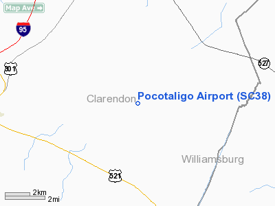
| From nearest city: | 8 nautical miles E of Manning, SC |
| Location: | Clarendon County, SC |
| Magnetic Variation: | 06W (1995) |
Owner & Manager
| Ownership: | Privately owned |
| Owner: | Richard D Porcher
ADDL OWNER: MICHAEL PIERCE; 1 MYRTLE LANE; ISLE OF PALMS, SC. |
| Address: | 395 Creole Pl
Mt Pleasant, SC 29464 |
| Phone number: | 803-849-9238 |
| Manager: | Richard D Porcher |
| Address: | 395 Creole Pl
Mt Pleasant, SC 29464 |
| Phone number: | 803-849-9238 |
Airport Operations and Facilities
| Airport Use: | Private |
| Wind indicator: | Yes |
| Segmented Circle: | No |
| Control Tower: | No |
| Landing fee charge: | No |
| Sectional chart: | Charlotte |
| Region: | ASO - Southern |
| Boundary ARTCC: | ZJX - Jacksonville |
| Tie-in FSS: | AND - Anderson |
| FSS on Airport: | No |
| FSS Toll Free: | 1-800-WX-BRIEF |
Runway Information
Runway 10/28
| Dimension: | 3340 x 80 ft / 1018.0 x 24.4 m |
| Surface: | TURF, |
| |
Runway 10 |
Runway 28 |
| Traffic Pattern: | Left | Left |
|
Radio Navigation Aids
| ID |
Type |
Name |
Ch |
Freq |
Var |
Dist |
| MNI | NDB | Manning | | 381.00 | 06W | 9.5 nm |
| CKI | NDB | Kingstree | | 404.00 | 06W | 11.3 nm |
| CFY | NDB | Evans | | 420.00 | 06W | 18.1 nm |
| SMS | NDB | Sumter | | 252.00 | 04W | 22.0 nm |
| HEK | NDB | Stuckey | | 236.00 | 06W | 27.8 nm |
| MKS | NDB | Moncks Corner | | 354.00 | 05W | 31.1 nm |
| PHH | NDB | Andrews | | 255.00 | 06W | 31.7 nm |
| MMT | NDB | Mc Entire | | 427.00 | 05W | 38.4 nm |
| DYB | NDB | Dorchester County | | 365.00 | 05W | 40.1 nm |
| HVS | NDB | Hartsville | | 341.00 | 07W | 42.1 nm |
| CDN | NDB | Camden | | 263.00 | 05W | 42.1 nm |
| CH | NDB | Ashly | | 329.00 | 05W | 44.0 nm |
| GGE | NDB | Georgetown | | 242.00 | 06W | 44.6 nm |
| OYI | NDB | Orangeburg | | 226.00 | 05W | 44.8 nm |
| UDG | NDB | Darlington | | 245.00 | 06W | 45.3 nm |
| MAO | NDB | Marion | | 388.00 | 06W | 47.0 nm |
| HYW | NDB | Horry | | 370.00 | 08W | 48.1 nm |
| SSC | TACAN | Shaw | 038X | | 05W | 25.2 nm |
| EDS | VOR/DME | Edisto | 051X | 111.40 | 05W | 41.8 nm |
| VAN | VORTAC | Vance | 041X | 110.40 | 06W | 23.1 nm |
| FLO | VORTAC | Florence | 099X | 115.20 | 03W | 38.0 nm |
| MMT | VORTAC | Mc Entire | 079X | 113.20 | 05W | 38.3 nm |
| CHS | VORTAC | Charleston | 082X | 113.50 | 05W | 48.9 nm |
| CAE | VORTAC | Columbia | 094X | 114.70 | 02W | 49.5 nm |
| CHS | VOT | Charleston | | 111.00 | | 48.2 nm |
Remarks
Images and information placed above are from
http://www.airport-data.com/airport/SC38/
We thank them for the data!
| General Info
|
| Country |
United States
|
| State |
SOUTH CAROLINA
|
| FAA ID |
SC38
|
| Latitude |
33-42-27.000N
|
| Longitude |
080-04-50.000W
|
| Elevation |
112 feet
|
| Near City |
MANNING
|
We don't guarantee the information is fresh and accurate. The data may
be wrong or outdated.
For more up-to-date information please refer to other sources.
|
|


