|
|
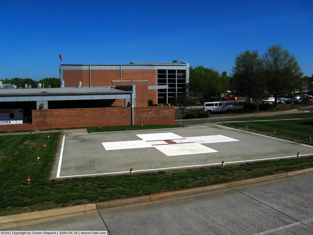
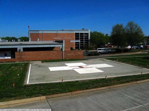
Piedmont Medical Center Heliport |
 |
(Click on the photo to enlarge) |
Location & QuickFacts
| FAA Information Effective: | 2008-09-25 |
| Airport Identifier: | SC04 |
| Airport Status: | Operational |
| Longitude/Latitude: | 081-03-29.2150W/34-57-20.5540N
-81.058115/34.955709 (Estimated) |
| Elevation: | 670 ft / 204.22 m (Estimated) |
| Land: | 0 acres |
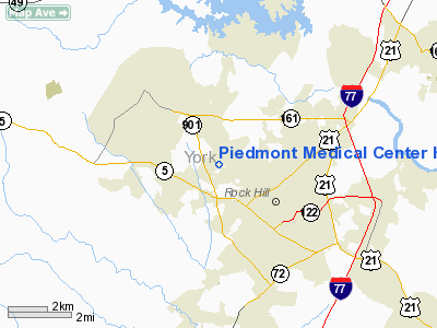
| From nearest city: | 5 nautical miles S of Rock Hill, SC |
| Location: | York County, SC |
| Magnetic Variation: | 05W (1985) |
Owner & Manager
| Ownership: | Privately owned |
| Owner: | Piedmont Medical Center |
| Address: | 222 S. Herlong Ave
Rock Hill, SC 29730 |
| Phone number: | 803-329-1234 |
| Manager: | Ronald L Green |
| Address: | 222 S. Herlong Ave
Rock Hill, SC 29730 |
| Phone number: | 803-329-6881 |
Airport Operations and Facilities
| Airport Use: | Private
MEDICAL |
| Wind indicator: | Yes |
| Segmented Circle: | No |
| Control Tower: | No |
| Lighting Schedule: | PHONE REQ
FOR PERIMETER LGTS CALL 803-329-1234 OR 803-329-6881. |
| Sectional chart: | Charlotte |
| Region: | ASO - Southern |
| Boundary ARTCC: | ZDC - Washington |
| Tie-in FSS: | AND - Anderson |
| FSS Toll Free: | 1-800-WX-BRIEF |
Runway Information
Helipad H1
| Dimension: | 50 x 50 ft / 15.2 x 15.2 m |
| Surface: | CONC, |
| |
Runway H1 |
Runway |
| Traffic Pattern: | Left | Left |
|
Radio Navigation Aids
| ID |
Type |
Name |
Ch |
Freq |
Var |
Dist |
| UZ | NDB | Rally | | 227.00 | 05W | 4.1 nm |
| DCM | NDB | Chester | | 220.00 | 06W | 12.4 nm |
| GHJ | NDB | Stonia | | 260.00 | 06W | 15.0 nm |
| LKR | NDB | Lancaster | | 400.00 | 07W | 17.1 nm |
| TWL | NDB | Wesley | | 204.00 | 06W | 17.4 nm |
| SLP | NDB | First River | | 417.00 | 06W | 32.0 nm |
| UOT | NDB | Union County | | 326.00 | 04W | 33.1 nm |
| IZN | NDB | Lincolnton | | 432.00 | 06W | 35.0 nm |
| PYG | NDB | Pageland | | 270.00 | 06W | 37.7 nm |
| FDW | NDB | Winnsboro | | 414.00 | 05W | 38.6 nm |
| FRT | NDB | Fairmont | | 248.00 | 05W | 45.8 nm |
| CDN | NDB | Camden | | 263.00 | 05W | 47.3 nm |
| EOE | NDB | Enoree | | 278.00 | 05W | 48.1 nm |
| AFP | NDB | Anson County | | 283.00 | 07W | 48.2 nm |
| VW | NDB | Temky | | 280.00 | 05W | 49.2 nm |
| RFE | NDB | Rutherford | | 344.00 | 05W | 49.9 nm |
| CLT | VOR/DME | Charlotte | 097X | 115.00 | 05W | 15.0 nm |
| CTF | VOR/DME | Chesterfield | 019X | 108.20 | 03W | 42.8 nm |
| FML | VORTAC | Fort Mill | 071X | 112.40 | 02W | 5.5 nm |
| SPA | VORTAC | Spartanburg | 104X | 115.70 | 02W | 43.0 nm |
| CLT | VOT | Charlotte | | 112.00 | | 16.7 nm |
| HKY | VOT | Hickory Regional | | 110.00 | | 49.9 nm |
Remarks
- (E111-1) BRUSH AND ALL LOOSE MATERIAL ADJACENT TO PAD REMOVED; SIGNS ERECTED TO NOTIFY PUBLIC OF OPERATIONS; FIRE EXTINGUISHER AT LANDING AREA; GROUND AROUND PAD STABLIZED TO PREVENT BLOWING OF SAND/ROCKS; AND OBSTRUCTION LGTING AFFIXED TO BLDGS/RDO ANTENNAS.
- PRVDD VFR/PVT USE; OPERATIONAL LTR OF AGREEMENT EXECUTED/MAINTAINED WITH OWNER/OPERATOR OF ROCK HILL ARPT & BRYANT FIELD ARPT ON TRAFFIC PATTERN OPERATIONS; CLEAR 8:1 APCH SLOPE ESTABLISHED; INGRESS/EGRESS ROUTES 120 DEGREES - 300 DEGREES USED.
Images and information placed above are from
http://www.airport-data.com/airport/SC04/
We thank them for the data!
| General Info
|
| Country |
United States
|
| State |
SOUTH CAROLINA
|
| FAA ID |
SC04
|
| Latitude |
34-57-20.554N
|
| Longitude |
080-03-29.215W
|
| Elevation |
670 feet
|
| Near City |
ROCK HILL
|
We don't guarantee the information is fresh and accurate. The data may
be wrong or outdated.
For more up-to-date information please refer to other sources.
|
|