 |
|
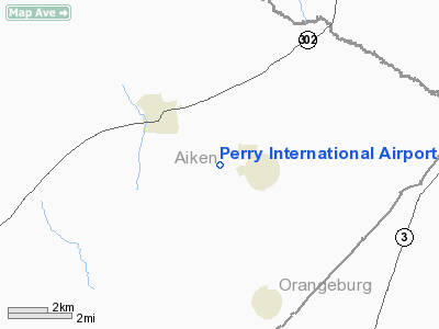
Location & QuickFacts
| FAA Information Effective: | 2008-09-25 |
| Airport Identifier: | SC95 |
| Airport Status: | Operational |
| Longitude/Latitude: | 081-19-47.0000W/33-37-45.5370N
-81.329722/33.629316 (Estimated) |
| Elevation: | 438 ft / 133.50 m (Estimated) |
| Land: | 68 acres |
| From nearest city: | 1 nautical miles NW of Perry, SC |
| Location: | Aiken County, SC |
| Magnetic Variation: | 05W (1990) |
Owner & Manager
| Ownership: | Privately owned |
| Owner: | Rhonda G Tyler |
| Address: | 194 Airport Rd Po Box 65
Wagener, SC 29164 |
| Phone number: | 803-564-5968 |
| Manager: | Al Tyler |
| Address: | 194 Airport Rd
Wagener, SC 29164 |
| Phone number: | 803-564-5968 |
Airport Operations and Facilities
| Airport Use: | Private |
| Wind indicator: | Yes |
| Segmented Circle: | No |
| Control Tower: | No |
| Sectional chart: | Atlanta |
| Region: | ASO - Southern |
| Boundary ARTCC: | ZJX - Jacksonville |
| Tie-in FSS: | AND - Anderson |
| FSS Toll Free: | 1-800-WX-BRIEF |
Runway Information
Runway 07/25
| Dimension: | 5000 x 100 ft / 1524.0 x 30.5 m |
| Surface: | TURF, |
| |
Runway 07 |
Runway 25 |
| Traffic Pattern: | Left | Left |
| Displaced threshold: | 1500.00 ft | 0.00 ft |
| Obstruction: | | 15 ft road, 0.0 ft from runway |
|
Radio Navigation Aids
| ID |
Type |
Name |
Ch |
Freq |
Var |
Dist |
| AIK | NDB | Aiken | | 347.00 | 04W | 17.4 nm |
| BKO | NDB | Barnwell | | 392.00 | 06W | 17.6 nm |
| OYI | NDB | Orangeburg | | 226.00 | 05W | 24.7 nm |
| MMT | NDB | Mc Entire | | 427.00 | 05W | 32.3 nm |
| EMR | NDB | Emory | | 385.00 | 04W | 34.9 nm |
| FDW | NDB | Winnsboro | | 414.00 | 05W | 42.6 nm |
| EOE | NDB | Enoree | | 278.00 | 05W | 43.8 nm |
| BXG | NDB | Burke County | | 356.00 | 04W | 48.9 nm |
| SSC | TACAN | Shaw | 038X | | 05W | 47.9 nm |
| ALD | VOR | Allendale | | 116.70 | 01W | 37.1 nm |
| EDS | VOR/DME | Edisto | 051X | 111.40 | 05W | 25.8 nm |
| CAE | VORTAC | Columbia | 094X | 114.70 | 02W | 19.4 nm |
| MMT | VORTAC | Mc Entire | 079X | 113.20 | 05W | 31.8 nm |
| IRQ | VORTAC | Colliers | 086X | 113.90 | 04W | 41.9 nm |
| VAN | VORTAC | Vance | 041X | 110.40 | 06W | 45.1 nm |
Remarks
- MODEL AVIATION ACTIVITY; GLIDER ACTIVITY.
- VFR PVT USE ONLY.
Images and information placed above are from
http://www.airport-data.com/airport/SC95/
We thank them for the data!
| General Info
|
| Country |
United States
|
| State |
SOUTH CAROLINA
|
| FAA ID |
SC95
|
| Latitude |
33-37-45.537N
|
| Longitude |
081-19-47.000W
|
| Elevation |
438 feet
|
| Near City |
PERRY
|
We don't guarantee the information is fresh and accurate. The data may
be wrong or outdated.
For more up-to-date information please refer to other sources.
|
|


