 |
|
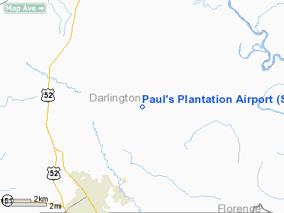
Paul's Plantation Airport |
Location & QuickFacts
| FAA Information Effective: | 2008-09-25 |
| Airport Identifier: | SC93 |
| Airport Status: | Operational |
| Longitude/Latitude: | 079-49-27.2250W/34-21-57.5580N
-79.824229/34.365988 (Estimated) |
| Elevation: | 180 ft / 54.86 m (Estimated) |
| Land: | 0 acres |
| From nearest city: | 6 nautical miles NE of Darlington, SC |
| Location: | Darlington County, SC |
| Magnetic Variation: | 06W (1990) |
Owner & Manager
| Ownership: | Privately owned |
| Owner: | Alexander Paul |
| Address: | 1700 Greenfield Road
Darlington, SC 29540 |
| Phone number: | 803-393-5554 |
| Manager: | Alexander Paul |
| Address: | 1700 Greenfield Road
Darlington, SC 29540 |
| Phone number: | 803-393-5554 |
Airport Operations and Facilities
| Airport Use: | Private |
| Segmented Circle: | No |
| Control Tower: | No |
| Sectional chart: | Charlotte |
| Region: | ASO - Southern |
| Boundary ARTCC: | ZJX - Jacksonville |
| Tie-in FSS: | AND - Anderson |
| FSS on Airport: | No |
| FSS Toll Free: | 1-800-WX-BRIEF |
Runway Information
Runway 18/36
| Dimension: | 3000 x 60 ft / 914.4 x 18.3 m |
| Surface: | TURF, |
| |
Runway 18 |
Runway 36 |
| Traffic Pattern: | Left | Left |
| Obstruction: | 30 ft pline | |
|
Radio Navigation Aids
| ID |
Type |
Name |
Ch |
Freq |
Var |
Dist |
| UDG | NDB | Darlington | | 245.00 | 06W | 5.6 nm |
| HVS | NDB | Hartsville | | 341.00 | 07W | 14.9 nm |
| BES | NDB | Bennettsville | | 230.00 | 07W | 15.9 nm |
| CQW | NDB | Cheraw | | 409.00 | 05W | 22.7 nm |
| DLC | NDB | Dillon | | 274.00 | 05W | 23.1 nm |
| MAO | NDB | Marion | | 388.00 | 06W | 26.7 nm |
| ME | NDB | Maxtn | | 257.00 | 08W | 29.0 nm |
| RCZ | NDB | Roscoe | | 375.00 | 07W | 30.0 nm |
| CFY | NDB | Evans | | 420.00 | 06W | 30.8 nm |
| PYG | NDB | Pageland | | 270.00 | 06W | 34.1 nm |
| SMS | NDB | Sumter | | 252.00 | 04W | 34.9 nm |
| JB | NDB | Jigel | | 384.00 | 08W | 35.7 nm |
| CDN | NDB | Camden | | 263.00 | 05W | 36.9 nm |
| CKI | NDB | Kingstree | | 404.00 | 06W | 39.0 nm |
| RSY | NDB | Robeson | | 359.00 | 08W | 40.7 nm |
| HEK | NDB | Stuckey | | 236.00 | 06W | 41.1 nm |
| AFP | NDB | Anson County | | 283.00 | 07W | 41.6 nm |
| HFF | NDB | Mackall | | 278.00 | 06W | 43.2 nm |
| HYW | NDB | Horry | | 370.00 | 08W | 47.6 nm |
| SSC | TACAN | Shaw | 038X | | 05W | 39.5 nm |
| LBT | VOR | Lumberton | | 110.00 | 08W | 40.9 nm |
| CTF | VOR/DME | Chesterfield | 019X | 108.20 | 03W | 28.1 nm |
| FLO | VORTAC | Florence | 099X | 115.20 | 03W | 11.5 nm |
Remarks
- OWNER DESIRES ARPT NOT BE CHARTED.
- VFR; PRIVATE USE ONLY.
Images and information placed above are from
http://www.airport-data.com/airport/SC93/
We thank them for the data!
| General Info
|
| Country |
United States
|
| State |
SOUTH CAROLINA
|
| FAA ID |
SC93
|
| Latitude |
34-21-57.558N
|
| Longitude |
079-49-27.225W
|
| Elevation |
180 feet
|
| Near City |
DARLINGTON
|
We don't guarantee the information is fresh and accurate. The data may
be wrong or outdated.
For more up-to-date information please refer to other sources.
|
|


