 |
|
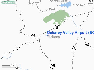
Location & QuickFacts
| FAA Information Effective: | 2008-09-25 |
| Airport Identifier: | SC75 |
| Airport Status: | Operational |
| Longitude/Latitude: | 082-44-05.4790W/34-59-53.4290N
-82.734855/34.998175 (Estimated) |
| Elevation: | 1000 ft / 304.80 m (Estimated) |
| Land: | 2 acres |
| From nearest city: | 8 nautical miles N of Pickens, SC |
| Location: | Pickens County, SC |
| Magnetic Variation: | 04W (1990) |
Owner & Manager
| Ownership: | Privately owned |
| Owner: | Clarence E. Shehan
/DAVID W. ABBOTT. |
| Address: | 2600 Duckpond Lane
Pickens, SC 29671 |
| Phone number: | 864-878-3757 |
| Manager: | Clarence E. Shehan |
| Address: | 2600 Duckpond Lane
Pickens, SC 29671 |
| Phone number: | 803-878-3757 |
Airport Operations and Facilities
| Airport Use: | Private |
| Wind indicator: | Yes |
| Segmented Circle: | No |
| Control Tower: | No |
| Sectional chart: | Atlanta |
| Region: | ASO - Southern |
| Boundary ARTCC: | ZTL - Atlanta |
| Tie-in FSS: | AND - Anderson |
| FSS Toll Free: | 1-800-WX-BRIEF |
Runway Information
Runway 10/28
| Dimension: | 1800 x 55 ft / 548.6 x 16.8 m |
| Surface: | TURF, |
| |
Runway 10 |
Runway 28 |
| Traffic Pattern: | Left | Left |
| Obstruction: | 70 ft trees, 200.0 ft from runway | 50 ft trees, 0.0 ft from runway |
|
Radio Navigation Aids
| ID |
Type |
Name |
Ch |
Freq |
Var |
Dist |
| LQK | NDB | Lake Keowee | | 408.00 | 04W | 11.3 nm |
| CEU | NDB | Clemson | | 257.00 | 05W | 20.9 nm |
| BRA | NDB | Broad River | | 379.00 | 04W | 21.0 nm |
| GY | NDB | Dyana | | 338.00 | 03W | 23.4 nm |
| AND | NDB | Anderson County | | 230.00 | 04W | 30.1 nm |
| FRT | NDB | Fairmont | | 248.00 | 05W | 37.4 nm |
| RFE | NDB | Rutherford | | 344.00 | 05W | 43.8 nm |
| LUX | NDB | Laurens | | 307.00 | 04W | 48.7 nm |
| ODF | VORTAC | Foothills | 081X | 113.40 | 00E | 33.2 nm |
| SUG | VORTAC | Sugarloaf Mountain | 059X | 112.20 | 02W | 33.6 nm |
| ELW | VORTAC | Electric City | 023X | 108.60 | 00E | 34.9 nm |
| SPA | VORTAC | Spartanburg | 104X | 115.70 | 02W | 39.8 nm |
Remarks
- PRVDD ALL OPNS ARE CONDUCTED IN VFR WX CONDS & LDG AREA LTD TO PVT USE.
Images and information placed above are from
http://www.airport-data.com/airport/SC75/
We thank them for the data!
| General Info
|
| Country |
United States
|
| State |
SOUTH CAROLINA
|
| FAA ID |
SC75
|
| Latitude |
34-59-53.429N
|
| Longitude |
082-44-05.479W
|
| Elevation |
1000 feet
|
| Near City |
PICKENS
|
We don't guarantee the information is fresh and accurate. The data may
be wrong or outdated.
For more up-to-date information please refer to other sources.
|
|


