|
 |
|
||||
|
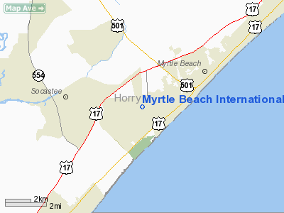
Myrtle Beach International Airport, formerly the Myrtle Beach Air Force Base; Myrtle Beach Jetport (1974-1989) (IATA: MYR, ICAO: KMYR, FAA LID: MYR) is a county-owned, public-use airport located three miles (5 km) southwest of the central business district of Myrtle Beach, a city in Horry County, South Carolina, United States. The airport is located on site of the former Myrtle Beach Air Force Base. On 22 March 1975, an agreement was made for joint civilian-military aviation activities at the base. Airport construction began on the northeast side of the Air Force Base runway on 19 July 1975 and opened to commercial aviation in 1976. This replaced the commercial airport located in the Crescent Beach area of North Myrtle Beach, which became Grand Strand Airport (CRE) and now serves private and corporate aircraft with parking, refueling, and maintenance. The airport is a launch abort site for the Space Shuttle. It has never been needed. On 20 April 1977, an agreement between the City of Myrtle Beach and the U.S. Department of Defense was signed, which incorporated the area of Myrtle Beach International Airport into the city. Until 1993, both MYR and Myrtle Beach AFB jointly used the main runway. In 1993, the Air Force closed the base as a result of BRAC 1991. The runway and other portions of the former military flight line were then turned over to the Horry County Department of Airports. The airport formerly served as a hub for Hooters Air, before that airline's shutdown in 2006. For 2010, US Airways was the dominating carrier. (Flight Schedule) The airport currently serves as a hub for Direct Air and a focus city for Allegiant Air. Facilities and AircraftMyrtle Beach International Airport covers an area of 3,795 acres (1,536 ha) and has one runway designated 18/36 with a 9,503 x 150 ft (2,897 x 46 m) asphalt/concrete surface. For the 12-month period ending December 31, 2007, the airport had 56,381 aircraft operations, an average of 154 per day: 40% general aviation, 30% scheduled commercial, 19% air taxi and 12% military. At that time there were 52 aircraft based at this airport: 71% single-engine, 25% multi-engine and 4% helicopter. See "Commercial Aircraft Handled at MYR" The Dr. W.L. Harrelson Terminal BuildingHarrelson Boulevard and the terminal building are named for Myrtle Beach’s first mayor, Dr. W.L. Harrelson, who served from March 1938 to December 1939 and again from January 1942 to December 1943. The city purchased land for the municipal airport during his first term, and the terminal at the airport was named in his honor. Today, it’s known as Myrtle Beach International Airport, with its entrance on Harrelson Boulevard. Right past the Transportation Security Administration's checkpoint a dedication plaque is hung in honor for the first mayor. The airport has seven gates and six gate areas. Also in the gate areas are a food court containing Pizza Hut, Subway, Java Coast coffee and the retail gift chain Hudson News. There is also a restaurant "J.J.'s sports grill and bar" serving an array of food and a full service bar. In 2007, 2 new jetways were added to gates 2 and 3, to replace the outdated jetways from 1979. In 2008 two renovations have taken place in the terminal building. Transportation Security Administration (TSA) added hard wood flooring in the security checkpoint to replace the carpet that had been in place for years. "J.J.'s sports grill and bar" received major renovations including flooring, new bar area and new furniture, the menu and appliances were also all replaced. Coming also this year the snack bar located on the lower level known as the "T-box" will also be completely renovated and a new menu will be added. Passenger and Guest ServicesThere are three information booths located throughout the terminal building, There are Pay-Phones that are TTY compatible on all levels. Also free wi-fi is provided in all areas of the terminal. ATM's are located on each level. In addition the following stores are located in the terminal:
There is an aircraft viewing area on the opposite side of the airfield in War Bird Park. Commercial Aircraft Handled at MYR
The airport is also equipped and capable of handling widebody aircraft. Public SafetyThe airport has a on site Fire Department and EMTs on staff 24 hours, The airport also has a 24 hour, on-site police precinct within the airport. There are AED s located throughout the terminal building. The airport also has a brand new, state of the art security system utilizing all digital cameras that is staffed 24 hours on site. Incidents and Accidents
DevelopmentAlso part of the Myrtle Beach International Airport, opposite the terminal building is the Market Common. The Market Common Myrtle Beach is a 114 acre lifestyle center located in Myrtle Beach, South Carolina. It is part of the Myrtle Beach International Airport complex that became civilian after the closure of the Air Force Base that was shared with the airport. It is located near the Myrtle Beach International Airport. It competes mainly with nearby shopping complexes Coastal Grand Mall and Broadway at the Beach. With a 'town like' atmosphere, the center has townhomes, small stores and restaurants, a movie theater, and a grocery store. Due to the construction site, many streets are named after former MBAFB Wing and Base Commanders, or other notable Air Force members who were assigned to the base. Also scattered throughout Market Common are small memorial information signs noting historical facts about the base. Popular stores at the center include Pottery Barn, Barnes and Noble, Piggly Wiggly, Williams-Sonoma, and Black Market. Popular restaurants include P.F. Chang's and Tommy Bahama. Market Common in 2011 will be part of the new course for Myrtle Beach Marathon XIII as turn off south Kings Highway, as runners on both the Bi-Lo Marathon (SC10008BS) and Dasani Half Marathon (SC10009BS) will run through the area as kilometers 8-12 of both courses. [1] HeliportHelipad OperationsHuffman Helicopters offers Helicopter tours on a daily basis, they are located on the far end of the airfield. Airlines and destinationsScheduled Commercial Passenger Service
Air CargoThe airport has a dedicated Air Cargo building at the entrance of the airport.
The above content comes from Wikipedia and is published under free licenses – click here to read more.
Location & QuickFacts
Owner & Manager
Airport Operations and Facilities
Airport Communications
Airport Services
Runway InformationRunway 18/36
Radio Navigation Aids
Remarks
Images and information placed above are from We thank them for the data!
We don't guarantee the information is fresh and accurate. The data may
be wrong or outdated.
|
|||||||||||||||||||||||||||||||||||||||||||||||||||||||||||||||||||||||||||||||||||||||||||||||||||||||||||||||||||||||||||||||||||||||||||||||||||||||||||||||||||||||||||||||||||||||||||||||||||||||||||||||||||||||||||||||||||||||||||||||||||||||||||||||||||||||||||||||||||||||||||||||||||||||||||||||||||||||||||||||||||||||||||||||||||||||||||||||||||||||||||||||||||||||||||

 |
|
Copyright 2004-2026 © by Airports-Worldwide.com, Vyshenskoho st. 36, Lviv 79010, Ukraine Legal Disclaimer |