 |
|
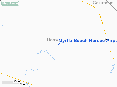
Myrtle Beach Hardee Airpark Airport |
Location & QuickFacts
| FAA Information Effective: | 2008-09-25 |
| Airport Identifier: | SC21 |
| Airport Status: | Operational |
| Longitude/Latitude: | 078-49-59.0850W/33-56-30.6160N
-78.833079/33.941838 (Estimated) |
| Elevation: | 45 ft / 13.72 m (Estimated) |
| Land: | 0 acres |
| From nearest city: | 8 nautical miles SE of Loris, SC |
| Location: | Horry County, SC |
| Magnetic Variation: | 06W (1985) |
Owner & Manager
| Ownership: | Privately owned |
| Owner: | Myrtle Beach Hardee Airpart Poa |
| Address: | 211 Mooney Ct
Loris, SC 29569 |
| Phone number: | 843-602-8220 |
| Manager: | Ronald Heidebrink |
| Address: | 211 Mooney Ct
Loris, SC 29569 |
| Phone number: | 843-602-8220 |
Airport Operations and Facilities
| Airport Use: | Private |
| Wind indicator: | Yes |
| Segmented Circle: | No |
| Control Tower: | No |
| Landing fee charge: | No |
| Sectional chart: | Charlotte |
| Region: | ASO - Southern |
| Boundary ARTCC: | ZJX - Jacksonville |
| Tie-in FSS: | AND - Anderson |
| FSS on Airport: | No |
| FSS Toll Free: | 1-800-WX-BRIEF |
Airport Services
| Airframe Repair: | NONE |
| Power Plant Repair: | NONE |
Runway Information
Runway 04/22
| Dimension: | 2800 x 80 ft / 853.4 x 24.4 m |
| Surface: | TURF, |
| |
Runway 04 |
Runway 22 |
| Traffic Pattern: | Left | Left |
| Obstruction: | 60 ft trees, 264.0 ft from runway | 60 ft pline, 264.0 ft from runway |
|
Runway 18/36
| Dimension: | 3300 x 130 ft / 1005.8 x 39.6 m |
| Surface: | TURF, |
| |
Runway 18 |
Runway 36 |
| Traffic Pattern: | Left | Left |
|
Radio Navigation Aids
| ID |
Type |
Name |
Ch |
Freq |
Var |
Dist |
| HYW | NDB | Horry | | 370.00 | 08W | 16.4 nm |
| CPC | NDB | Camp | | 227.00 | 07W | 20.7 nm |
| MAO | NDB | Marion | | 388.00 | 06W | 28.9 nm |
| HEK | NDB | Stuckey | | 236.00 | 06W | 36.9 nm |
| SUT | NDB | Yaupon | | 233.00 | 08W | 37.9 nm |
| TGQ | NDB | Elizabethtown | | 398.00 | 08W | 38.6 nm |
| JB | NDB | Jigel | | 384.00 | 08W | 39.4 nm |
| DLC | NDB | Dillon | | 274.00 | 05W | 40.5 nm |
| RSY | NDB | Robeson | | 359.00 | 08W | 41.9 nm |
| CLB | NDB | Carolina Beach | | 216.00 | 04W | 44.5 nm |
| GGE | NDB | Georgetown | | 242.00 | 06W | 45.0 nm |
| PHH | NDB | Andrews | | 255.00 | 06W | 45.5 nm |
| CFY | NDB | Evans | | 420.00 | 06W | 46.8 nm |
| LBT | VOR | Lumberton | | 110.00 | 08W | 41.7 nm |
| CRE | VORTAC | Grand Strand | 123X | 117.60 | 03W | 9.4 nm |
| FLO | VORTAC | Florence | 099X | 115.20 | 03W | 44.6 nm |
Remarks
Images and information placed above are from
http://www.airport-data.com/airport/SC21/
We thank them for the data!
| General Info
|
| Country |
United States
|
| State |
SOUTH CAROLINA
|
| FAA ID |
SC21
|
| Latitude |
33-56-30.616N
|
| Longitude |
078-49-59.085W
|
| Elevation |
45 feet
|
| Near City |
LORIS
|
We don't guarantee the information is fresh and accurate. The data may
be wrong or outdated.
For more up-to-date information please refer to other sources.
|
|


