 |
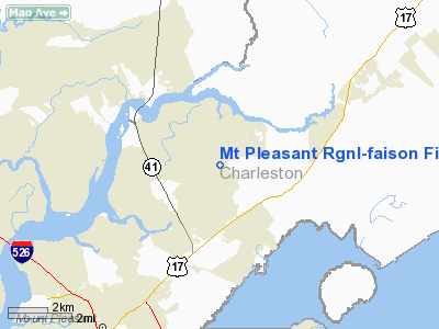
|
Mt Pleasant Rgnl-faison Field Airport |
Mount Pleasant Regional Airport
Faison Field |
| IATA: none – ICAO: KLRO – FAA LID: LRO |
| Summary |
| Airport type |
Public |
| Owner |
Charleston Aviation Authority |
| Serves |
Mount Pleasant, South Carolina |
| Location |
700 Faison Parkway Mt. Plesant, SC 29464 |
| Elevation AMSL |
12 ft / 4 m |
| Coordinates |
32°53′52″N 079°46′58″W / 32.89778°N 79.78278°W / 32.89778; -79.78278 |
| Runways |
| Direction |
Length |
Surface |
| ft |
m |
| 17/35 |
3,700 |
1,128 |
Asphalt |
| Statistics (2006) |
| Aircraft operations |
29,200 |
| Based aircraft |
72 |
| Source: Federal Aviation Administration |
Mount Pleasant Regional Airport (ICAO: KLRO, FAA LID: LRO, formerly 8S5), also known as Faison Field, is a public airport located nine nautical miles (16 km) northeast of the central business district of Mount Pleasant, a town in Charleston County, South Carolina, United States. It is owned by the Charleston Aviation Authority. It was formerly the East Cooper Airport.
Although most U.S. airports use the same three-letter location identifier for the FAA and IATA, this airport is assigned LRO by the FAA but has no designation from the IATA.
Facilities and aircraft
Mount Pleasant Regional Airport covers an area of 300 acres (121 ha) which contains one asphalt paved runway (17/35) measuring 3,700 x 75 ft (1,128 x 23 m).
For the 12-month period ending September 21, 2006, the airport had 29,200 aircraft operations, an average of 80 per day: 96% general aviation, 3% air taxi and 1% military. There are 72 aircraft based at this airport: 90% single engine, 8% multi-engine and 1% helicopter.
The above content comes from Wikipedia and is published under free licenses – click here to read more.
Location & QuickFacts
| FAA Information Effective: | 2008-09-25 |
| Airport Identifier: | LRO |
| Airport Status: | Operational |
| Longitude/Latitude: | 079-46-58.3000W/32-53-52.2000N
-79.782861/32.897833 (Estimated) |
| Elevation: | 12 ft / 3.66 m (Surveyed) |
| Land: | 300 acres |
| From nearest city: | 9 nautical miles NE of Mount Pleasant, SC |
| Location: | Charleston County, SC |
| Magnetic Variation: | 05W (1985) |
Owner & Manager
| Ownership: | Publicly owned |
| Owner: | Charleston Aviation Authority |
| Address: | 5500 International Blvd
Charleston, SC 29418-6911 |
| Phone number: | 843-767-7010 |
| Manager: | Sue Stevens |
| Address: | Charleston Aviation Auth, 5500 Intl Blvd
Charleston, SC 29418-6911 |
| Phone number: | 843-884-8837 |
Airport Operations and Facilities
| Airport Use: | Open to public |
| Wind indicator: | Yes |
| Segmented Circle: | Yes |
| Control Tower: | No |
| Lighting Schedule: | DUSK-DAWN
ACTVT MIRL RY 17/35 - CTAF. |
| Beacon Color: | Clear-Green (lighted land airport) |
| Landing fee charge: | No |
| Sectional chart: | Charlotte |
| Region: | ASO - Southern |
| Traffic Pattern Alt: | 988 ft |
| Boundary ARTCC: | ZJX - Jacksonville |
| Tie-in FSS: | AND - Anderson |
| FSS on Airport: | No |
| FSS Toll Free: | 1-800-WX-BRIEF |
| NOTAMs Facility: | AND (NOTAM-d service avaliable) |
| Federal Agreements: | NGY |
Airport Communications
| CTAF: | 122.700 |
| Unicom: | 122.700 |
Airport Services
Runway Information
Runway 17/35
| Dimension: | 3700 x 75 ft / 1127.8 x 22.9 m |
| Surface: | ASPH, Good Condition |
| Weight Limit: | Single wheel: 12500 lbs. |
| Edge Lights: | Medium |
| |
Runway 17 |
Runway 35 |
| Longitude: | 079-47-03.1765W | 079-46-53.4129W |
| Latitude: | 32-54-10.0461N | 32-53-34.3835N |
| Elevation: | 11.00 ft | 11.00 ft |
| Alignment: | 127 | 127 |
| Traffic Pattern: | Left | Right |
| Markings: | Non-precision instrument, Good Condition | Non-precision instrument, Good Condition |
| Crossing Height: | 27.00 ft | 27.00 ft |
| VASI: | 4-light PAPI on left side | 4-light PAPI on left side |
| Visual Glide Angle: | 4.00° | 4.00° |
| Obstruction: | 96 ft tree, 2560.0 ft from runway, 425 ft right of centerline, 24:1 slope to clear | 47 ft tree, 1086.0 ft from runway, 131 ft right of centerline, 19:1 slope to clear |
|
Radio Navigation Aids
| ID |
Type |
Name |
Ch |
Freq |
Var |
Dist |
| JZI | NDB | Johns Island | | 283.00 | 05W | 16.3 nm |
| CH | NDB | Ashly | | 329.00 | 05W | 16.6 nm |
| MKS | NDB | Moncks Corner | | 354.00 | 05W | 21.7 nm |
| DYB | NDB | Dorchester County | | 365.00 | 05W | 26.8 nm |
| GGE | NDB | Georgetown | | 242.00 | 06W | 34.1 nm |
| PHH | NDB | Andrews | | 255.00 | 06W | 35.7 nm |
| RBW | NDB | Walterboro | | 221.00 | 05W | 43.3 nm |
| MNI | NDB | Manning | | 381.00 | 06W | 46.6 nm |
| CKI | NDB | Kingstree | | 404.00 | 06W | 49.4 nm |
| CHS | VORTAC | Charleston | 082X | 113.50 | 05W | 12.9 nm |
| VAN | VORTAC | Vance | 041X | 110.40 | 06W | 48.2 nm |
| CHS | VOT | Charleston | | 111.00 | | 13.0 nm |
Remarks
- TWO 2000 FT TOWERS APPROX 4-6 MILES EAST OF ARPT.
- DEER & BIRDS ON & INVOF ARPT.
- JONNY MC MANUS FBO MGR AERO EAST - PHONE 843-884-8837.
- PROVIDING VFR; WILSON MEMORIAL ARPT WILL BE CLOSED WHEN EAST COOPER ARPT BECOMES OPERATIONAL.
Images and information placed above are from
http://www.airport-data.com/airport/LRO/
We thank them for the data!
| General Info
|
| Country |
United States
|
| State |
SOUTH CAROLINA
|
| FAA ID |
LRO
|
| Latitude |
32.897833
32° 53' 52.20" N
|
| Longitude |
-79.782861
079° 46' 58.30" W
|
| Elevation |
12 feet
4 meters
|
| Magnetic Variation |
007° W (01/06)
|
| Beacon |
Yes
|
| Operating Agency |
MUNICIPAL
|
| Daylight Saving Time |
Second Sunday in March at 0200 to first Sunday in November at 0200 local time (Exception Arizona and that portion of Indiana in the Eastern Time Zone)
|
We don't guarantee the information is fresh and accurate. The data may
be wrong or outdated.
For more up-to-date information please refer to other sources.
|
|


