 |
|
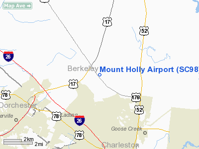
Location & QuickFacts
| FAA Information Effective: | 2008-09-25 |
| Airport Identifier: | SC98 |
| Airport Status: | Operational |
| Longitude/Latitude: | 080-05-00.3000W/33-03-15.6000N
-80.083417/33.054333 (Estimated) |
| Elevation: | 55 ft / 16.76 m (Estimated) |
| Land: | 30 acres |
| From nearest city: | 3 nautical miles NW of Goose Creek, SC |
| Location: | Berkeley County, SC |
| Magnetic Variation: | 06W (1995) |
Owner & Manager
| Ownership: | Privately owned |
| Owner: | Jim Mc Cormick |
| Address: | 1030 St James Ave
Summerville, SC 29483 |
| Phone number: | 803-875-1530 |
| Manager: | Jim Mc Cormick |
| Address: | 1030 St James Ave
Summerville, SC 29483 |
| Phone number: | 803-875-1530 |
Airport Operations and Facilities
| Airport Use: | Private |
| Wind indicator: | Yes |
| Segmented Circle: | No |
| Control Tower: | No |
| Sectional chart: | Charlotte |
| Region: | ASO - Southern |
| Boundary ARTCC: | ZJX - Jacksonville |
| Tie-in FSS: | AND - Anderson |
| FSS on Airport: | No |
| FSS Toll Free: | 1-800-WX-BRIEF |
Runway Information
Runway 12/30
| Dimension: | 2700 x 65 ft / 823.0 x 19.8 m |
| Surface: | TURF, |
| |
Runway 12 |
Runway 30 |
| Traffic Pattern: | Left | Left |
| Displaced threshold: | 300.00 ft | 1400.00 ft |
| Obstruction: | 50 ft trees, 300.0 ft from runway | 50 ft trees, 800.0 ft from runway |
|
Radio Navigation Aids
| ID |
Type |
Name |
Ch |
Freq |
Var |
Dist |
| CH | NDB | Ashly | | 329.00 | 05W | 4.7 nm |
| MKS | NDB | Moncks Corner | | 354.00 | 05W | 8.6 nm |
| DYB | NDB | Dorchester County | | 365.00 | 05W | 9.8 nm |
| JZI | NDB | Johns Island | | 283.00 | 05W | 21.6 nm |
| RBW | NDB | Walterboro | | 221.00 | 05W | 29.1 nm |
| MNI | NDB | Manning | | 381.00 | 06W | 32.7 nm |
| PHH | NDB | Andrews | | 255.00 | 06W | 36.8 nm |
| GGE | NDB | Georgetown | | 242.00 | 06W | 41.3 nm |
| CKI | NDB | Kingstree | | 404.00 | 06W | 41.5 nm |
| OYI | NDB | Orangeburg | | 226.00 | 05W | 46.8 nm |
| HEK | NDB | Stuckey | | 236.00 | 06W | 49.3 nm |
| NBC | TACAN | Beaufort | 042X | | 05W | 47.1 nm |
| EDS | VOR/DME | Edisto | 051X | 111.40 | 05W | 45.8 nm |
| CHS | VORTAC | Charleston | 082X | 113.50 | 05W | 9.9 nm |
| VAN | VORTAC | Vance | 041X | 110.40 | 06W | 31.2 nm |
| CHS | VOT | Charleston | | 111.00 | | 9.2 nm |
Remarks
Images and information placed above are from
http://www.airport-data.com/airport/SC98/
We thank them for the data!
| General Info
|
| Country |
United States
|
| State |
SOUTH CAROLINA
|
| FAA ID |
SC98
|
| Latitude |
33-03-15.600N
|
| Longitude |
080-05-00.300W
|
| Elevation |
55 feet
|
| Near City |
GOOSE CREEK
|
We don't guarantee the information is fresh and accurate. The data may
be wrong or outdated.
For more up-to-date information please refer to other sources.
|
|


