 |
|
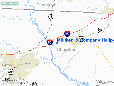
Milliken & Company Heliport |
Location & QuickFacts
| FAA Information Effective: | 2008-09-25 |
| Airport Identifier: | SC84 |
| Airport Status: | Operational |
| Longitude/Latitude: | 081-33-41.3350W/35-06-59.4640N
-81.561482/35.116518 (Estimated) |
| Elevation: | 606 ft / 184.71 m (Estimated) |
| Land: | 0 acres |
| From nearest city: | 5 nautical miles SW of Blacksburg, SC |
| Location: | Cherokee County, SC |
| Magnetic Variation: | 05W (1990) |
Owner & Manager
| Ownership: | Privately owned |
| Owner: | Milliken & Co. |
| Address: | Milliken & Co.
Blacksburg, SC 29304 |
| Phone number: | 803-839-0321 |
| Manager: | Cassidy Carlile |
| Address: | Milliken & Co.
Blacksburg, SC 29702 |
| Phone number: | 803-573-1740 |
Airport Operations and Facilities
| Airport Use: | Private |
| Segmented Circle: | No |
| Control Tower: | No |
| Sectional chart: | Atlanta |
| Region: | ASO - Southern |
| Boundary ARTCC: | ZTL - Atlanta |
| Tie-in FSS: | AND - Anderson |
| FSS Toll Free: | 1-800-WX-BRIEF |
Runway Information
Helipad H1
| Dimension: | 25 x 25 ft / 7.6 x 7.6 m |
| Surface: | CONC, |
| |
Runway H1 |
Runway |
| Traffic Pattern: | Left | Left |
|
Radio Navigation Aids
| ID |
Type |
Name |
Ch |
Freq |
Var |
Dist |
| MRN | FAN MARKER | Lenoir | | | 03W | 41.0 nm |
| SLP | NDB | First River | | 417.00 | 06W | 8.4 nm |
| GHJ | NDB | Stonia | | 260.00 | 06W | 20.4 nm |
| RFE | NDB | Rutherford | | 344.00 | 05W | 23.8 nm |
| FRT | NDB | Fairmont | | 248.00 | 05W | 24.5 nm |
| UOT | NDB | Union County | | 326.00 | 04W | 26.3 nm |
| DCM | NDB | Chester | | 220.00 | 06W | 26.6 nm |
| UZ | NDB | Rally | | 227.00 | 05W | 27.3 nm |
| IZN | NDB | Lincolnton | | 432.00 | 06W | 34.4 nm |
| FIQ | NDB | Fiddlers | | 391.00 | 07W | 36.1 nm |
| LUX | NDB | Laurens | | 307.00 | 04W | 41.3 nm |
| LKR | NDB | Lancaster | | 400.00 | 07W | 41.9 nm |
| HK | NDB | Tawba | | 332.00 | 06W | 42.2 nm |
| TWL | NDB | Wesley | | 204.00 | 06W | 43.3 nm |
| BRA | NDB | Broad River | | 379.00 | 04W | 45.7 nm |
| VW | NDB | Temky | | 280.00 | 05W | 46.4 nm |
| EOE | NDB | Enoree | | 278.00 | 05W | 48.5 nm |
| CLT | VOR/DME | Charlotte | 097X | 115.00 | 05W | 30.3 nm |
| BZM | VOR/DME | Barretts Mountain | 045X | 110.80 | 06W | 47.9 nm |
| SPA | VORTAC | Spartanburg | 104X | 115.70 | 02W | 18.7 nm |
| FML | VORTAC | Fort Mill | 071X | 112.40 | 02W | 30.8 nm |
| SUG | VORTAC | Sugarloaf Mountain | 059X | 112.20 | 02W | 38.8 nm |
| CLT | VOT | Charlotte | | 112.00 | | 31.2 nm |
| HKY | VOT | Hickory Regional | | 110.00 | | 38.4 nm |
Remarks
- PRVDD VFR; PVT USE; APCH/DEP RTE OPS FM 345 TO 030 & FM 160 TO 190 TKOF/LDG AREA MKD; & WIND INDICATOR IS MAINTAINED.
Images and information placed above are from
http://www.airport-data.com/airport/SC84/
We thank them for the data!
| General Info
|
| Country |
United States
|
| State |
SOUTH CAROLINA
|
| FAA ID |
SC84
|
| Latitude |
35-06-59.464N
|
| Longitude |
081-33-41.335W
|
| Elevation |
606 feet
|
| Near City |
BLACKSBURG
|
We don't guarantee the information is fresh and accurate. The data may
be wrong or outdated.
For more up-to-date information please refer to other sources.
|
|


