 |
|
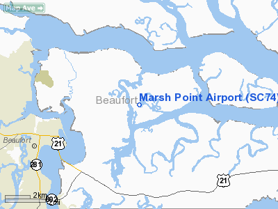
Location & QuickFacts
| FAA Information Effective: | 2008-09-25 |
| Airport Identifier: | SC74 |
| Airport Status: | Operational |
| Longitude/Latitude: | 080-36-03.3800W/32-27-42.6860N
-80.600939/32.461857 (Estimated) |
| Elevation: | 12 ft / 3.66 m (Estimated) |
| Land: | 10 acres |
| From nearest city: | 7 nautical miles N of Beaufort, SC |
| Location: | Beaufort County, SC |
| Magnetic Variation: | 04W (1985) |
Owner & Manager
| Ownership: | Privately owned |
| Owner: | James E Knight |
| Address: | 80 Long Point Drive
Beaufort, SC 29902 |
| Phone number: | 803-521-4402 |
| Manager: | James E Knight |
| Address: | 80 Long Point Drive
Beaufort, SC 29902 |
| Phone number: | 803-521-4402 |
Airport Operations and Facilities
| Airport Use: | Private
PERSONAL USE. |
| Wind indicator: | Yes |
| Segmented Circle: | No |
| Control Tower: | No |
| Sectional chart: | Charlotte |
| Region: | ASO - Southern |
| Boundary ARTCC: | ZJX - Jacksonville |
| Tie-in FSS: | AND - Anderson |
| FSS Toll Free: | 1-800-WX-BRIEF |
| NOTAMs Facility: | AND |
Runway Information
Runway 18/36
| Dimension: | 1700 x 75 ft / 518.2 x 22.9 m |
| Surface: | TURF, Good Condition |
| |
Runway 18 |
Runway 36 |
| Traffic Pattern: | Left | Left |
| Obstruction: | 50 ft trees, 5.0 ft from runway | |
|
Radio Navigation Aids
| ID |
Type |
Name |
Ch |
Freq |
Var |
Dist |
| RBW | NDB | Walterboro | | 221.00 | 05W | 28.0 nm |
| JZI | NDB | Johns Island | | 283.00 | 05W | 33.4 nm |
| DYB | NDB | Dorchester County | | 365.00 | 05W | 39.6 nm |
| CH | NDB | Ashly | | 329.00 | 05W | 40.1 nm |
| NBC | TACAN | Beaufort | 042X | | 05W | 6.0 nm |
| ALD | VOR | Allendale | | 116.70 | 01W | 48.1 nm |
| SVN | VOR/DME | Hunter | 53X | 111.60 | 02W | 38.5 nm |
| SAV | VORTAC | Savannah | 106Y | 115.95 | 06W | 35.8 nm |
| CHS | VORTAC | Charleston | 082X | 113.50 | 05W | 38.6 nm |
| SAV | VOT | Savannah Travis Fld | | 111.00 | | 36.6 nm |
| CHS | VOT | Charleston | | 111.00 | | 38.9 nm |
Remarks
Images and information placed above are from
http://www.airport-data.com/airport/SC74/
We thank them for the data!
| General Info
|
| Country |
United States
|
| State |
SOUTH CAROLINA
|
| FAA ID |
SC74
|
| Latitude |
32-27-42.686N
|
| Longitude |
080-36-03.380W
|
| Elevation |
12 feet
|
| Near City |
BEAUFORT
|
We don't guarantee the information is fresh and accurate. The data may
be wrong or outdated.
For more up-to-date information please refer to other sources.
|
|


