 |
|
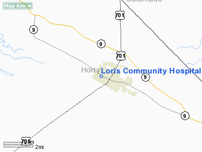
Loris Community Hospital Heliport |
Location & QuickFacts
| FAA Information Effective: | 2008-09-25 |
| Airport Identifier: | 5SC5 |
| Airport Status: | Operational |
| Longitude/Latitude: | 078-53-54.0000W/34-03-32.0000N
-78.898333/34.058889 (Estimated) |
| Elevation: | 91 ft / 27.74 m (Estimated) |
| Land: | 2 acres |
| From nearest city: | 1 nautical miles E of Loris, SC |
| Location: | Horry County, SC |
| Magnetic Variation: | 06W (1985) |
Owner & Manager
| Ownership: | Privately owned |
| Owner: | Loris Healthcare System |
| Address: | 3655 Mitchell Street
Loris, SC 29569 |
| Phone number: | 843-716-7000 |
| Manager: | Ray Lloyd Manager |
| Address: | 3655 Mitchell Street
Loris, SC 29569 |
| Phone number: | 843-716-7525 |
Airport Operations and Facilities
| Airport Use: | Private
MEDICAL. |
| Wind indicator: | Yes |
| Segmented Circle: | Yes |
| Control Tower: | No |
| Lighting Schedule: | PHONE REQ
FOR PERIMETER LGTS CALL 843-716-7000. |
| Sectional chart: | Charlotte |
| Region: | ASO - Southern |
| Boundary ARTCC: | ZJX - Jacksonville |
| Tie-in FSS: | AND - Anderson |
| FSS Toll Free: | 1-800-WX-BRIEF |
Runway Information
Helipad H1
| Dimension: | 40 x 40 ft / 12.2 x 12.2 m |
| Surface: | CONC, |
| |
Runway H1 |
Runway |
| Traffic Pattern: | Left | Left |
|
Radio Navigation Aids
| ID |
Type |
Name |
Ch |
Freq |
Var |
Dist |
| CPC | NDB | Camp | | 227.00 | 07W | 15.7 nm |
| HYW | NDB | Horry | | 370.00 | 08W | 18.2 nm |
| MAO | NDB | Marion | | 388.00 | 06W | 22.9 nm |
| JB | NDB | Jigel | | 384.00 | 08W | 31.6 nm |
| DLC | NDB | Dillon | | 274.00 | 05W | 33.2 nm |
| TGQ | NDB | Elizabethtown | | 398.00 | 08W | 34.0 nm |
| RSY | NDB | Robeson | | 359.00 | 08W | 34.3 nm |
| HEK | NDB | Stuckey | | 236.00 | 06W | 37.0 nm |
| SUT | NDB | Yaupon | | 233.00 | 08W | 41.8 nm |
| CFY | NDB | Evans | | 420.00 | 06W | 44.9 nm |
| CLB | NDB | Carolina Beach | | 216.00 | 04W | 46.7 nm |
| PHH | NDB | Andrews | | 255.00 | 06W | 48.2 nm |
| ME | NDB | Maxtn | | 257.00 | 08W | 48.8 nm |
| GGE | NDB | Georgetown | | 242.00 | 06W | 49.5 nm |
| LBT | VOR | Lumberton | | 110.00 | 08W | 34.1 nm |
| CRE | VORTAC | Grand Strand | 123X | 117.60 | 03W | 17.1 nm |
| FLO | VORTAC | Florence | 099X | 115.20 | 03W | 39.2 nm |
Remarks
- SEE AIRSPACE CASE #95-ATL-063-NRA.
Images and information placed above are from
http://www.airport-data.com/airport/5SC5/
We thank them for the data!
| General Info
|
| Country |
United States
|
| State |
SOUTH CAROLINA
|
| FAA ID |
5SC5
|
| Latitude |
34-03-32.000N
|
| Longitude |
078-53-54.000W
|
| Elevation |
91 feet
|
| Near City |
LORIS
|
We don't guarantee the information is fresh and accurate. The data may
be wrong or outdated.
For more up-to-date information please refer to other sources.
|
|


