 |
|
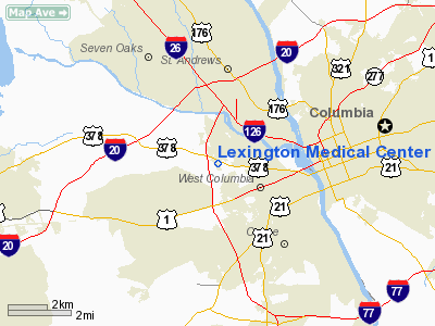
Lexington Medical Center Heliport |
Location & QuickFacts
| FAA Information Effective: | 2008-09-25 |
| Airport Identifier: | SC18 |
| Airport Status: | Operational |
| Longitude/Latitude: | 081-06-14.3410W/34-00-01.5480N
-81.103984/34.000430 (Estimated) |
| Elevation: | 340 ft / 103.63 m (Estimated) |
| Land: | 0 acres |
| From nearest city: | 1 nautical miles W of West Columbia, SC |
| Location: | Lexington County, SC |
| Magnetic Variation: | 04W (1985) |
Owner & Manager
| Ownership: | Publicly owned |
| Owner: | Lexington Medical Center |
| Address: | 2720 Sunset Blvd.
West Columbia, SC 29169 |
| Phone number: | 803-791-2000 |
| Manager: | Kevin Stanley |
| Address: | 2720 Sunset Blvd.
West Columbia, SC 29169 |
| Phone number: | 803-791-2000 |
Airport Operations and Facilities
| Airport Use: | Private
MEDICAL. |
| Segmented Circle: | No |
| Control Tower: | No |
| Lighting Schedule: | PHONE REQ
FOR PERIMETER LGTS CALL 803-791-2000. |
| Sectional chart: | Atlanta |
| Region: | ASO - Southern |
| Boundary ARTCC: | ZJX - Jacksonville |
| Tie-in FSS: | AND - Anderson |
| FSS on Airport: | No |
| FSS Toll Free: | 1-800-WX-BRIEF |
Runway Information
Helipad H1
| Dimension: | 30 x 30 ft / 9.1 x 9.1 m |
| Surface: | CONC, |
| |
Runway H1 |
Runway |
| Traffic Pattern: | Left | Left |
|
Radio Navigation Aids
| ID |
Type |
Name |
Ch |
Freq |
Var |
Dist |
| MMT | NDB | Mc Entire | | 427.00 | 05W | 15.7 nm |
| FDW | NDB | Winnsboro | | 414.00 | 05W | 18.9 nm |
| CDN | NDB | Camden | | 263.00 | 05W | 31.9 nm |
| EOE | NDB | Enoree | | 278.00 | 05W | 32.4 nm |
| AIK | NDB | Aiken | | 347.00 | 04W | 35.5 nm |
| OYI | NDB | Orangeburg | | 226.00 | 05W | 36.4 nm |
| SMS | NDB | Sumter | | 252.00 | 04W | 37.1 nm |
| BKO | NDB | Barnwell | | 392.00 | 06W | 42.4 nm |
| LKR | NDB | Lancaster | | 400.00 | 07W | 45.2 nm |
| DCM | NDB | Chester | | 220.00 | 06W | 47.5 nm |
| UOT | NDB | Union County | | 326.00 | 04W | 49.0 nm |
| SSC | TACAN | Shaw | 038X | | 05W | 31.8 nm |
| EDS | VOR/DME | Edisto | 051X | 111.40 | 05W | 35.0 nm |
| CAE | VORTAC | Columbia | 094X | 114.70 | 02W | 9.0 nm |
| MMT | VORTAC | Mc Entire | 079X | 113.20 | 05W | 15.7 nm |
| VAN | VORTAC | Vance | 041X | 110.40 | 06W | 45.5 nm |
Images and information placed above are from
http://www.airport-data.com/airport/SC18/
We thank them for the data!
| General Info
|
| Country |
United States
|
| State |
SOUTH CAROLINA
|
| FAA ID |
SC18
|
| Latitude |
34-00-01.548N
|
| Longitude |
081-06-14.341W
|
| Elevation |
340 feet
|
| Near City |
WEST COLUMBIA
|
We don't guarantee the information is fresh and accurate. The data may
be wrong or outdated.
For more up-to-date information please refer to other sources.
|
|


