 |
|
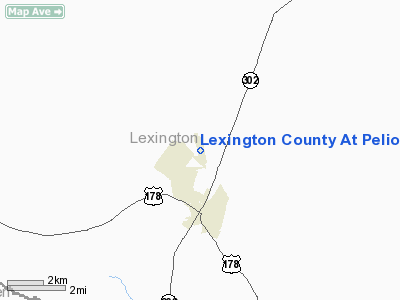
Lexington County At Pelion Airport |
Location & QuickFacts
| FAA Information Effective: | 2008-09-25 |
| Airport Identifier: | 6J0 |
| Airport Status: | Operational |
| Longitude/Latitude: | 081-14-45.1000W/33-47-40.7000N
-81.245861/33.794639 (Estimated) |
| Elevation: | 452 ft / 137.77 m (Surveyed) |
| Land: | 110 acres |
| From nearest city: | 2 nautical miles N of Pelion, SC |
| Location: | Lexington County, SC |
| Magnetic Variation: | 04W (1985) |
Owner & Manager
| Ownership: | Publicly owned |
| Owner: | Lexington County |
| Address: | 212 South Lake Drive
Lexington, SC 29072 |
| Phone number: | 803-785-8100 |
| Manager: | Jim Starling
ENGINEER, LEXINGTON CO. PUBLIC WORKS DEPT. |
| Address: | 440 Ball Park Road
Lexington, SC 29072 |
| Phone number: | 803-785-8204 |
Airport Operations and Facilities
| Airport Use: | Open to public |
| Wind indicator: | Yes |
| Segmented Circle: | Yes |
| Control Tower: | No |
| Lighting Schedule: | DUSK-DAWN
ARPT LIGHTING ON CONT FROM 1800 UNTIL 2200, AFTER 2200 UNTIL DAWN, ACTIVATED WITH PCL. ACTIVATE MIRL RY 17/35 PAPI RY 35 - CTAF. PAPI RY 35 ON DURING DAYLIGH. |
| Beacon Color: | Clear-Green (lighted land airport) |
| Landing fee charge: | No |
| Sectional chart: | Atlanta |
| Region: | ASO - Southern |
| Boundary ARTCC: | ZJX - Jacksonville |
| Tie-in FSS: | AND - Anderson |
| FSS on Airport: | No |
| FSS Toll Free: | 1-800-WX-BRIEF |
| NOTAMs Facility: | AND (NOTAM-d service avaliable) |
| Federal Agreements: | NGY |
Airport Communications
| CTAF: | 122.800 |
| Unicom: | 122.800 |
Airport Services
| Fuel available: | 100LL
SELF SVC FUEL AVBL WITH CREDIT CARD. |
| Bottled Oxygen: | NONE |
| Bulk Oxygen: | NONE |
Runway Information
Runway 17/35
| Dimension: | 4335 x 60 ft / 1321.3 x 18.3 m |
| Surface: | ASPH, Fair Condition |
| Weight Limit: | Single wheel: 12500 lbs. |
| Edge Lights: | Medium |
| |
Runway 17 |
Runway 35 |
| Longitude: | 081-14-49.2620W | 081-14-40.9480W |
| Latitude: | 33-48-01.8310N | 33-47-19.5130N |
| Elevation: | 450.00 ft | 451.00 ft |
| Alignment: | 127 | 127 |
| Traffic Pattern: | Left | Left |
| Markings: | Basic, Fair Condition
RY 17/35 CNTRLN FADED. | Basic, Fair Condition |
| Crossing Height: | 0.00 ft | 40.00 ft |
| VASI: | | 2-light PAPI on right side |
| Visual Glide Angle: | 0.00° | 3.00° |
| Obstruction: | 59 ft tree, 2017.0 ft from runway, 302 ft right of centerline, 30:1 slope to clear | 53 ft tree, 1705.0 ft from runway, 270 ft left of centerline, 28:1 slope to clear |
|
Radio Navigation Aids
| ID |
Type |
Name |
Ch |
Freq |
Var |
Dist |
| AIK | NDB | Aiken | | 347.00 | 04W | 23.2 nm |
| MMT | NDB | Mc Entire | | 427.00 | 05W | 23.9 nm |
| OYI | NDB | Orangeburg | | 226.00 | 05W | 28.3 nm |
| BKO | NDB | Barnwell | | 392.00 | 06W | 28.4 nm |
| FDW | NDB | Winnsboro | | 414.00 | 05W | 31.9 nm |
| EOE | NDB | Enoree | | 278.00 | 05W | 36.6 nm |
| EMR | NDB | Emory | | 385.00 | 04W | 42.6 nm |
| CDN | NDB | Camden | | 263.00 | 05W | 45.0 nm |
| SMS | NDB | Sumter | | 252.00 | 04W | 45.7 nm |
| SSC | TACAN | Shaw | 038X | | 05W | 40.4 nm |
| ALD | VOR | Allendale | | 116.70 | 01W | 47.1 nm |
| EDS | VOR/DME | Edisto | 051X | 111.40 | 05W | 28.1 nm |
| CAE | VORTAC | Columbia | 094X | 114.70 | 02W | 10.3 nm |
| MMT | VORTAC | Mc Entire | 079X | 113.20 | 05W | 23.5 nm |
| VAN | VORTAC | Vance | 041X | 110.40 | 06W | 44.3 nm |
| IRQ | VORTAC | Colliers | 086X | 113.90 | 04W | 46.1 nm |
Remarks
- PLINE 800 FT FROM THLD RY END 35; MKD WITH RED BALLS.
- PCL OTS INDEFLY.
- ACCESS INTO TERMINAL BLDG, USE THE KEY PAD AND ENTER THE UNICOM FREQ FOLLOWED BY THE '#' BOTTON.
- ARPT LGTNG SYSTEM CONTROLLED BY RADIO FM 2200 UNTIL DAWN USING FREQ 122.8.
- VFR USE ONLY.
Images and information placed above are from
http://www.airport-data.com/airport/6J0/
We thank them for the data!
| General Info
|
| Country |
United States
|
| State |
SOUTH CAROLINA
|
| FAA ID |
6J0
|
| Latitude |
33-47-40.700N
|
| Longitude |
081-14-45.100W
|
| Elevation |
452 feet
|
| Near City |
PELION
|
We don't guarantee the information is fresh and accurate. The data may
be wrong or outdated.
For more up-to-date information please refer to other sources.
|
|


