 |
|
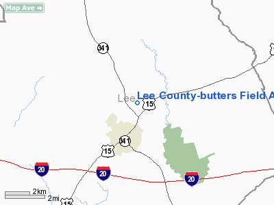
Lee County-butters Field Airport |
Location & QuickFacts
| FAA Information Effective: | 2008-09-25 |
| Airport Identifier: | 52J |
| Airport Status: | Operational |
| Longitude/Latitude: | 080-14-09.7210W/34-14-40.1460N
-80.236034/34.244485 (Estimated) |
| Elevation: | 211 ft / 64.31 m (Surveyed) |
| Land: | 63 acres |
| From nearest city: | 2 nautical miles N of Bishopville, SC |
| Location: | Lee County, SC |
| Magnetic Variation: | 05W (1985) |
Owner & Manager
| Ownership: | Publicly owned |
| Owner: | Lee County |
| Address: | 123 S. Main St
Bishopville, SC 29010 |
| Phone number: | 803-484-5341 |
| Manager: | Ray Butters |
| Address: | 532 West Church St
Bishopville, SC 29010 |
| Phone number: | 803-484-4390 |
Airport Operations and Facilities
| Airport Use: | Open to public |
| Wind indicator: | Yes |
| Segmented Circle: | Yes |
| Control Tower: | No |
| Landing fee charge: | No |
| Sectional chart: | Charlotte |
| Region: | ASO - Southern |
| Boundary ARTCC: | ZJX - Jacksonville |
| Tie-in FSS: | AND - Anderson |
| FSS on Airport: | No |
| FSS Toll Free: | 1-800-WX-BRIEF |
| NOTAMs Facility: | AND (NOTAM-d service avaliable) |
| Federal Agreements: | NGY |
Airport Communications
Airport Services
| Airframe Repair: | NONE |
| Power Plant Repair: | NONE |
| Bottled Oxygen: | NONE |
| Bulk Oxygen: | NONE |
Runway Information
Runway 06/24
| Dimension: | 3200 x 60 ft / 975.4 x 18.3 m |
| Surface: | ASPH, |
| |
Runway 06 |
Runway 24 |
| Longitude: | 080-14-24.4500W | 080-13-54.9900W |
| Latitude: | 34-14-30.0900N | 34-14-50.2000N |
| Elevation: | 211.00 ft | 188.00 ft |
| Traffic Pattern: | Left | Left |
| Markings: | Basic, Good Condition | Basic, Good Condition |
| Obstruction: | 106 ft tree, 2673.0 ft from runway, 329 ft right of centerline, 23:1 slope to clear | 86 ft tree, 1917.0 ft from runway, 232 ft right of centerline, 19:1 slope to clear |
|
Radio Navigation Aids
| ID |
Type |
Name |
Ch |
Freq |
Var |
Dist |
| HVS | NDB | Hartsville | | 341.00 | 07W | 11.3 nm |
| CDN | NDB | Camden | | 263.00 | 05W | 16.3 nm |
| SMS | NDB | Sumter | | 252.00 | 04W | 16.4 nm |
| UDG | NDB | Darlington | | 245.00 | 06W | 21.0 nm |
| PYG | NDB | Pageland | | 270.00 | 06W | 30.5 nm |
| CFY | NDB | Evans | | 420.00 | 06W | 33.1 nm |
| MMT | NDB | Mc Entire | | 427.00 | 05W | 33.6 nm |
| BES | NDB | Bennettsville | | 230.00 | 07W | 33.6 nm |
| CQW | NDB | Cheraw | | 409.00 | 05W | 35.1 nm |
| CKI | NDB | Kingstree | | 404.00 | 06W | 36.9 nm |
| MNI | NDB | Manning | | 381.00 | 06W | 39.5 nm |
| LKR | NDB | Lancaster | | 400.00 | 07W | 42.2 nm |
| FDW | NDB | Winnsboro | | 414.00 | 05W | 43.7 nm |
| DLC | NDB | Dillon | | 274.00 | 05W | 44.8 nm |
| MAO | NDB | Marion | | 388.00 | 06W | 45.0 nm |
| RCZ | NDB | Roscoe | | 375.00 | 07W | 45.4 nm |
| HEK | NDB | Stuckey | | 236.00 | 06W | 47.1 nm |
| AFP | NDB | Anson County | | 283.00 | 07W | 47.5 nm |
| TWL | NDB | Wesley | | 204.00 | 06W | 48.5 nm |
| ME | NDB | Maxtn | | 257.00 | 08W | 49.0 nm |
| SSC | TACAN | Shaw | 038X | | 05W | 19.7 nm |
| CTF | VOR/DME | Chesterfield | 019X | 108.20 | 03W | 24.5 nm |
| FLO | VORTAC | Florence | 099X | 115.20 | 03W | 28.8 nm |
| MMT | VORTAC | Mc Entire | 079X | 113.20 | 05W | 34.1 nm |
| CAE | VORTAC | Columbia | 094X | 114.70 | 02W | 46.9 nm |
| VAN | VORTAC | Vance | 041X | 110.40 | 06W | 47.5 nm |
Remarks
Images and information placed above are from
http://www.airport-data.com/airport/52J/
We thank them for the data!
| General Info
|
| Country |
United States
|
| State |
SOUTH CAROLINA
|
| FAA ID |
52J
|
| Latitude |
34-14-40.556N
|
| Longitude |
080-14-14.256W
|
| Elevation |
216 feet
|
| Near City |
BISHOPVILLE
|
We don't guarantee the information is fresh and accurate. The data may
be wrong or outdated.
For more up-to-date information please refer to other sources.
|
|


