 |
|
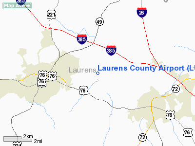
Location & QuickFacts
| FAA Information Effective: | 2008-09-25 |
| Airport Identifier: | LUX |
| Airport Status: | Operational |
| Longitude/Latitude: | 081-56-49.9000W/34-30-25.4000N
-81.947194/34.507056 (Estimated) |
| Elevation: | 697 ft / 212.45 m (Surveyed) |
| Land: | 78 acres |
| From nearest city: | 3 nautical miles E of Laurens, SC |
| Location: | Laurens County, SC |
| Magnetic Variation: | 04W (1985) |
Owner & Manager
| Ownership: | Publicly owned |
| Owner: | Laurens County |
| Address: | Po Box 445
Laurens, SC 29360 |
| Phone number: | 864-984-5484 |
| Manager: | George Wham, Chairman |
| Address: | 606 S. Adair St.
Clinton, SC 29325 |
| Phone number: | 864-833-4304 |
Airport Operations and Facilities
| Airport Use: | Open to public |
| Wind indicator: | Yes |
| Segmented Circle: | Yes |
| Control Tower: | No |
| Lighting Schedule: | DUSK-DAWN
ACTVT MIRL RY 08/26 - CTAF. |
| Beacon Color: | Clear-Green (lighted land airport) |
| Landing fee charge: | No |
| Sectional chart: | Atlanta |
| Region: | ASO - Southern |
| Traffic Pattern Alt: | 803 ft |
| Boundary ARTCC: | ZTL - Atlanta |
| Tie-in FSS: | AND - Anderson |
| FSS on Airport: | No |
| FSS Toll Free: | 1-800-WX-BRIEF |
| NOTAMs Facility: | AND (NOTAM-d service avaliable) |
| Federal Agreements: | NY1 |
Airport Communications
| CTAF: | 122.800 |
| Unicom: | 122.800 |
Airport Services
| Fuel available: | 100LL |
| Airframe Repair: | MAJOR |
| Power Plant Repair: | MAJOR |
| Bottled Oxygen: | NONE |
| Bulk Oxygen: | NONE |
Runway Information
Runway 08/26
| Dimension: | 3898 x 75 ft / 1188.1 x 22.9 m |
| Surface: | ASPH, Good Condition |
| Weight Limit: | Single wheel: 12500 lbs. |
| Edge Lights: | Medium |
| |
Runway 08 |
Runway 26 |
| Longitude: | 081-57-12.0790W | 081-56-27.6840W |
| Latitude: | 34-30-19.5380N | 34-30-31.1990N |
| Elevation: | 697.00 ft | 693.00 ft |
| Alignment: | 72 | 127 |
| Traffic Pattern: | Left | Left |
| Markings: | Non-precision instrument, Good Condition | Non-precision instrument, Good Condition |
| Crossing Height: | 41.00 ft | 40.00 ft |
| VASI: | 2-light PAPI on left side | 2-light PAPI on left side |
| Visual Glide Angle: | 3.00° | 3.00° |
| Obstruction: | 38 ft tree, 737.0 ft from runway, 293 ft right of centerline, 13:1 slope to clear | 73 ft tree, 1263.0 ft from runway, 155 ft right of centerline, 14:1 slope to clear |
|
Radio Navigation Aids
| ID |
Type |
Name |
Ch |
Freq |
Var |
Dist |
| LUX | NDB | Laurens | | 307.00 | 04W | 0.1 nm |
| GIW | NDB | Coronaca | | 239.00 | 04W | 16.7 nm |
| UOT | NDB | Union County | | 326.00 | 04W | 18.5 nm |
| EOE | NDB | Enoree | | 278.00 | 05W | 19.4 nm |
| FRT | NDB | Fairmont | | 248.00 | 05W | 23.8 nm |
| GY | NDB | Dyana | | 338.00 | 03W | 26.9 nm |
| AND | NDB | Anderson County | | 230.00 | 04W | 37.7 nm |
| DCM | NDB | Chester | | 220.00 | 06W | 40.5 nm |
| LQK | NDB | Lake Keowee | | 408.00 | 04W | 41.6 nm |
| FDW | NDB | Winnsboro | | 414.00 | 05W | 43.0 nm |
| CEU | NDB | Clemson | | 257.00 | 05W | 47.6 nm |
| SLP | NDB | First River | | 417.00 | 06W | 48.0 nm |
| UZ | NDB | Rally | | 227.00 | 05W | 48.6 nm |
| GRD | VORTAC | Greenwood | 102X | 115.50 | 01W | 18.5 nm |
| SPA | VORTAC | Spartanburg | 104X | 115.70 | 02W | 31.7 nm |
| ELW | VORTAC | Electric City | 023X | 108.60 | 00E | 41.8 nm |
| IRQ | VORTAC | Colliers | 086X | 113.90 | 04W | 49.2 nm |
Images and information placed above are from
http://www.airport-data.com/airport/LUX/
We thank them for the data!
| General Info
|
| Country |
United States
|
| State |
MINNESOTA
|
| FAA ID |
MN28
|
| Latitude |
44-58-58.863N
|
| Longitude |
094-44-52.987W
|
| Elevation |
1120 feet
|
| Near City |
COSMOS
|
We don't guarantee the information is fresh and accurate. The data may
be wrong or outdated.
For more up-to-date information please refer to other sources.
|
|


