 |
|
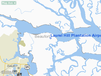
Laurel Hill Plantation Airport |
Location & QuickFacts
| FAA Information Effective: | 2008-09-25 |
| Airport Identifier: | SC05 |
| Airport Status: | Operational |
| Longitude/Latitude: | 080-36-54.3790W/32-29-28.6800N
-80.615105/32.491300 (Estimated) |
| Elevation: | 10 ft / 3.05 m (Estimated) |
| Land: | 15 acres |
| From nearest city: | 6 nautical miles NE of Beaufort, SC |
| Location: | Beaufort County, SC |
| Magnetic Variation: | 04W (1985) |
Owner & Manager
| Ownership: | Privately owned |
| Owner: | Homestate Realty Company |
| Address: | Po Box 2505
Anderson, SC 29622 |
| Phone number: | 864-224-1991 |
| Manager: | Robert Gallant |
| Address: | Po Box 2505
Anderson, SC 29622 |
| Phone number: | 864-296-1991 |
Airport Operations and Facilities
| Airport Use: | Private |
| Wind indicator: | Yes |
| Segmented Circle: | No |
| Control Tower: | No |
| Lighting Schedule: | DUSK-0200
FOR LIRL RY 03/21 AFTER 0200 CALL 803-525-1448. |
| Sectional chart: | Charlotte |
| Region: | ASO - Southern |
| Boundary ARTCC: | ZJX - Jacksonville |
| Tie-in FSS: | AND - Anderson |
| FSS on Airport: | No |
| FSS Toll Free: | 1-800-WX-BRIEF |
Airport Services
| Airframe Repair: | MINOR
AIRFRAME REPAIRS AVBL BY PRIOR REQUEST; CALL (803) 525-1448. |
| Power Plant Repair: | MINOR
POWER PLANT & ENGINE SVC AVBL BY PRIOR REQUEST; CALL (803) 525-1448. |
Runway Information
Runway 03/21
| Dimension: | 2400 x 100 ft / 731.5 x 30.5 m |
| Surface: | TURF, Fair Condition
GRADIENT BUMPY. |
| Edge Lights: | Low |
| |
Runway 03 |
Runway 21 |
| Traffic Pattern: | Left | Left |
| Obstruction: | 60 ft trees, 75 ft right of centerline | 85 ft trees, 500.0 ft from runway, 140 ft left of centerline, 5:1 slope to clear |
|
Radio Navigation Aids
| ID |
Type |
Name |
Ch |
Freq |
Var |
Dist |
| RBW | NDB | Walterboro | | 221.00 | 05W | 26.1 nm |
| JZI | NDB | Johns Island | | 283.00 | 05W | 33.3 nm |
| DYB | NDB | Dorchester County | | 365.00 | 05W | 38.3 nm |
| CH | NDB | Ashly | | 329.00 | 05W | 39.2 nm |
| NBC | TACAN | Beaufort | 042X | | 05W | 5.2 nm |
| ALD | VOR | Allendale | | 116.70 | 01W | 46.4 nm |
| SVN | VOR/DME | Hunter | 53X | 111.60 | 02W | 39.3 nm |
| SAV | VORTAC | Savannah | 106Y | 115.95 | 06W | 36.2 nm |
| CHS | VORTAC | Charleston | 082X | 113.50 | 05W | 37.9 nm |
| SAV | VOT | Savannah Travis Fld | | 111.00 | | 37.0 nm |
| CHS | VOT | Charleston | | 111.00 | | 38.2 nm |
Remarks
- 60-70 FT TREES ALONG BOTH SIDES OF RY PENETRATE 7:1 TRANSITION SFC.
- SEE AIRSPACE LETTER DATED 10/29/90.
Images and information placed above are from
http://www.airport-data.com/airport/SC05/
We thank them for the data!
| General Info
|
| Country |
United States
|
| State |
SOUTH CAROLINA
|
| FAA ID |
SC05
|
| Latitude |
32-29-28.680N
|
| Longitude |
080-36-54.379W
|
| Elevation |
10 feet
|
| Near City |
BEAUFORT
|
We don't guarantee the information is fresh and accurate. The data may
be wrong or outdated.
For more up-to-date information please refer to other sources.
|
|


