 |
|
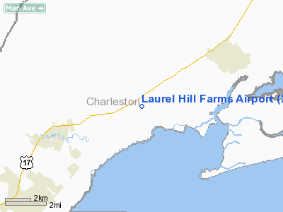
Laurel Hill Farms Airport |
Location & QuickFacts
| FAA Information Effective: | 2008-09-25 |
| Airport Identifier: | 2SC7 |
| Airport Status: | Operational |
| Longitude/Latitude: | 079-32-29.0000W/33-03-06.0000N
-79.541389/33.051667 (Estimated) |
| Elevation: | 8 ft / 2.44 m (Estimated) |
| Land: | 5 acres |
| From nearest city: | 5 nautical miles SW of Mcclellanville, SC |
| Location: | Charleston County, SC |
| Magnetic Variation: | 07W (2000) |
Owner & Manager
| Ownership: | Privately owned |
| Owner: | Laurel Hill Farms Llc |
| Address: | 1041 Wharf Indigo
Mt. Pleasant, SC 29464 |
| Phone number: | 843-849-8343 |
| Manager: | Bright Mc Connell, Iii |
| Address: | 1041 Wharf Indigo
Mt. Pleasant, SC 29464 |
| Phone number: | 843-849-8343 |
Airport Operations and Facilities
| Airport Use: | Private |
| Wind indicator: | Yes |
| Segmented Circle: | No |
| Control Tower: | No |
| Sectional chart: | Charlotte |
| Region: | ASO - Southern |
| Boundary ARTCC: | ZJX - Jacksonville |
| Tie-in FSS: | AND - Anderson |
| FSS Toll Free: | 1-800-WX-BRIEF |
Runway Information
Runway 06/24
| Dimension: | 1900 x 100 ft / 579.1 x 30.5 m |
| Surface: | TURF, |
| |
Runway 06 |
Runway 24 |
| Traffic Pattern: | Left | Left |
| Obstruction: | 60 ft trees, 50.0 ft from runway | 40 ft pline, 40.0 ft from runway |
|
Radio Navigation Aids
| ID |
Type |
Name |
Ch |
Freq |
Var |
Dist |
| GGE | NDB | Georgetown | | 242.00 | 06W | 19.2 nm |
| PHH | NDB | Andrews | | 255.00 | 06W | 24.0 nm |
| MKS | NDB | Moncks Corner | | 354.00 | 05W | 26.1 nm |
| CH | NDB | Ashly | | 329.00 | 05W | 28.4 nm |
| JZI | NDB | Johns Island | | 283.00 | 05W | 31.5 nm |
| DYB | NDB | Dorchester County | | 365.00 | 05W | 37.1 nm |
| HEK | NDB | Stuckey | | 236.00 | 06W | 40.7 nm |
| CKI | NDB | Kingstree | | 404.00 | 06W | 43.0 nm |
| MNI | NDB | Manning | | 381.00 | 06W | 46.4 nm |
| CFY | NDB | Evans | | 420.00 | 06W | 49.6 nm |
| CHS | VORTAC | Charleston | 082X | 113.50 | 05W | 26.8 nm |
| CHS | VOT | Charleston | | 111.00 | | 26.7 nm |
Remarks
Images and information placed above are from
http://www.airport-data.com/airport/2SC7/
We thank them for the data!
| General Info
|
| Country |
United States
|
| State |
SOUTH CAROLINA
|
| FAA ID |
2SC7
|
| Latitude |
33-03-06.000N
|
| Longitude |
079-32-29.000W
|
| Elevation |
8 feet
|
| Near City |
MCCLELLANVILLE
|
We don't guarantee the information is fresh and accurate. The data may
be wrong or outdated.
For more up-to-date information please refer to other sources.
|
|


