 |
|
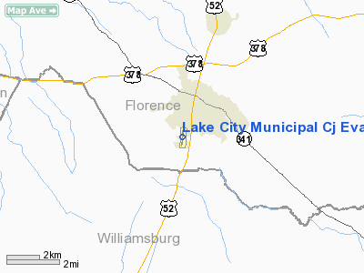
Lake City Muni Cj Evans Field Airport |
Location & QuickFacts
| FAA Information Effective: | 2008-09-25 |
| Airport Identifier: | 51J |
| Airport Status: | Operational |
| Longitude/Latitude: | 079-46-05.2000W/33-51-12.9000N
-79.768111/33.853583 (Estimated) |
| Elevation: | 80 ft / 24.38 m (Surveyed) |
| Land: | 39 acres |
| From nearest city: | 2 nautical miles SW of Lake City, SC |
| Location: | Florence County, SC |
| Magnetic Variation: | 06W (1990) |
Owner & Manager
| Ownership: | Publicly owned |
| Owner: | Town Of Lake City |
| Address: | P.o. Box 1329
Lake City, SC 29560 |
| Phone number: | 843-374-5421 |
| Manager: | Marion Lowder |
| Address: | P.o. Box 1329
Lake City, SC 29560 |
| Phone number: | 843-374-5421 |
Airport Operations and Facilities
| Airport Use: | Open to public |
| Wind indicator: | Yes |
| Segmented Circle: | Yes |
| Control Tower: | No |
| Lighting Schedule: | RDO CTL
ACTVT MIRL RY 01/19 - CTAF. |
| Beacon Color: | Clear-Green (lighted land airport) |
| Landing fee charge: | No |
| Sectional chart: | Charlotte |
| Region: | ASO - Southern |
| Boundary ARTCC: | ZJX - Jacksonville |
| Tie-in FSS: | AND - Anderson |
| FSS on Airport: | No |
| FSS Toll Free: | 1-800-WX-BRIEF |
| NOTAMs Facility: | AND (NOTAM-d service avaliable) |
Airport Communications
Airport Services
| Airframe Repair: | NONE |
| Power Plant Repair: | NONE |
| Bottled Oxygen: | NONE |
| Bulk Oxygen: | NONE |
Runway Information
Runway 01/19
| Dimension: | 3700 x 75 ft / 1127.8 x 22.9 m |
| Surface: | ASPH, Good Condition
RY CRACKING BADLY WITH GRASS GROWING THRU CRACKS. |
| Weight Limit: | Single wheel: 10000 lbs. |
| Edge Lights: | Medium |
| |
Runway 01 |
Runway 19 |
| Longitude: | 079-46-07.6020W | 079-46-02.8530W |
| Latitude: | 33-50-54.7010N | 33-51-31.0790N |
| Elevation: | 80.00 ft | 80.00 ft |
| Alignment: | 6 | 127 |
| Traffic Pattern: | Left | Left |
| Markings: | Basic, Good Condition | Basic, Good Condition |
| Crossing Height: | 25.00 ft | 25.00 ft |
| VASI: | 2-box on left side | 2-box on left side |
| Visual Glide Angle: | 3.00° | 3.00° |
| Obstruction: | 74 ft tree, 1895.0 ft from runway, 44 ft right of centerline, 22:1 slope to clear | 81 ft tree, 994.0 ft from runway, 249 ft left of centerline, 9:1 slope to clear |
|
Radio Navigation Aids
| ID |
Type |
Name |
Ch |
Freq |
Var |
Dist |
| CFY | NDB | Evans | | 420.00 | 06W | 0.2 nm |
| CKI | NDB | Kingstree | | 404.00 | 06W | 9.2 nm |
| HEK | NDB | Stuckey | | 236.00 | 06W | 14.3 nm |
| PHH | NDB | Andrews | | 255.00 | 06W | 27.0 nm |
| MNI | NDB | Manning | | 381.00 | 06W | 27.1 nm |
| MAO | NDB | Marion | | 388.00 | 06W | 29.4 nm |
| SMS | NDB | Sumter | | 252.00 | 04W | 30.7 nm |
| HYW | NDB | Horry | | 370.00 | 08W | 32.0 nm |
| UDG | NDB | Darlington | | 245.00 | 06W | 35.9 nm |
| HVS | NDB | Hartsville | | 341.00 | 07W | 37.6 nm |
| GGE | NDB | Georgetown | | 242.00 | 06W | 39.2 nm |
| DLC | NDB | Dillon | | 274.00 | 05W | 41.0 nm |
| MKS | NDB | Moncks Corner | | 354.00 | 05W | 42.0 nm |
| BES | NDB | Bennettsville | | 230.00 | 07W | 46.1 nm |
| CDN | NDB | Camden | | 263.00 | 05W | 47.2 nm |
| SSC | TACAN | Shaw | 038X | | 05W | 35.6 nm |
| FLO | VORTAC | Florence | 099X | 115.20 | 03W | 23.5 nm |
| VAN | VORTAC | Vance | 041X | 110.40 | 06W | 41.0 nm |
Remarks
- RWY 19 TWO RDO TOWERS 1 1/2-1 3/4 MI. FROM END RIGHT OF CNTRLN; ALSO LGTD WATER TANK 3/4 MI FROM END.
- EXISTED PRIOR TO 1958.
Images and information placed above are from
http://www.airport-data.com/airport/51J/
We thank them for the data!
| General Info
|
| Country |
United States
|
| State |
SOUTH CAROLINA
|
| FAA ID |
51J
|
| Latitude |
33-51-12.900N
|
| Longitude |
079-46-05.200W
|
| Elevation |
80 feet
|
| Near City |
LAKE CITY
|
We don't guarantee the information is fresh and accurate. The data may
be wrong or outdated.
For more up-to-date information please refer to other sources.
|
|


