 |
|
Location & QuickFacts
| FAA Information Effective: | 2008-09-25 |
| Airport Identifier: | 3SC7 |
| Airport Status: | Operational |
| Longitude/Latitude: | 079-31-55.0000W/33-32-23.0000N
-79.531944/33.539722 (Estimated) |
| Elevation: | 35 ft / 10.67 m (Estimated) |
| Land: | 0 acres |
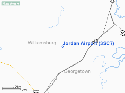
| From nearest city: | 5 nautical miles NE of Andrews, SC |
| Location: | Georgetown County, SC |
| Magnetic Variation: | 07W (1995) |
Owner & Manager
| Ownership: | Privately owned |
| Owner: | Ray Jordan |
| Address: | Route 1, Box 294-d
Andrews, SC 29510 |
| Phone number: | 803-221-5236 |
| Manager: | Ray Jordan |
| Address: | Route 1, Box 294-d
Andrews, SC 29510 |
| Phone number: | 803-221-5236 |
Airport Operations and Facilities
| Airport Use: | Private |
| Wind indicator: | Yes |
| Segmented Circle: | No |
| Control Tower: | No |
| Sectional chart: | Charlotte |
| Region: | ASO - Southern |
| Boundary ARTCC: | ZJX - Jacksonville |
| Tie-in FSS: | AND - Anderson |
| FSS Toll Free: | 1-800-WX-BRIEF |
Runway Information
Runway 15/33
| Dimension: | 2750 x 120 ft / 838.2 x 36.6 m |
| Surface: | TURF, |
| |
Runway 15 |
Runway 33 |
| Traffic Pattern: | Left | Left |
| Obstruction: | 35 ft trees, 10.0 ft from runway | |
|
Radio Navigation Aids
| ID |
Type |
Name |
Ch |
Freq |
Var |
Dist |
| PHH | NDB | Andrews | | 255.00 | 06W | 5.3 nm |
| HEK | NDB | Stuckey | | 236.00 | 06W | 11.4 nm |
| GGE | NDB | Georgetown | | 242.00 | 06W | 17.0 nm |
| CKI | NDB | Kingstree | | 404.00 | 06W | 19.4 nm |
| CFY | NDB | Evans | | 420.00 | 06W | 22.3 nm |
| HYW | NDB | Horry | | 370.00 | 08W | 26.4 nm |
| MKS | NDB | Moncks Corner | | 354.00 | 05W | 32.8 nm |
| MNI | NDB | Manning | | 381.00 | 06W | 33.9 nm |
| MAO | NDB | Marion | | 388.00 | 06W | 40.0 nm |
| CH | NDB | Ashly | | 329.00 | 05W | 44.2 nm |
| DYB | NDB | Dorchester County | | 365.00 | 05W | 47.2 nm |
| SMS | NDB | Sumter | | 252.00 | 04W | 49.5 nm |
| FLO | VORTAC | Florence | 099X | 115.20 | 03W | 42.1 nm |
| CRE | VORTAC | Grand Strand | 123X | 117.60 | 03W | 43.6 nm |
| VAN | VORTAC | Vance | 041X | 110.40 | 06W | 46.1 nm |
| CHS | VORTAC | Charleston | 082X | 113.50 | 05W | 46.4 nm |
| CHS | VOT | Charleston | | 111.00 | | 45.9 nm |
Remarks
Images and information placed above are from
http://www.airport-data.com/airport/3SC7/
We thank them for the data!
| General Info
|
| Country |
United States
|
| State |
SOUTH CAROLINA
|
| FAA ID |
3SC7
|
| Latitude |
33-32-23.000N
|
| Longitude |
079-31-55.000W
|
| Elevation |
35 feet
|
| Near City |
ANDREWS
|
We don't guarantee the information is fresh and accurate. The data may
be wrong or outdated.
For more up-to-date information please refer to other sources.
|
|


