 |
|
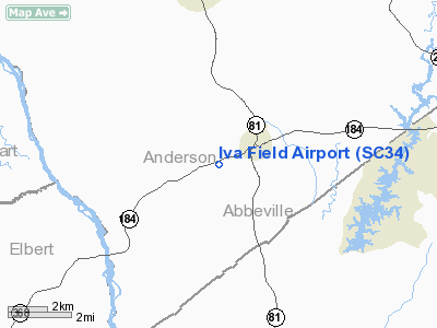
Location & QuickFacts
| FAA Information Effective: | 2008-09-25 |
| Airport Identifier: | SC34 |
| Airport Status: | Operational |
| Longitude/Latitude: | 082-41-01.4760W/34-17-49.3870N
-82.683743/34.297052 (Estimated) |
| Elevation: | 660 ft / 201.17 m (Estimated) |
| Land: | 0 acres |
| From nearest city: | 1 nautical miles NE of Iva, SC |
| Location: | Anderson County, SC |
| Magnetic Variation: | 03W (1990) |
Owner & Manager
| Ownership: | Privately owned |
| Owner: | William Epstein |
| Address: | Po Box 148
Iva, SC 29655 |
| Phone number: | 803-348-6151 |
| Manager: | William Epstein |
| Address: | Po Box 148
Iva, SC 29655 |
| Phone number: | 803-348-6151 |
Airport Operations and Facilities
| Airport Use: | Private |
| Segmented Circle: | No |
| Control Tower: | No |
| Sectional chart: | Atlanta |
| Region: | ASO - Southern |
| Boundary ARTCC: | ZTL - Atlanta |
| Tie-in FSS: | AND - Anderson |
| FSS Toll Free: | 1-800-WX-BRIEF |
Runway Information
Runway 18/36
| Dimension: | 2600 x 50 ft / 792.5 x 15.2 m |
| Surface: | TURF, |
| |
Runway 18 |
Runway 36 |
| Traffic Pattern: | Left | Left |
| Obstruction: | 50 ft trees, 300.0 ft from runway | |
|
Radio Navigation Aids
| ID |
Type |
Name |
Ch |
Freq |
Var |
Dist |
| AND | NDB | Anderson County | | 230.00 | 04W | 12.1 nm |
| CEU | NDB | Clemson | | 257.00 | 05W | 24.8 nm |
| GY | NDB | Dyana | | 338.00 | 03W | 26.5 nm |
| GIW | NDB | Coronaca | | 239.00 | 04W | 29.8 nm |
| LQK | NDB | Lake Keowee | | 408.00 | 04W | 30.9 nm |
| IIY | NDB | Washington/wilkes County | | 435.00 | 03W | 32.0 nm |
| BJT | NDB | Bulldog | | 221.00 | 03W | 33.8 nm |
| LUX | NDB | Laurens | | 307.00 | 04W | 38.5 nm |
| VV | NDB | Junne | | 353.00 | 05W | 42.6 nm |
| DDA | NDB | Commerce | | 244.00 | 03W | 44.0 nm |
| AJR | NDB | Habersham | | 347.00 | 03W | 44.7 nm |
| AA | NDB | Cedar | | 341.00 | 04W | 46.0 nm |
| HQU | NDB | Thomson-mcduffie | | 333.00 | 04W | 47.0 nm |
| ELW | VORTAC | Electric City | 023X | 108.60 | 00E | 8.9 nm |
| GRD | VORTAC | Greenwood | 102X | 115.50 | 01W | 26.4 nm |
| AHN | VORTAC | Athens | 33 | 109.60 | 00E | 38.2 nm |
| ODF | VORTAC | Foothills | 081X | 113.40 | 00E | 38.7 nm |
| IRQ | VORTAC | Colliers | 086X | 113.90 | 04W | 44.0 nm |
Remarks
- OWNER DESIRES ARPT NOT BE CHARTED.
- PRVDD VFR/PVT USE ONLY.
Images and information placed above are from
http://www.airport-data.com/airport/SC34/
We thank them for the data!
| General Info
|
| Country |
United States
|
| State |
SOUTH CAROLINA
|
| FAA ID |
SC34
|
| Latitude |
34-17-49.387N
|
| Longitude |
082-41-01.476W
|
| Elevation |
660 feet
|
| Near City |
IVA
|
We don't guarantee the information is fresh and accurate. The data may
be wrong or outdated.
For more up-to-date information please refer to other sources.
|
|


