 |
|
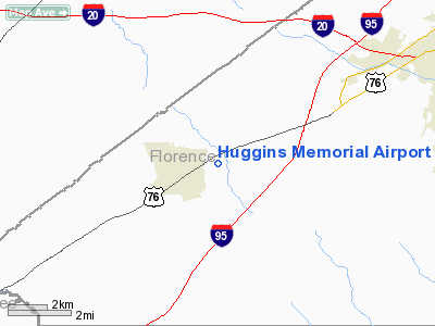
Location & QuickFacts
| FAA Information Effective: | 2008-09-25 |
| Airport Identifier: | 58J |
| Airport Status: | Operational |
| Longitude/Latitude: | 079-55-14.2370W/34-08-15.5610N
-79.920621/34.137656 (Estimated) |
| Elevation: | 143 ft / 43.59 m (Surveyed) |
| Land: | 59 acres |
| From nearest city: | 1 nautical miles NE of Timmonsville, SC |
| Location: | Florence County, SC |
| Magnetic Variation: | 06W (1985) |
Owner & Manager
| Ownership: | Privately owned |
| Owner: | Sonny Huggins |
| Address: | 776 E. Smith Street
Timmonsville, SC 29161 |
| Phone number: | 843-346-3734 |
| Manager: | Sonny Huggins |
| Address: | Rt 4 Box 60
Timmonsville, SC 29161 |
| Phone number: | 843-346-3734 |
Airport Operations and Facilities
| Airport Use: | Open to public |
| Wind indicator: | Yes |
| Segmented Circle: | No |
| Control Tower: | No |
| Lighting Schedule: | RDO-CTL
ACTVT LIRL RY 14/32 & ROTG BCN - CTAF. |
| Beacon Color: | Clear-Green (lighted land airport) |
| Landing fee charge: | No |
| Sectional chart: | Charlotte |
| Region: | ASO - Southern |
| Boundary ARTCC: | ZJX - Jacksonville |
| Tie-in FSS: | AND - Anderson |
| FSS on Airport: | No |
| FSS Toll Free: | 1-800-WX-BRIEF |
| NOTAMs Facility: | AND (NOTAM-d service avaliable) |
Airport Communications
Airport Services
| Airframe Repair: | NONE |
| Power Plant Repair: | NONE |
| Bottled Oxygen: | NONE |
| Bulk Oxygen: | NONE |
Runway Information
Runway 14/32
| Dimension: | 3090 x 150 ft / 941.8 x 45.7 m |
| Surface: | TURF, Good Condition |
| Edge Lights: | Low |
| |
Runway 14 |
Runway 32 |
| Traffic Pattern: | Left | Left |
| Markings: | None, | None, |
| Runway End Identifier: | No | No |
| Centerline Lights: | No | No |
| Touchdown Lights: | No | No |
| Obstruction: | 83 ft tree, 615.0 ft from runway, 63 ft right of centerline, 7:1 slope to clear | 70 ft tree, 800.0 ft from runway, 134 ft right of centerline, 11:1 slope to clear |
|
Radio Navigation Aids
| ID |
Type |
Name |
Ch |
Freq |
Var |
Dist |
| UDG | NDB | Darlington | | 245.00 | 06W | 18.4 nm |
| CFY | NDB | Evans | | 420.00 | 06W | 18.6 nm |
| HVS | NDB | Hartsville | | 341.00 | 07W | 19.0 nm |
| SMS | NDB | Sumter | | 252.00 | 04W | 23.6 nm |
| CKI | NDB | Kingstree | | 404.00 | 06W | 25.4 nm |
| MAO | NDB | Marion | | 388.00 | 06W | 29.4 nm |
| BES | NDB | Bennettsville | | 230.00 | 07W | 30.5 nm |
| HEK | NDB | Stuckey | | 236.00 | 06W | 31.5 nm |
| CDN | NDB | Camden | | 263.00 | 05W | 33.0 nm |
| DLC | NDB | Dillon | | 274.00 | 05W | 33.2 nm |
| MNI | NDB | Manning | | 381.00 | 06W | 36.0 nm |
| CQW | NDB | Cheraw | | 409.00 | 05W | 36.4 nm |
| PYG | NDB | Pageland | | 270.00 | 06W | 42.0 nm |
| ME | NDB | Maxtn | | 257.00 | 08W | 42.9 nm |
| HYW | NDB | Horry | | 370.00 | 08W | 43.8 nm |
| RCZ | NDB | Roscoe | | 375.00 | 07W | 44.4 nm |
| MMT | NDB | Mc Entire | | 427.00 | 05W | 45.4 nm |
| PHH | NDB | Andrews | | 255.00 | 06W | 45.7 nm |
| JB | NDB | Jigel | | 384.00 | 08W | 45.9 nm |
| SSC | TACAN | Shaw | 038X | | 05W | 28.8 nm |
| CTF | VOR/DME | Chesterfield | 019X | 108.20 | 03W | 35.5 nm |
| FLO | VORTAC | Florence | 099X | 115.20 | 03W | 14.3 nm |
| MMT | VORTAC | Mc Entire | 079X | 113.20 | 05W | 45.8 nm |
| VAN | VORTAC | Vance | 041X | 110.40 | 06W | 47.8 nm |
Remarks
- ARPT EXISTED PRIOR TO 1958
Images and information placed above are from
http://www.airport-data.com/airport/58J/
We thank them for the data!
| General Info
|
| Country |
United States
|
| State |
SOUTH CAROLINA
|
| FAA ID |
58J
|
| Latitude |
34-08-15.561N
|
| Longitude |
079-55-14.237W
|
| Elevation |
143 feet
|
| Near City |
TIMMONSVILLE
|
We don't guarantee the information is fresh and accurate. The data may
be wrong or outdated.
For more up-to-date information please refer to other sources.
|
|


