 |
|
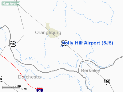
Location & QuickFacts
| FAA Information Effective: | 2008-09-25 |
| Airport Identifier: | 5J5 |
| Airport Status: | Operational |
| Longitude/Latitude: | 080-23-38.3350W/33-18-03.5840N
-80.393982/33.300996 (Estimated) |
| Elevation: | 96 ft / 29.26 m (Estimated) |
| Land: | 41 acres |
| From nearest city: | 2 nautical miles SE of Holly Hill, SC |
| Location: | Orangeburg County, SC |
| Magnetic Variation: | 05W (1985) |
Owner & Manager
| Ownership: | Publicly owned |
| Owner: | Town Of Holly Hill |
| Address: | Po Box 1108
Holly Hill, SC 29059 |
| Phone number: | 803-496-3330 |
| Manager: | Larry Gardner |
| Address: | 2208 Unity Rd.
Holly Hill, SC 29059 |
| Phone number: | 803-496-3947 |
Airport Operations and Facilities
| Airport Use: | Open to public |
| Wind indicator: | Yes |
| Segmented Circle: | No |
| Control Tower: | No |
| Landing fee charge: | No |
| Sectional chart: | Charlotte |
| Region: | ASO - Southern |
| Boundary ARTCC: | ZJX - Jacksonville |
| Tie-in FSS: | AND - Anderson |
| FSS on Airport: | No |
| FSS Toll Free: | 1-800-WX-BRIEF |
| NOTAMs Facility: | AND (NOTAM-d service avaliable) |
Airport Communications
Airport Services
| Airframe Repair: | NONE |
| Power Plant Repair: | NONE |
| Bottled Oxygen: | NONE |
| Bulk Oxygen: | NONE |
Runway Information
Runway 04/22
| Dimension: | 2900 x 150 ft / 883.9 x 45.7 m |
| Surface: | TURF, Good Condition |
| |
Runway 04 |
Runway 22 |
| Traffic Pattern: | Left | Left |
| Obstruction: | 58 ft trees, 150.0 ft from runway, 2:1 slope to clear | 65 ft tree, 1050.0 ft from runway, 16:1 slope to clear |
|
Radio Navigation Aids
| ID |
Type |
Name |
Ch |
Freq |
Var |
Dist |
| DYB | NDB | Dorchester County | | 365.00 | 05W | 15.6 nm |
| MKS | NDB | Moncks Corner | | 354.00 | 05W | 19.3 nm |
| MNI | NDB | Manning | | 381.00 | 06W | 19.7 nm |
| CH | NDB | Ashly | | 329.00 | 05W | 24.6 nm |
| RBW | NDB | Walterboro | | 221.00 | 05W | 25.7 nm |
| OYI | NDB | Orangeburg | | 226.00 | 05W | 26.6 nm |
| CKI | NDB | Kingstree | | 404.00 | 06W | 36.8 nm |
| JZI | NDB | Johns Island | | 283.00 | 05W | 41.0 nm |
| SMS | NDB | Sumter | | 252.00 | 04W | 41.5 nm |
| MMT | NDB | Mc Entire | | 427.00 | 05W | 43.2 nm |
| PHH | NDB | Andrews | | 255.00 | 06W | 44.4 nm |
| CFY | NDB | Evans | | 420.00 | 06W | 45.8 nm |
| SSC | TACAN | Shaw | 038X | | 05W | 40.8 nm |
| ALD | VOR | Allendale | | 116.70 | 01W | 48.4 nm |
| EDS | VOR/DME | Edisto | 051X | 111.40 | 05W | 25.1 nm |
| VAN | VORTAC | Vance | 041X | 110.40 | 06W | 10.8 nm |
| CHS | VORTAC | Charleston | 082X | 113.50 | 05W | 30.3 nm |
| MMT | VORTAC | Mc Entire | 079X | 113.20 | 05W | 42.7 nm |
| CAE | VORTAC | Columbia | 094X | 114.70 | 02W | 47.0 nm |
| CHS | VOT | Charleston | | 111.00 | | 29.7 nm |
Remarks
Images and information placed above are from
http://www.airport-data.com/airport/5J5/
We thank them for the data!
| General Info
|
| Country |
United States
|
| State |
SOUTH CAROLINA
|
| FAA ID |
5J5
|
| Latitude |
33-18-03.584N
|
| Longitude |
080-23-38.335W
|
| Elevation |
96 feet
|
| Near City |
HOLLY HILL
|
We don't guarantee the information is fresh and accurate. The data may
be wrong or outdated.
For more up-to-date information please refer to other sources.
|
|


