 |
|
| Hilton Head Airport |
| IATA: HHH – ICAO: KHXD – FAA LID: HXD |
| Summary |
| Airport type |
Public |
| Owner |
Beaufort County / The town of Hilton Head Island |
| Serves |
Hilton Head Island, South Carolina |
| Elevation AMSL |
19 ft / 6 m |
| Coordinates |
32°13′28″N 080°41′51″W / 32.22444°N 80.6975°W / 32.22444; -80.6975 |
| Website |
www.bcgov.net/... |
| Runways |
| Direction |
Length |
Surface |
| ft |
m |
| 3/21 |
4,300 |
1,311 |
Asphalt |
| Statistics (2007) |
| Aircraft operations |
50,638 |
| Based aircraft |
87 |
| Source: Federal Aviation Administration |
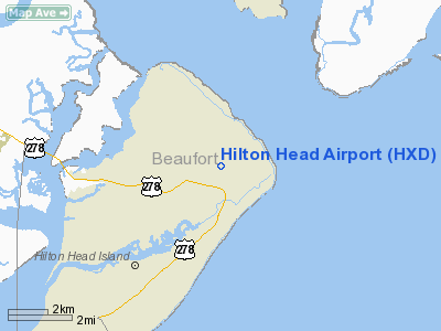
Hilton Head Airport (IATA: HHH, ICAO: KHXD, FAA LID: HXD), also known as Hilton Head Island Airport, is a county and town-owned, public-use airport located in northeastern Hilton Head Island in Beaufort County, South Carolina, United States. It is mostly used for general aviation but is also served by two commercial airlines and one public charter airline operating limited service.
Although most U.S. airports use the same three-letter location identifier for the FAA and IATA, Hilton Head Airport is assigned HXD by the FAA and HHH by the IATA. The IATA code HHH is used for commercial airline booking purposes. Facilities and aircraft
Hilton Head Airport covers an area of 131 acres (53 ha) and has one runway designated 3/21 with a 4,300 x 100 ft (1,311 x 30 m) asphalt surface. The current terminal building was built in 1995. At 18,000 square feet (1,700 m), it has four airline gates.
For the 12-month period ending July 31, 2007, the airport had 50,638 aircraft operations, an average of 138 per day: 50% air taxi, 49% general aviation and 1% military. At that time there were 87 aircraft based at this airport: 63% single-engine, 26% multi-engine, 9% jet and 1% ultralight.
Airlines and destinations
| Airlines |
Destinations |
| Delta Connection operated by Mesaba Airlines |
Atlanta [seasonal] |
| US Airways Express operated by Piedmont Airlines |
Charlotte, Washington-Reagan [seasonal] |
The above content comes from Wikipedia and is published under free licenses – click here to read more.
Location & QuickFacts
| FAA Information Effective: | 2008-09-25 |
| Airport Identifier: | HXD |
| Airport Status: | Operational |
| Longitude/Latitude: | 080-41-50.9000W/32-13-27.7000N
-80.697472/32.224361 (Estimated) |
| Elevation: | 19 ft / 5.79 m (Surveyed) |
| Land: | 131 acres |
| From nearest city: | 3 nautical miles E of Hilton Head Island, SC |
| Location: | Beaufort County, SC |
| Magnetic Variation: | 07W (2005) |
Owner & Manager
| Ownership: | Publicly owned |
| Owner: | Beaufort County |
| Address: | Po Box 23739
Hilton Head Island, SC 29925 |
| Phone number: | 843-689-5400 |
| Manager: | Paul Andres, Director Of Airports |
| Address: | Po Box 23739
Hilton Head Island, SC 29925 |
| Phone number: | 843-689-5400 |
Airport Operations and Facilities
| Airport Use: | Open to public |
| Wind indicator: | Yes |
| Segmented Circle: | Yes |
| Control Tower: | Yes |
| Lighting Schedule: | DUSK-DAWN
ACTVT MIRL 03/21 AND REIL RYS 03 & 21 - CTAF. |
| Beacon Color: | Clear-Green (lighted land airport) |
| Landing fee charge: | No |
| Sectional chart: | Charlotte |
| Region: | ASO - Southern |
| Boundary ARTCC: | ZJX - Jacksonville |
| Tie-in FSS: | AND - Anderson |
| FSS on Airport: | No |
| FSS Toll Free: | 1-800-WX-BRIEF |
| NOTAMs Facility: | AND (NOTAM-d service avaliable) |
| Certification type/date: | I A S 06/1982
CLSD TO UNSKED ACR OPNS WITH MORE THAN 30 PSGR SEATS EXCP 24 HRS PPR CALL AMGR (843) 689-5400. |
| Federal Agreements: | NGY |
Airport Communications
| CTAF: | 118.975 |
| Unicom: | 123.000 |
Airport Services
| Fuel available: | 100LLA |
| Airframe Repair: | NONE |
| Power Plant Repair: | NONE |
| Bottled Oxygen: | NONE |
| Bulk Oxygen: | NONE |
Runway Information
Runway 03/21
| Dimension: | 4300 x 100 ft / 1310.6 x 30.5 m |
| Surface: | ASPH, |
| Weight Limit: | Single wheel: 55000 lbs.
Dual wheel: 75000 lbs. |
| Edge Lights: | Medium |
| |
Runway 03 |
Runway 21 |
| Longitude: | 080-42-01.9105W | 080-41-39.9176W |
| Latitude: | 32-13-08.5992N | 32-13-46.8165N |
| Elevation: | 19.00 ft | 18.00 ft |
| Alignment: | 26 | 127 |
| ILS Type: | | LOC/DME
|
| Traffic Pattern: | Left | Left |
| Markings: | Non-precision instrument, Good Condition | Non-precision instrument, Good Condition |
| Crossing Height: | 40.00 ft | 40.00 ft |
| Displaced threshold: | 299.00 ft | 300.00 ft |
| VASI: | 4-light PAPI on left side | 4-light PAPI on right side |
| Visual Glide Angle: | 3.30° | 3.00° |
| Runway End Identifier: | Yes | Yes |
| Obstruction: | 56 ft tree, 1325.0 ft from runway, 250 ft right of centerline, 20:1 slope to clear
15:1 TO DSPLCD THLD ; TREES AT 1650 FT. | 55 ft tree, 1300.0 ft from runway, 225 ft right of centerline, 20:1 slope to clear
33:1 TO DSPLCD THLD ; TREES AT 1600 FT. |
|
Radio Navigation Aids
| ID |
Type |
Name |
Ch |
Freq |
Var |
Dist |
| RBW | NDB | Walterboro | | 221.00 | 05W | 42.3 nm |
| JZI | NDB | Johns Island | | 283.00 | 05W | 45.3 nm |
| MOQ | NDB | Mc Intosh | | 263.00 | 04W | 47.7 nm |
| NBC | TACAN | Beaufort | 042X | | 05W | 15.3 nm |
| SVN | VOR/DME | Hunter | 53X | 111.60 | 02W | 25.9 nm |
| SAV | VORTAC | Savannah | 106Y | 115.95 | 06W | 25.9 nm |
| SAV | VOT | Savannah Travis Fld | | 111.00 | | 26.3 nm |
Remarks
- NOISE ABATEMENT PROCEDURES IN EFFECT - CTC AMGR 843-689-5400.
- BIRDS ON & INVOF ARPT.
- PARASAIL OPNS WITHIN 3 NM RADIUS OF SAV 009 DEGS/15 NM, SFC TO 1500 DURG DALGT HRS.
- NON-STD SEPARATION BETWEEN RY AND GENERAL AVIATION TWY 'A'.
- DEER ON AND INVOF ARPT.
- TSNT PARKING RAMP NOT VSB FM TWR.
Images and information placed above are from
http://www.airport-data.com/airport/HXD/
We thank them for the data!
| General Info
|
| Country |
United States
|
| State |
SOUTH CAROLINA
|
| FAA ID |
HXD
|
| Latitude |
32-13-27.700N
|
| Longitude |
080-41-50.900W
|
| Elevation |
19 feet
|
| Near City |
HILTON HEAD ISLAND
|
We don't guarantee the information is fresh and accurate. The data may
be wrong or outdated.
For more up-to-date information please refer to other sources.
|
|


