 |
|
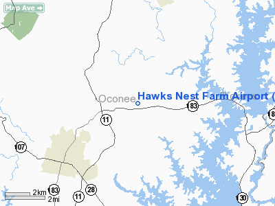
Location & QuickFacts
| FAA Information Effective: | 2008-09-25 |
| Airport Identifier: | SC26 |
| Airport Status: | Operational |
| Longitude/Latitude: | 082-59-55.0000W/34-48-29.0000N
-82.998611/34.808056 (Estimated) |
| Elevation: | 1050 ft / 320.04 m (Estimated) |
| Land: | 40 acres |
| From nearest city: | 4 nautical miles NE of West Union, SC |
| Location: | Oconee County, SC |
| Magnetic Variation: | 04W (1995) |
Owner & Manager
| Ownership: | Privately owned |
| Owner: | Dan T Suddeth |
| Address: | 213 Burnt Tanyard Road
West Union, SC 29696 |
| Phone number: | 864-903-1017 |
| Manager: | Dan T. Suddeth |
| Address: | 213 Burnt Tanyard Road
West Union, SC 29696 |
| Phone number: | 864-903-1017 |
Airport Operations and Facilities
| Airport Use: | Private |
| Wind indicator: | Yes |
| Segmented Circle: | No |
| Control Tower: | No |
| Sectional chart: | Atlanta |
| Region: | ASO - Southern |
| Boundary ARTCC: | ZTL - Atlanta |
| Tie-in FSS: | AND - Anderson |
| FSS on Airport: | No |
| FSS Toll Free: | 1-800-WX-BRIEF |
Runway Information
Runway 03/21
| Dimension: | 1800 x 150 ft / 548.6 x 45.7 m |
| Surface: | TURF, |
| |
Runway 03 |
Runway 21 |
| Traffic Pattern: | Left | Left |
|
Radio Navigation Aids
| ID |
Type |
Name |
Ch |
Freq |
Var |
Dist |
| CEU | NDB | Clemson | | 257.00 | 05W | 9.8 nm |
| LQK | NDB | Lake Keowee | | 408.00 | 04W | 14.6 nm |
| AND | NDB | Anderson County | | 230.00 | 04W | 23.5 nm |
| GY | NDB | Dyana | | 338.00 | 03W | 28.3 nm |
| AJR | NDB | Habersham | | 347.00 | 03W | 32.9 nm |
| BRA | NDB | Broad River | | 379.00 | 04W | 38.1 nm |
| ODF | VORTAC | Foothills | 081X | 113.40 | 00E | 16.2 nm |
| ELW | VORTAC | Electric City | 023X | 108.60 | 00E | 25.7 nm |
| HRS | VORTAC | Harris | 035X | 109.80 | 00E | 45.9 nm |
Remarks
Images and information placed above are from
http://www.airport-data.com/airport/SC26/
We thank them for the data!
| General Info
|
| Country |
United States
|
| State |
SOUTH CAROLINA
|
| FAA ID |
SC26
|
| Latitude |
34-48-29.000N
|
| Longitude |
082-59-55.000W
|
| Elevation |
1050 feet
|
| Near City |
WEST UNION
|
We don't guarantee the information is fresh and accurate. The data may
be wrong or outdated.
For more up-to-date information please refer to other sources.
|
|


