 |
|
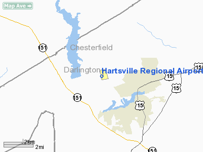
Location & QuickFacts
| FAA Information Effective: | 2008-09-25 |
| Airport Identifier: | HVS |
| Airport Status: | Operational |
| Longitude/Latitude: | 080-07-09.2000W/34-24-11.1000N
-80.119222/34.403083 (Estimated) |
| Elevation: | 364 ft / 110.95 m (Surveyed) |
| Land: | 281 acres |
| From nearest city: | 3 nautical miles NW of Hartsville, SC |
| Location: | Darlington County, SC |
| Magnetic Variation: | 07W (2000) |
Owner & Manager
| Ownership: | Publicly owned |
| Owner: | City Of Hartsville |
| Address: | Po Box 1230
Hartsville, SC 29550 |
| Phone number: | 843-383-3007 |
| Manager: | Mike Welch
FBO, HARTSVILLE AVIATION: JOHNNY PAYNE 843-383-5571. |
| Address: | P.o. Box 2467
Hartsville, SC 29551 |
| Phone number: | 843-383-3006 |
Airport Operations and Facilities
| Airport Use: | Open to public |
| Wind indicator: | Yes |
| Segmented Circle: | Yes |
| Control Tower: | No |
| Lighting Schedule: | DUSK-DAWN
MIRL RY 03/21 PRESET LOW INTST DUSK-2100; TO INCR INTST AND ACTVT MIRL 03/21 AFTER 2100 - CTAF. |
| Beacon Color: | Clear-Green (lighted land airport) |
| Landing fee charge: | No |
| Sectional chart: | Charlotte |
| Region: | ASO - Southern |
| Boundary ARTCC: | ZJX - Jacksonville |
| Tie-in FSS: | AND - Anderson |
| FSS on Airport: | No |
| FSS Toll Free: | 1-800-WX-BRIEF |
| NOTAMs Facility: | AND (NOTAM-d service avaliable) |
| Federal Agreements: | NGY |
Airport Communications
| CTAF: | 122.800 |
| Unicom: | 122.800 |
Airport Services
| Fuel available: | 100LLA
FOR FUEL AFT HRS CALL (843) 383-8490. |
| Bottled Oxygen: | NONE |
| Bulk Oxygen: | NONE |
Runway Information
Runway 03/21
| Dimension: | 5000 x 75 ft / 1524.0 x 22.9 m |
| Surface: | ASPH, Good Condition |
| Weight Limit: | Single wheel: 30000 lbs. |
| Edge Lights: | Medium |
| |
Runway 03 |
Runway 21 |
| Longitude: | 080-07-20.6042W | 080-06-57.8360W |
| Latitude: | 34-23-48.2057N | 34-24-33.9250N |
| Elevation: | 342.00 ft | 364.00 ft |
| Alignment: | 22 | 127 |
| Traffic Pattern: | Right | Left |
| Markings: | Non-precision instrument, Good Condition | Non-precision instrument, Good Condition |
| Crossing Height: | 28.00 ft | 23.00 ft |
| VASI: | 2-light PAPI on left side | 2-light PAPI on left side |
| Visual Glide Angle: | 3.00° | 3.00° |
| Runway End Identifier: | | No |
| Obstruction: | 9 ft tree, 232.0 ft from runway, 64 ft left of centerline, 3:1 slope to clear | 102 ft tree, 884.0 ft from runway, 565 ft right of centerline, 6:1 slope to clear |
|
Radio Navigation Aids
| ID |
Type |
Name |
Ch |
Freq |
Var |
Dist |
| HVS | NDB | Hartsville | | 341.00 | 07W | 0.2 nm |
| UDG | NDB | Darlington | | 245.00 | 06W | 11.7 nm |
| CDN | NDB | Camden | | 263.00 | 05W | 23.1 nm |
| BES | NDB | Bennettsville | | 230.00 | 07W | 23.1 nm |
| PYG | NDB | Pageland | | 270.00 | 06W | 23.2 nm |
| CQW | NDB | Cheraw | | 409.00 | 05W | 23.9 nm |
| SMS | NDB | Sumter | | 252.00 | 04W | 27.5 nm |
| RCZ | NDB | Roscoe | | 375.00 | 07W | 34.3 nm |
| CFY | NDB | Evans | | 420.00 | 06W | 37.3 nm |
| DLC | NDB | Dillon | | 274.00 | 05W | 37.3 nm |
| AFP | NDB | Anson County | | 283.00 | 07W | 37.4 nm |
| ME | NDB | Maxtn | | 257.00 | 08W | 38.9 nm |
| MAO | NDB | Marion | | 388.00 | 06W | 41.2 nm |
| LKR | NDB | Lancaster | | 400.00 | 07W | 41.3 nm |
| CKI | NDB | Kingstree | | 404.00 | 06W | 43.2 nm |
| TWL | NDB | Wesley | | 204.00 | 06W | 43.9 nm |
| MMT | NDB | Mc Entire | | 427.00 | 05W | 44.0 nm |
| HFF | NDB | Mackall | | 278.00 | 06W | 48.9 nm |
| MNI | NDB | Manning | | 381.00 | 06W | 49.2 nm |
| JB | NDB | Jigel | | 384.00 | 08W | 49.4 nm |
| FDW | NDB | Winnsboro | | 414.00 | 05W | 49.6 nm |
| SSC | TACAN | Shaw | 038X | | 05W | 30.8 nm |
| CTF | VOR/DME | Chesterfield | 019X | 108.20 | 03W | 16.7 nm |
| FLO | VORTAC | Florence | 099X | 115.20 | 03W | 25.1 nm |
| MMT | VORTAC | Mc Entire | 079X | 113.20 | 05W | 44.5 nm |
Remarks
- +300 FT ANT 2.5 MI SW OF ARPT.
Images and information placed above are from
http://www.airport-data.com/airport/HVS/
We thank them for the data!
| General Info
|
| Country |
United States
|
| State |
SOUTH CAROLINA
|
| FAA ID |
HVS
|
| Latitude |
34-24-11.100N
|
| Longitude |
080-07-09.200W
|
| Elevation |
364 feet
|
| Near City |
HARTSVILLE
|
We don't guarantee the information is fresh and accurate. The data may
be wrong or outdated.
For more up-to-date information please refer to other sources.
|
|


