 |
|
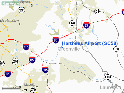
Location & QuickFacts
| FAA Information Effective: | 2008-09-25 |
| Airport Identifier: | SC58 |
| Airport Status: | Operational |
| Longitude/Latitude: | 082-15-06.4130W/34-50-49.4240N
-82.251781/34.847062 (Estimated) |
| Elevation: | 850 ft / 259.08 m (Estimated) |
| Land: | 0 acres |
| From nearest city: | 8 nautical miles E of Greenville, SC |
| Location: | Greenville County, SC |
| Magnetic Variation: | 04W (1985) |
Owner & Manager
| Ownership: | Privately owned |
| Owner: | Thomas P. Hartness |
| Address: | 300 Smith Drive
Greenville, SC 29615 |
| Phone number: | 803-2-1522 |
| Manager: | Thomas P. Hartness |
| Address: | 300 Smith Drive
Greenville, SC 29615 |
| Phone number: | 803-297-1200 |
Airport Operations and Facilities
| Airport Use: | Private |
| Wind indicator: | Yes |
| Segmented Circle: | No |
| Control Tower: | No |
| Sectional chart: | Atlanta |
| Region: | ASO - Southern |
| Boundary ARTCC: | ZTL - Atlanta |
| Tie-in FSS: | AND - Anderson |
| FSS Toll Free: | 1-800-WX-BRIEF |
Runway Information
Runway 18/36
| Dimension: | 1740 x 100 ft / 530.4 x 30.5 m |
| Surface: | TURF, |
| |
Runway 18 |
Runway 36 |
| Traffic Pattern: | Left | Left |
|
Radio Navigation Aids
| ID |
Type |
Name |
Ch |
Freq |
Var |
Dist |
| GY | NDB | Dyana | | 338.00 | 03W | 13.3 nm |
| FRT | NDB | Fairmont | | 248.00 | 05W | 13.6 nm |
| LQK | NDB | Lake Keowee | | 408.00 | 04W | 22.4 nm |
| LUX | NDB | Laurens | | 307.00 | 04W | 25.3 nm |
| BRA | NDB | Broad River | | 379.00 | 04W | 27.8 nm |
| AND | NDB | Anderson County | | 230.00 | 04W | 30.8 nm |
| UOT | NDB | Union County | | 326.00 | 04W | 31.6 nm |
| CEU | NDB | Clemson | | 257.00 | 05W | 33.0 nm |
| RFE | NDB | Rutherford | | 344.00 | 05W | 33.6 nm |
| GIW | NDB | Coronaca | | 239.00 | 04W | 36.6 nm |
| SLP | NDB | First River | | 417.00 | 06W | 40.3 nm |
| EOE | NDB | Enoree | | 278.00 | 05W | 44.3 nm |
| SPA | VORTAC | Spartanburg | 104X | 115.70 | 02W | 19.5 nm |
| SUG | VORTAC | Sugarloaf Mountain | 059X | 112.20 | 02W | 33.6 nm |
| GRD | VORTAC | Greenwood | 102X | 115.50 | 01W | 36.1 nm |
| ELW | VORTAC | Electric City | 023X | 108.60 | 00E | 36.8 nm |
Remarks
- VFR PVT USE; AGRMT MAINTD WITH GREER ATCT REG OPNL PROCS; ALL TFC PATS ARE NORTH OF ROPER MOUNTAIN ROAD TO MAINT COMPATIBILITY WITH COX FIELD.
Images and information placed above are from
http://www.airport-data.com/airport/SC58/
We thank them for the data!
| General Info
|
| Country |
United States
|
| State |
SOUTH CAROLINA
|
| FAA ID |
SC58
|
| Latitude |
34-50-49.424N
|
| Longitude |
082-15-06.413W
|
| Elevation |
850 feet
|
| Near City |
GREENVILLE
|
We don't guarantee the information is fresh and accurate. The data may
be wrong or outdated.
For more up-to-date information please refer to other sources.
|
|


